


Get to know Yushu
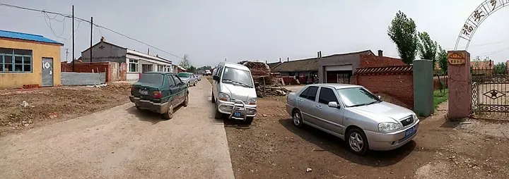
Photo adjustments
Full frame retained; proportionally resized and converted to WebP. No retouching or changes to the photographed subject. Card displays may crop the view.
- Administrative area
- County-level city · 县级市
- Part of
- Changchun
- Chinese name
- 榆树市
- Local areas
- County-level city guide
Area & population
- Area in the source
- 4,724.00 km²
- Population · 2010
- 1,160,568
Source: cited geographic source, as of the dates shown.
Setting and landscape
Rivers mark much of the boundary. The Lalin River (拉林河) separates Yushu from Wuchang (五常) and Shuangcheng (双城) in Heilongjiang to the east and north, and across the Songhua (松花江) to the south-west lie Changchun's Jiutai District (九台区) and Dehui (德惠). The land is a plain of river and lake deposits that tilts gently from south-east to north-west, mostly between 157 and 220 m; the highest ground, at 302 m, is around Huayuan Mountain (花园山) in Tuqiao town (土桥镇).
Winters are long and cold, with a January average of about minus 18.4°C, and July averages about 22.6°C. The Kacha River (卡岔河) runs south to north through the middle of the city.
History
People lived here more than 40,000 years ago; the Yushu Man site (榆树人遗址) at Xiushui (秀水镇) is described by Chinese Wikipedia as the earliest known human site in the Changchun area. The area later belonged to the Buyeo (夫余) kingdom, Balhae (渤海) and the Liao.
The town began as Gu Yushu Tun (孤榆树屯), "lone elm hamlet". In 1877 it was given a moat and four gates, with elms planted as a barrier, and in 1882 the Boduna sub-prefecture (伯都讷厅) moved its office here from Boduna. When that office moved again in 1906, Yushu County was created in its place. It became a county-level city on 26 December 1990.
Food and local products
Yushuqian liquor (榆树钱酒), also sold as Yushu Daqu (榆树大曲), carries China's geographical indication mark. Yushu was named among the first national counties for farm produce quality and safety in 2016.
Getting oriented
Yushu station lies on a trunk line of the Shenyang railway bureau: westward the Yushu–Taolaizhao line (榆陶铁路) joins the Beijing–Harbin main line, and eastward the Yushu–Shulan line (榆舒铁路) leads to Jilin. National Highway 102 and the Beijing–Harbin expressway (京哈高速公路) pass through the city.
Highlights
- Yushu Man site 榆树人遗址: Palaeolithic site at Xiushui, the earliest known human site in the Changchun area.
- Yushuqian liquor 榆树钱酒: Local liquor also called Yushu Daqu, a Chinese geographical indication product.
Sources for this guide
走进榆树:榆树概况 · Yushu City People's Government
走进榆树:历史沿革 · Yushu City People's Government
走进榆树:自然状况 · Yushu City People's Government
走进榆树:交通条件 · Yushu City People's Government
榆树市 · Wikipedia (Chinese) · CC BY-SA 4.0
Original English written from the listed sources and checked sentence by sentence against quoted extracts by a separate reviewer. Updated 2026-09-25.
Explore Yushu
Core places to explore, with English and Chinese names.
Plan your visit
Getting there
Yushu is about 140 km in a straight line from central Changchun. Search for 榆树市 in a map app to find stations and your accommodation.
Where to stay →More in Changchun
Sources & geographic information
Administrative names and parent areas: Official geographic directory · Reference date 2026-09-06.
Some facts checked against 榆树市 — Wikipedia contributors, CC BY-SA 4.0.
Map data © OpenStreetMap contributors. Pins mark approximate centres, not entrances or boundaries.