


Get to know Kuandian Manchu Autonomous County
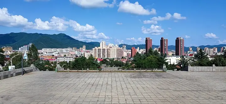
Photo adjustments
Full frame retained; resized proportionally to a maximum dimension of 960 pixels and converted to WebP quality 88. No crop, retouch, generated elements, or subject alteration. Final website rendition: full frame retained, proportionally resized to at most 720 pixels and converted to WebP. No additional retouching or subject alteration. Card displays may crop the view.
- Administrative area
- Autonomous county · 自治县
- Part of
- Dandong
- Chinese name
- 宽甸满族自治县
- Local areas
- Autonomous county guide
Area & population
- Area in the source
- 6,193.70 km²
- Population · 2020 census
- 334,636
- Administrative seat
- Kuandian Town
Source: cited geographic source, as of the dates shown.
Setting and landscape
The county lies among the Changbai Mountains (长白山), with Ji'an (集安) to the northeast, Fengcheng (凤城) to the west and Huanren County (桓仁县) to the north. Winters are long, cold and very dry and most of the year's rain falls in July and August. Boron is the best-known mineral: the county produces about half of China's output, which is why the area is sometimes called 'boron sea' (硼海).
History
The Dandong culture and tourism bureau dates the Hushan Great Wall (虎山长城) to 1469, when the Liaodong deputy commander Han Bin (韩斌) had it built against Jurchen raids; it marks the eastern starting point of the Ming wall. On 25 October 1894 Japanese troops crossed pontoon bridges from Uiju (义州) and attacked Hushan, the first land battle of the First Sino-Japanese War fought inside China. The defending general Ma Jinxu (马金叙) held the hill with five or six hundred men, and more than 500 defenders died.
Kuandian became a county in 1876 under Fenghuang Subprefecture (凤凰厅), came under Dandong in 1965 and became a Manchu autonomous county in September 1989.
What to see
At Hushan, the hill takes its name from its shape, like a crouching tiger, and gun emplacement remains still stand on the wall. At its foot, the spot called Yibukua (一步跨), 'one stride', is one of the closest points between China and North Korea.
Tianqiaogou National Forest Park (天桥沟国家森林公园) has four scenic zones, including Lotus Peak (莲花峰) and Red Maple Valley (红枫谷), and more than 20 sites of the Northeast Anti-Japanese United Army. Qingshangou (青山沟), a national scenic area between the Changbai range and the Yalu river system, groups Qingshan Lake (青山湖), waterfall gorges and Manjiazhai (满家寨) into one area that pairs mountain scenery with Manchu folk culture. Huabo Mountain (花脖山), 1,336.1 m, is described by Liaoshen Evening News as the highest peak in Liaoning.
At Hekou (河口) on the Yalu, the Broken Bridge (河口断桥), first called Qingcheng Bridge (清城桥), was the earliest road bridge across the river and one of three crossing points of the Chinese People's Volunteers. Hekou also has a large peach orchard, and Hekou village (河口村) is where the song 'In the Place Where Peach Blossoms Bloom' (在那桃花盛开的地方) originated. The Shanghekou station (上河口车站旧址), built in November 1950, served as a temporary command post when China entered the Korean War.
Highlights
- Hushan Great Wall 虎山长城: Built in 1469 as the eastern starting point of the Ming wall; scene of the first land battle of the 1894 war inside China.
- Tianqiaogou National Forest Park 天桥沟国家森林公园: Four scenic zones and more than 20 Northeast Anti-Japanese United Army sites.
- Qingshangou 青山沟: National scenic area pairing lake and waterfall scenery with Manchu folk culture.
- Hekou Broken Bridge 河口断桥: The earliest road bridge across the Yalu and a Volunteer Army crossing point.
Sources for this guide
景区历史文化故事|烽火虎山:不能忘却的炮声 · Dandong Municipal Bureau of Culture, Tourism, Radio and Television
Kuandian Manchu Autonomous County · Wikipedia · CC BY-SA 4.0
宽甸入选“2024中国最美县域榜单” · Liaoshen Evening News (Liaoning Daily Media Group)
Original English written from the listed sources and checked sentence by sentence against quoted extracts by a separate reviewer. Updated 2026-09-25.
Explore Kuandian Manchu Autonomous County
Core places to explore, with English and Chinese names.
Places to explore around Kuandian Manchu Autonomous County
 AI illustration · AI 示意图(仅供参考,非该地点实拍)
Tianqiaogou Valley天桥沟
Tianqiaogou is a forested mountain attraction in Kuandian Manchu Autonomous County, known for maple scenery and sites associated with the Northeast Anti-Japanese United Army.
Read the place guide →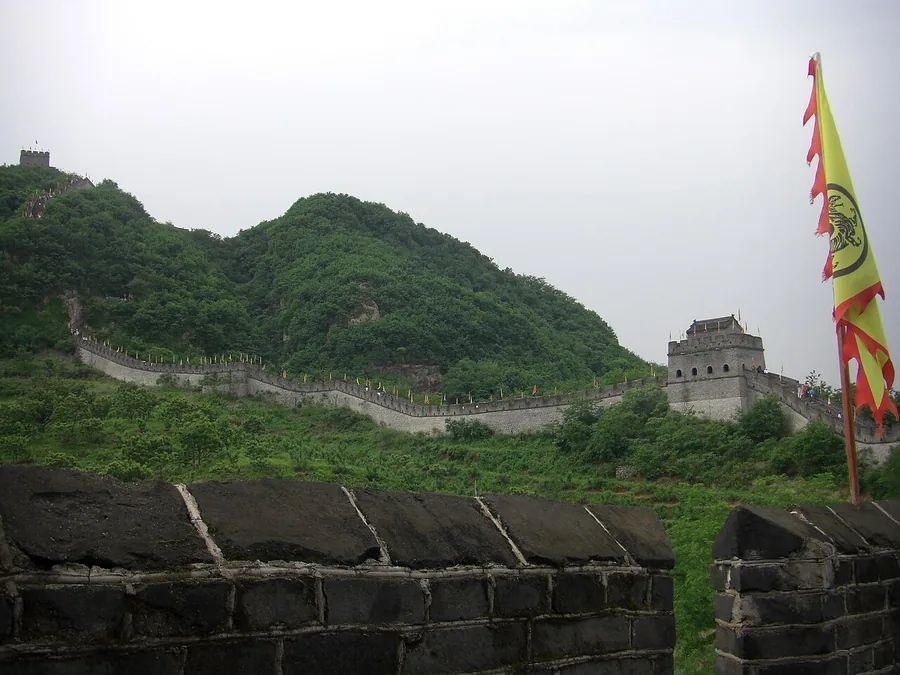 Restored wall and watchtowers climbing Hushan near Dandong. Photographed on 11 October 2009.
Hushan Great Wall虎山长城
Hushan's restored wall climbs a low but steep hill near the meeting of the Yalu and Ai rivers. The height above the surrounding plain provides a clear sense of why this border position mattered. Much of the visible wall is…
Read the place guide →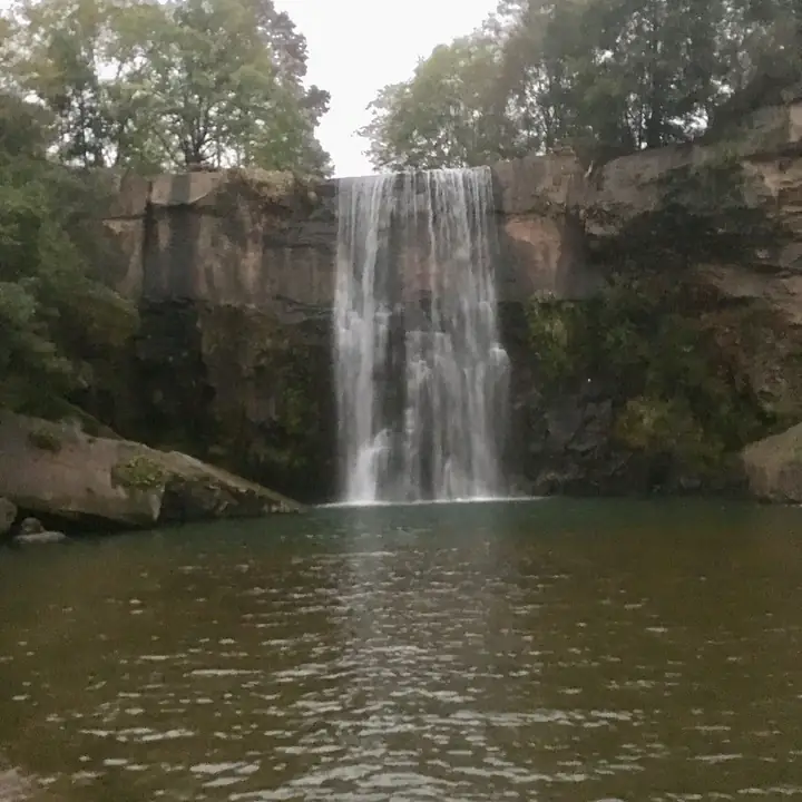 Qingshangou Valley · 青山沟
Qingshangou Valley青山沟
Qingshangou is a mountain scenic area in northeastern Kuandian, combining the wooded banks of Qingshan Lake with waterfall valleys and Manchu cultural attractions.
Read the place guide →Plan your visit
Getting there
Kuandian Manchu Autonomous County is about 75 km in a straight line from central Dandong. Search for 宽甸满族自治县 in a map app to find stations and your accommodation.
Where to stay →Build your route
Tianqiaogou Valley and Hushan Great Wall are both listed here. The linked place guides have entrance and visit details.
Continue with Dandong →More in Dandong
Sources & geographic information
Administrative names and parent areas: Official geographic directory · Reference date 2026-09-06.
Some facts checked against Kuandian Manchu Autonomous County — Wikipedia contributors, CC BY-SA 4.0.
Photo: Hushan Great Wall · 立志堂 · CC BY-SA 3.0. Proportionally resized and converted to WebP without cropping, retouching or changing the photographed subject.

Photo: Qingshangou Valley · Source photographer · License not provided. EXIF orientation normalized; resized without changing aspect ratio; converted to WebP. No subject edits.
Map data © OpenStreetMap contributors. Pins mark approximate centres, not entrances or boundaries.