


Get to know Laobian District
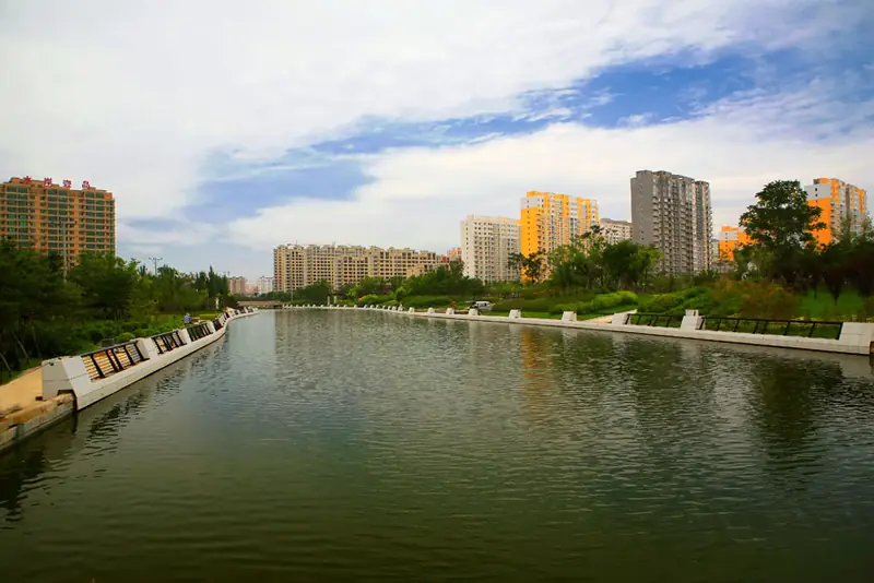
Photo adjustments
EXIF orientation normalized; resized without changing aspect ratio; converted to WebP. No subject edits.
- Administrative area
- District · 市辖区
- Part of
- Yingkou
- Chinese name
- 老边区
- Local areas
- District guide
Area & population
- Area in the source
- 249.40 km²
- Population · 2020 census
- 146,748
Source: cited geographic source, as of the dates shown.
Setting and landscape
The district is narrow in the south and wider in the north, and its average elevation is only 2 to 7 metres, the ground sloping down from northeast to southwest. Thirty-four rivers and channels cross it, among them the Dahan (大旱河) and Huzhuang (虎庄河) flood channels. Five low hills break the plain; the highest, Wuguan Mountain (五棺山), reaches 176.7 metres. Dapingshan (大平山) and Dalongshan (大龙山) are two of the others.
History
The district government explains the name this way: in the early Qing a family named Ma settled here beside a boundary ditch, a 'bian', and the place became Laobian. Finds in the district include Neolithic stone axes and hammers, the Warring States site at Dapingshan (大平山战国遗址) in Liushu town (柳树镇), the base of a Tang-era Koguryo mountain fort, and a Liao-dynasty earth-walled town at Tuchengzi (土城子遗址).
In 1908 its villages were divided between Haicheng and Gaiping counties, and in 1909 most of them passed to the new Yingkou sub-prefecture (营口直隶厅). In 1950 it became Yingkou's Fifth District, renamed the suburban district in 1957, and it took the name Laobian District in July 1984.
Food and local products
Its sea area of about 600,000 mu yields shellfish, prawns, sea cucumbers, jellyfish, Chinese white shrimp and Chinese mitten crab, which the government says are known across the country. Rice and maize take up most of its grain fields.
Getting oriented
Laobian borders Dashiqiao (大石桥) to the east and north and Zhanqian District (站前区) and Liaodong Bay to the west. The Harbin–Dalian high-speed railway and National Highway 305 run north–south through it, and Yingkou East Station (营口东站) on the high-speed line lies inside the district, 4 kilometres from its centre. Yingkou Lanqi Airport (营口兰旗机场) is 13 kilometres from the centre.
Highlights
- Dapingshan Warring States site 大平山战国遗址: Warring States to Han tombs and dwelling remains in Xida village, Liushu town.
- Tuchengzi site 土城子遗址: Remains of a Liao-dynasty earth-walled town in the former Erdao town.
- Wuguan Mountain 五棺山: Highest of the district's five hills at 176.7 metres.
- Yingkou East Station 营口东站: High-speed rail station inside the district, 4 km from its centre.
Explore Laobian District
Core places to explore, with English and Chinese names.
Laobian District 老边区
Plan your visit
Getting there
Laobian District is about 10 km in a straight line from central Yingkou. Search for 老边区 in a map app to find stations and your accommodation.
Where to stay →More in Yingkou
Sources & geographic information
Administrative names and parent areas: Official geographic directory · Reference date 2026-09-06.
Some facts checked against 老边区 — Wikipedia contributors, CC BY-SA 4.0.
Map data © OpenStreetMap contributors. Pins mark approximate centres, not entrances or boundaries.