


Get to know Bayuquan District
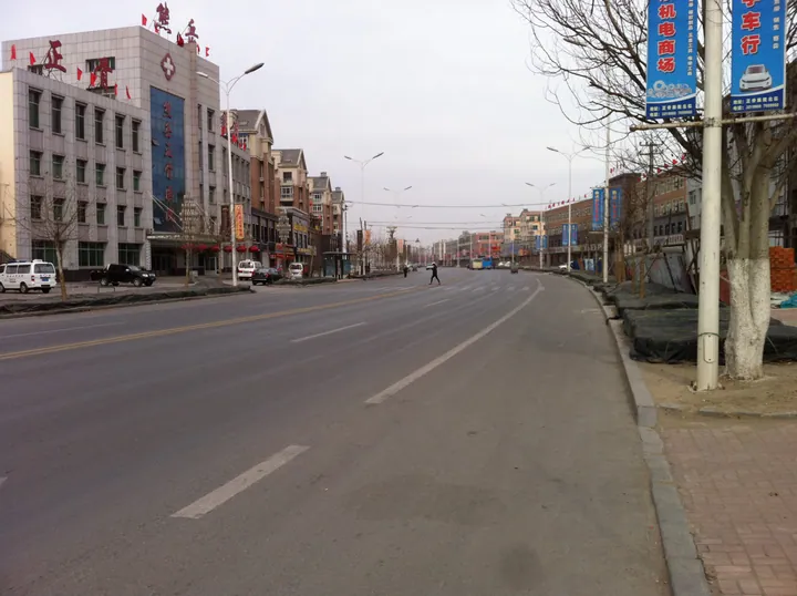
Photo adjustments
Full frame retained; proportionally resized and converted to WebP. No retouching or changes to the photographed subject. Card displays may crop the view.
- Administrative area
- District · 市辖区
- Part of
- Yingkou
- Chinese name
- 鲅鱼圈区
- Local areas
- District guide
Area & population
- Area in the source
- 352.90 km²
- Population · 2020 census
- 541,113
Source: cited geographic source, as of the dates shown.
History
Bayuquan was a township of Gai County (盖县) when the state chose it in 1974 as the site of Yingkou's new port; construction began in 1983, and the township became a district directly under Yingkou on 27 January 1984. A national development zone approved in October 1992 was merged with the district government in 1993. In 2004 three towns of Gaizhou (盖州), Xiongyue (熊岳), Lutun (芦屯) and Hongqi (红旗), were transferred to the district.
What to see
The seaside west of the district holds the Guishitan geopark (龟石滩地质公园), Duntaishan Park (墩台山公园) and the Yueyawan (月牙湾) beach resort, whose waterfront includes Shanhai Square (山海广场), a shell viewing platform and a statue of the "Mackerel Princess" (鲅鱼公主).
Inland to the east, Xiongyue town keeps stretches of its old city wall and a gate tower. The Xiongyuecheng hot spring (熊岳城温泉), which rises from the bed of the Xiongyue River (熊岳河) at about 85 °C, was developed in the South Manchuria Railway and Manchukuo era and counted as one of the three great hot springs of Manchuria; the writer Natsume Sōseki (夏目漱石) visited in 1909. The district government also lists Wang'er Mountain (望儿山), the Xiongyue botanical garden and the New Northeast Electric museum (新东北电气博物馆) among its sights. Xiongyue is also home to the Liaoning Fruit Research Institute, on the site of a South Manchuria Railway agricultural station.
Setting and getting oriented
Twelve rivers cross the district, chief among them the Xiongyue, Sha (沙河), Erdao (二道河) and Honghai (红海河). The district lies on a migration route, and large numbers of wild birds pass through in spring and autumn. The Changchun–Dalian railway, the Harbin–Dalian high-speed line and the Shenyang–Dalian expressway all run through the district.
Highlights
- Xiongyuecheng hot spring 熊岳城温泉: River-bed spring at about 85 °C, once one of the three great hot springs of Manchuria; visited by Natsume Sōseki in 1909.
- Shanhai Square 山海广场: Seafront square in the Yueyawan beach resort, with a shell viewing platform and the Mackerel Princess statue.
- Guishitan geopark 龟石滩地质公园: Coastal geopark on the western, seaward side of the district.
- Xiongyue old town 熊岳城: Former walled town with surviving sections of wall and a gate tower.
Sources for this guide
历史沿革 · Bayuquan District People's Government / Yingkou Economic and Technological Development Zone
自然情况 · Bayuquan District People's Government / Yingkou Economic and Technological Development Zone
鲅鱼圈区 · Wikipedia (Chinese) · CC BY-SA 4.0
熊岳镇 · Wikipedia (Chinese) · CC BY-SA 4.0
熊岳城温泉 · Wikipedia (Chinese) · CC BY-SA 4.0
Original English written from the listed sources and checked sentence by sentence against quoted extracts by a separate reviewer. Updated 2026-09-25.
Explore Bayuquan District
Core places to explore, with English and Chinese names.
Places to explore around Bayuquan District
 Shanhai Square Waterfront ·
 Plan your visit
Getting there
Bayuquan District is about 40 km in a straight line from central Yingkou. Search for 鲅鱼圈区 in a map app to find stations and your accommodation.
Where to stay →Build your route
Start with Shanhai Square Waterfront. The linked place guides have entrance and visit details.
Continue with Yingkou →More in Yingkou
Sources & geographic information
Administrative names and parent areas: Official geographic directory · Reference date 2026-09-06.
Some facts checked against 鲅鱼圈区 — Wikipedia contributors, CC BY-SA 4.0.
Some facts checked against 熊岳镇 — Wikipedia contributors, CC BY-SA 4.0.
Some facts checked against 熊岳城温泉 — Wikipedia contributors, CC BY-SA 4.0.
Photo: Shanhai Square Waterfront · Source photographer · License not provided. EXIF orientation normalized; resized without changing aspect ratio; converted to WebP. No subject edits.
Map data © OpenStreetMap contributors. Pins mark approximate centres, not entrances or boundaries.