


Photo adjustments
Proportionally resized and converted to WebP without cropping, retouching or changing the photographed subject.
Explore the region
About Flaming Mountains
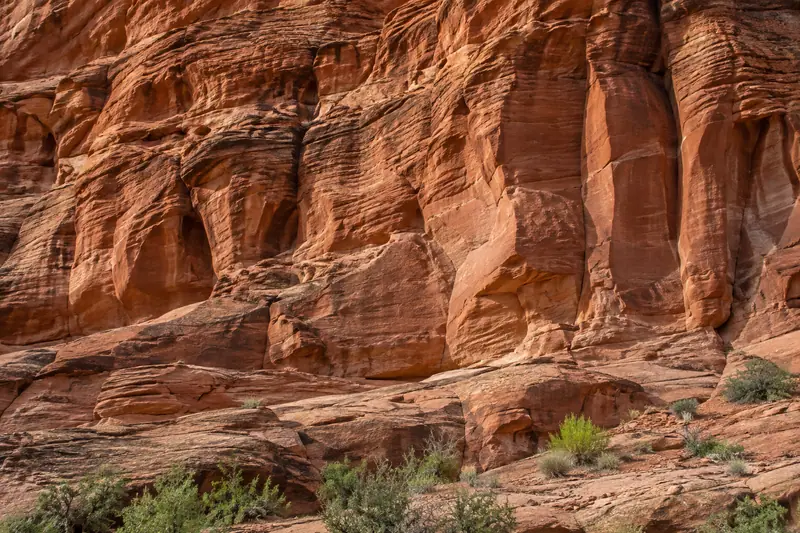
Deep gullies and strong sunlight create the flame-like appearance behind their name. The landscape also became famous through Journey to the West, whose magical story is distinct from the hills’ geology. Visitor attractions add themed interpretation and a giant thermometer, while nearby valleys show how water and settlement interrupt the barren slopes.
The hills form an east-west belt of folds and thrust faults in front of the Bogda Mountains (博格达山). Their exposed strata include Jurassic, Cretaceous, Paleogene, Neogene and Quaternary formations. The range extends about 100 kilometres and is 6 to 9 kilometres wide, with a generally gentler northern side and steeper southern slopes. Both sandstone and mudstone contribute to its orange-red and brown-red colouring.
The surrounding mountains block moist air, while descending air warms as it enters the basin. Bare ground, long sunshine hours and difficulty dispersing heat intensify the dry climate. Average annual temperature is 14.4°C, and surface temperatures can exceed 80°C. Water from the northern mountains seeps into alluvial fans, travels underground and re-emerges near the hills as springs and streams.
What to look for
- Red sandstone ridges and gullies create the characteristic flame-like forms.
- Journey to the West interpretation adds a literary layer to the landscape.
Background & history
The Flaming Mountains (Chinese: 火焰山; pinyin: huǒyànshān) or Huoyan Mountains, are barren, eroded, red sandstone hills in the Tian Shan of Xinjiang. They lie near the northern rim of the Taklamakan Desert and east of the city of Turpan. Their striking gullies and trenches caused by erosion of the red sandstone bedrock give the mountains a flaming appearance at certain times of the day. The mountains are approximately 100 kilometres (60 mi) long and 5–10 km (3–6 mi) wide, crossing the Turpan Depression from east to west. The average height of the Flaming Mountains is 500 m (1,600 ft), with some peaks reaching over 800 m (2,600 ft). The mountain climate is harsh, with summer temperatures often rising extremely high. One of the largest thermometers in China is on display adjacent to the mountain, tracking the surrounding ground temperatures. It is a popular tourist spot. A number of important palaeontological remains have been found in the area, see e.g. Lianmuqin Formation and Subashi Formation.
Excerpt from Wikipedia: Flaming Mountains · Wikipedia contributors · CC BY-SA 4.0. Selected introductory sentences; formatting simplified. Background information, not current visitor-service advice.
Location & getting there
Getting to Flaming Mountains
Choose the named Flaming Mountains visitor attraction east of Turpan rather than a general mountain-range pin. Confirm the entrance and any included indoor displays; combine the exposed viewpoint with a planned return vehicle.
Combine your visit
Choose from these complementary stops when planning your visit.
-
Visitor interpretation景区解说区
Separate the literary story from the geology.
-
Red-hill viewpoint红色山体观景处
Look at the gullies and changing light.
-
Bezeklik caves柏孜克里克千佛洞
Add the separate valley cave site if your route allows.
This is a suggested combination, not a timed route; confirm the opening and transport arrangements for your date.
Find Flaming Mountains
火焰山 · 吐鲁番
The pin marks the area, not the entrance.
More places nearby
Approximate straight-line distances between map pins, not travel distances.
Tuyoq 吐峪沟
6 km awayTuyoq is an oasis valley cutting through the Flaming Mountains in Shanshan County. Village buildings and grape cultivation occupy the greener ground beneath the dry cliffs, while nearby Buddhist cave remains add an earlier…
View guide →Astana Tombs 阿斯塔那古墓群
9 km awayAstana Cemetery served communities associated with nearby Gaochang. Its underground chambers preserved textiles, documents, painted objects and human remains in the dry environment, providing unusually detailed evidence of daily…
View guide →Gaochang ruins 高昌故城
9 km awayGaochang was an important oasis city and trading centre east of Turpan. Its surviving earthen walls, inner enclosures and religious ruins reveal a much broader urban footprint than a single monument. The city’s history includes…
View guide →Sources & visit information
The linked encyclopedia sources support background and place descriptions. Current opening hours, ticket prices, booking rules and transport schedules have not been independently verified for this guide. Confirm them with the venue or operator before travelling.
- Flaming Mountains — Wikipedia geographic and historical reference ↗
- Chinese Wikipedia: 火焰山 (revision 92719029, 2026-05-19) ↗
Geographic and historical facts selectively adapted from Wikipedia contributors, Flaming Mountains · CC BY-SA 4.0. Source revision 1368999778.
Background paragraphs translated and condensed from Wikipedia contributors, "火焰山", Chinese Wikipedia · CC BY-SA 4.0. Source revision 92719029.