


Get to know Huzhu Tu Autonomous County
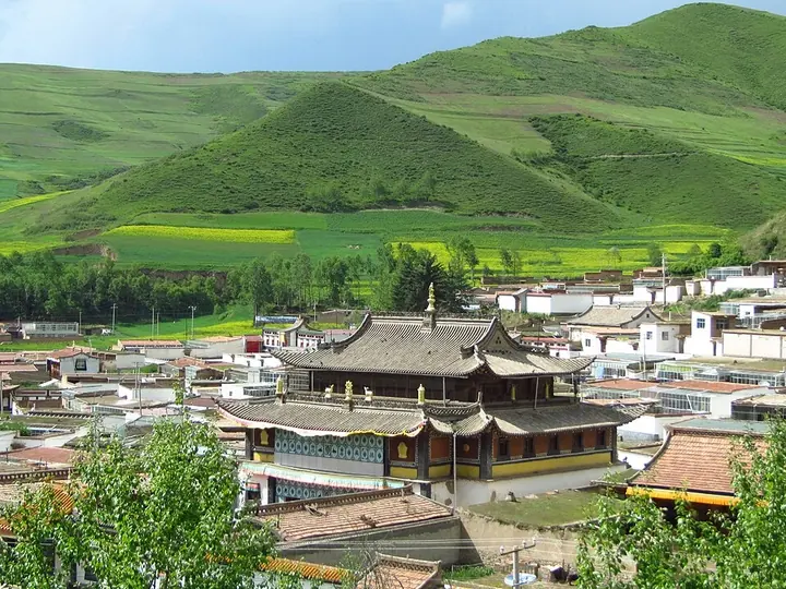
Photo adjustments
Full frame retained; proportionally resized and converted to WebP. No retouching or changes to the photographed subject. Card displays may crop the view.
- Administrative area
- Autonomous county · 自治县
- Part of
- Haidong
- Chinese name
- 互助土族自治县
- Local areas
- Autonomous county guide
Area & population
- Population · 2019
- 438,067
- Administrative seat
- Weiyuan Town
Source: cited geographic source, as of the dates shown.
Setting and landscape
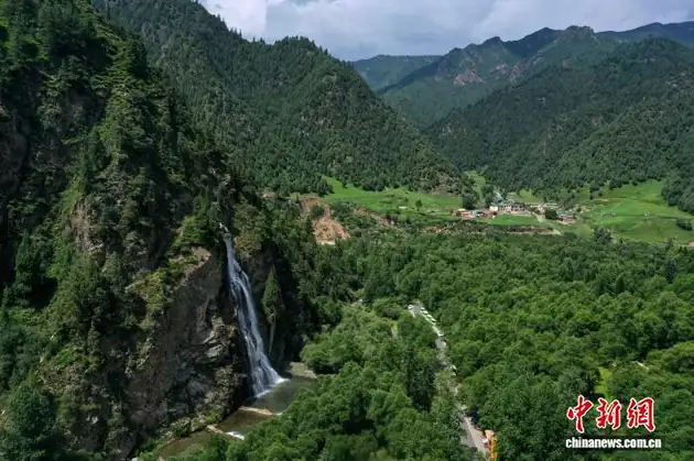
Beishan National Forest Park (北山国家森林公园) lies in the north-east of the county and covers 1,127 square kilometres at heights of 2,100 to 4,308 metres. In the Beishan area, Zhalong Gully (扎龙沟) spreads like a huge deer antler of ravines and dense woods, with rhododendrons in spring. Deep in the gully the Yaoshuiquan Waterfall (药水泉瀑布), fed by 108 springs, drops more than 40 metres over a width of about 50 metres; the water is a naturally carbonated mineral spring. Beside the Datong River (大通河) stands Qingtianzhu (擎天柱), a Danxia rock pillar more than 30 metres high.
History
The county government dates human settlement here to about 5,000 years ago. Under the Qin the area belonged to the land called Huangzhong (湟中); it was later governed from Linqiang County in the Han, Xiping Commandery in the Sui, Shanzhou in the Tang, Xining Prefecture in the Song and Yuan, and Xining Garrison and Xining Prefecture in the Ming and Qing. Huzhu became a county on 29 September 1930, a Tu autonomous area on 14 February 1954, and an autonomous county in 1955.
What to see
The Tu Folk Culture Park (土族故土园), which presents Tu customs, is Qinghai's third and Haidong's first national 5A scenic area. Youning Monastery (佑宁寺), a nationally protected heritage site, is a Tibetan Buddhist monastery known as the "mother of the monasteries north of the Huangshui"; Quezang Monastery (却藏寺) was an imperial monastery under the Qing, and Wufeng Monastery (五峰寺) was counted among the eight views of old Huangzhong.
Food, crafts and local products
Huzhu holds nine national intangible-heritage items, among them Tu coiled embroidery (土族盘绣), the Tu wheel swing (土族轮子秋), the Danma hua'er song festival (丹麻花儿会) and Lairenbu and Jimensuo (拉仁布与吉门索). Huzhu highland barley liquor (互助青稞酒) is a Chinese geographical-indication product; the county government calls Huzhu the country's largest production base for the spirit, brewed here for 400 years and led by the Tianyoude (天佑德) brand. The county government also lists Huzhu as the country's largest conservation base for the Bamei pig (八眉猪), and rapeseed and potatoes each account for a quarter of Qinghai's output.
Getting oriented
Menyuan lies to the north, Tianzhu and Yongdeng in Gansu and Ledu to the east, Datong to the west, and Xining's Chengdong District and Ping'an to the south. The county seat is Weiyuan (威远镇). Caojiabao Airport (曹家堡机场) is inside the county, and the Xining–Huzhu expressway (宁互高速公路) crosses it.
Highlights
- Tu Folk Culture Park 土族故土园: National 5A scenic area presenting Tu customs; the first in Haidong.
- Beishan National Forest Park 北山国家森林公园: 1,127 square kilometres of mountain forest at 2,100–4,308 metres in the north-east of the county.
- Youning Monastery 佑宁寺: Nationally protected Tibetan Buddhist monastery called the mother of the monasteries north of the Huangshui.
- Yaoshuiquan Waterfall 药水泉瀑布: Waterfall in Zhalong Gully fed by 108 mineral springs, dropping more than 40 metres.
- Huzhu highland barley liquor 互助青稞酒: Geographical-indication spirit brewed in Huzhu for 400 years.
Sources for this guide
互助土族自治县 - 维基百科,自由的百科全书 · Chinese Wikipedia · CC BY-SA 4.0
互助概况-互助县人民政府 · Huzhu Tu Autonomous County People's Government
北山扎龙沟景区-互助县人民政府 · Huzhu Tu Autonomous County People's Government
Original English written from the listed sources and checked sentence by sentence against quoted extracts by a separate reviewer. Updated 2026-09-26.
Explore Huzhu Tu Autonomous County
Core places to explore, with English and Chinese names.
Places to explore around Huzhu Tu Autonomous County
 Beishan National Forest Park · 北山国家森林公园
Beishan National Forest Park北山国家森林公园
Beishan National Forest Park (北山国家森林公园) is a forest park in the north-east of Huzhu Tu Autonomous County, Qinghai, approved as a provincial forest park in July 1992 and as a national forest park that November, rated an AAAA-grade tourist scenic area in 2000 and listed as a fourth-batch national geopark in 2005.
Read the place guide →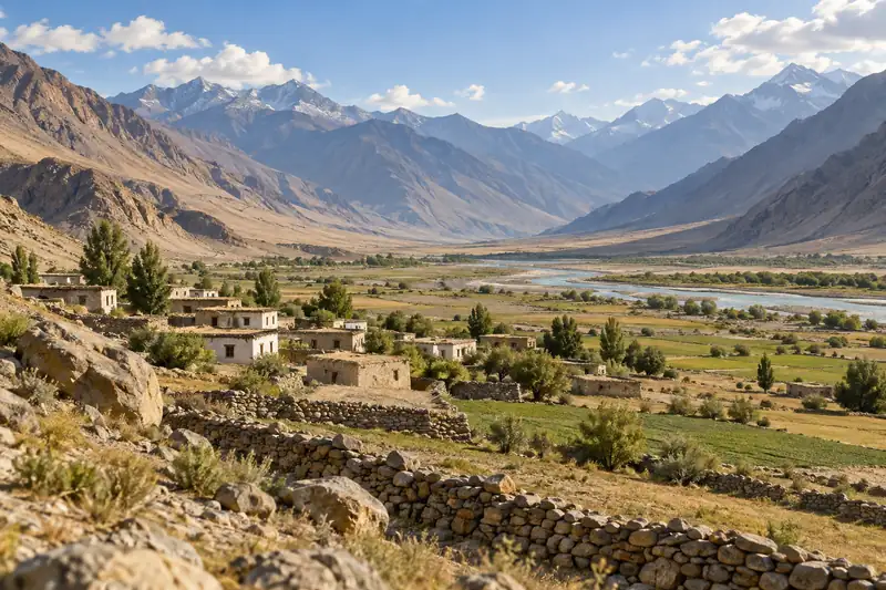 AI illustration · AI 示意图(仅供参考,非该地点实拍)
Huzhu Tu Homeland互助土族故土园
Huzhu Tu Homeland brings together several visitor areas around Weiyuan, with Tu dress, embroidery, courtyard architecture and performance traditions as its focus. Xiaozhuang village adds a community setting, while other…
Read the place guide →Plan your visit
Getting there
Huzhu Tu Autonomous County is about 50 km in a straight line from central Haidong. Search for 互助土族自治县 in a map app to find stations and your accommodation.
Where to stay →Build your route
Beishan National Forest Park and Huzhu Tu Homeland are both listed here. The linked place guides have entrance and visit details.
Continue with Haidong →More in Haidong
Sources & geographic information
Administrative names and parent areas: Official geographic directory · Reference date 2026-09-06.
Some facts checked against 互助土族自治县 — Wikipedia contributors, CC BY-SA 4.0.
Photo: Beishan National Forest Park · Source photographer · License not provided. EXIF orientation normalized; resized without changing aspect ratio; converted to WebP. No subject edits.
Map data © OpenStreetMap contributors. Pins mark approximate centres, not entrances or boundaries.