


Get to know Haidong

Photo adjustments
Full frame retained; proportionally resized and converted to WebP. No retouching or changes to the photographed subject. Card displays may crop the view.
- Administrative area
- Prefecture-level city · 地级市
- Part of
- Qinghai
- Chinese name
- 海东市
- Local areas
- 6 local areas
Area & population
- Area in the source
- 13,200.00 km²
- Population · 2019
- 1,726,100
- Administrative seat
- Ledu District
Source: cited geographic source, as of the dates shown.
Haidong was historically populated by the Qiang people, although the area has been inhabited as early as 6000 years ago. In 121 BC the area was captured by Huo Qubing, defeating the Xiongnu. In 399 AD the Xianbei founded the state of Nanliang, with its capital in Ledu District.
Explore Haidong
Core places to explore, with English and Chinese names.
Qutan Temple 瞿昙寺
Xunhua 循化
Huzhu Tu Homeland 互助土族故土园
Xining Caojiabao Airport 西宁曹家堡国际机场
Beishan National Forest Park 北山国家森林公园
Qunke New District Yellow River Waterfront 群科新区黄河沿岸
Mengda Heavenly Lake 孟达天池
Jiezi Great Mosque and Salar Folk Culture 街子清真大寺与撒拉族民俗
Lajia Site Museum 喇家遗址博物馆
Ledu District 乐都区
Ping'an District 平安区
Minhe Hui and Tu Autonomous County 民和回族土族自治县
Huzhu Tu Autonomous County 互助土族自治县
Hualong Hui Autonomous County 化隆回族自治县
Xunhua Salar Autonomous County 循化撒拉族自治县
Places to explore around Haidong
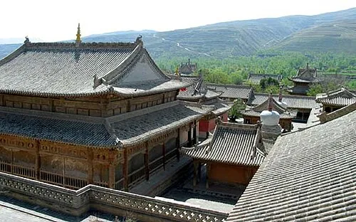 Roofs and courtyards of Qutan Temple in Ledu, Qinghai; photographed by Andreas Gruschke in May 2004.
Qutan Temple瞿昙寺
Qutan Temple stands in a valley south of Ledu, with a Ming-period complex shaped by imperial patronage and Tibetan Buddhist use. The scale of Longguo Hall and the sequence of courts show a strong relationship with Chinese palace…
Read the place guide →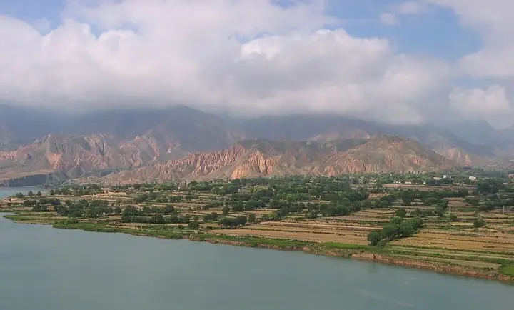 The Yellow River's southern shore near Xunhua, Haidong · 青海海东循化附近黄河南岸 Source-recorded photograph date: 2018-09-08.
Xunhua循化
Xunhua introduces Salar communities along the Yellow River in eastern Qinghai. Jiezi is particularly associated with stories of migration from Central Asia: Camel Spring commemorates the legendary white camel, while Jiezi Mosque…
Read the place guide → AI illustration · AI 示意图(仅供参考,非该地点实拍)
Huzhu Tu Homeland互助土族故土园
Huzhu Tu Homeland brings together several visitor areas around Weiyuan, with Tu dress, embroidery, courtyard architecture and performance traditions as its focus. Xiaozhuang village adds a community setting, while other…
Read the place guide → Xining Caojiabao Airport’s terminal, photographed in 2018 · 西宁曹家堡机场 Photograph date recorded by the source: 26 August 2018, 11:37:05.
Xining Caojiabao Airport西宁曹家堡国际机场
Xining Caojiabao Airport is Qinghai’s main air gateway, located east of the city in Haidong. The expanded T3 terminal and its ground-transport centre changed the arrival layout in August 2025. China Eastern and Hainan Airlines…
Read the place guide →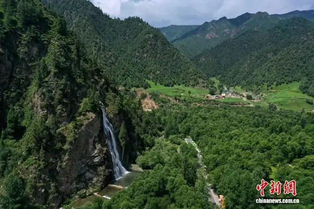 Beishan National Forest Park · 北山国家森林公园
Beishan National Forest Park北山国家森林公园
Beishan National Forest Park (北山国家森林公园) is a forest park in the north-east of Huzhu Tu Autonomous County, Qinghai, approved as a provincial forest park in July 1992 and as a national forest park that November, rated an AAAA-grade tourist scenic area in 2000 and listed as a fourth-batch national geopark in 2005.
Read the place guide →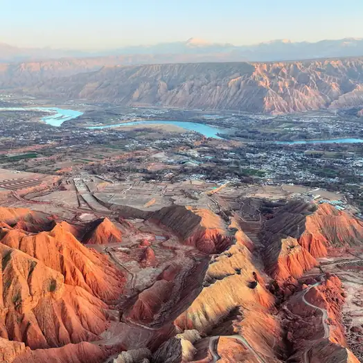 Qunke New District Yellow River Waterfront · 群科新区黄河沿岸
Qunke New District Yellow River Waterfront群科新区黄河沿岸
Qunke New District (群科新区) is the new town area of Hualong Hui Autonomous County in Haidong, Qinghai, built on the bank of the Yellow River. The riverbank this entry covers is the stretch of shore that the county's own forestry plan names the Qunke New District section of the Yellow River.
Read the place guide → Mengda Heavenly Lake · 孟达天池
Mengda Heavenly Lake孟达天池
Mengda Tianchi (孟达天池) is a barrier lake of about 20 hectares lying in the heart of the Mengda National Nature Reserve, in Xunhua Salar Autonomous County, Haidong, Qinghai. The reserve was established in 1980 and approved as a national nature reserve in April 2000, and its protection target is a forest ecosystem.
Read the place guide → Jiezi Great Mosque and Salar Folk Culture · 街子清真大寺与撒拉族民俗
Jiezi Great Mosque and Salar Folk Culture街子清真大寺与撒拉族民俗
Jiezi Great Mosque (街子清真大寺) is the ancestral mosque of the Salar people, in Sanlanbahai village, Jiezi town, Xunhua Salar Autonomous County, Haidong, Qinghai. The catalogue pairs it with Salar folk custom, and the pages cited here carry that half as well: the story of the Salar migration, the spring and the ancestors' tombs within a hundred paces of the mosque, and the customs kept at them.
Read the place guide → Lajia Site Museum · 喇家遗址博物馆
Lajia Site Museum喇家遗址博物馆
Lajia Site Museum (喇家遗址博物馆) is the museum at the Lajia site in Lajia village, Guanting town, Minhe Hui and Tu Autonomous County, Haidong, Qinghai. The site is a large settlement of about 4,000 years ago on the upper Yellow River that both cited pages describe as the only large prehistoric disaster site found by archaeology in China so far.
Read the place guide →Local life & food
Haidong local specialties
海东市特色美食 · 11 specialties to discover
 Hehuang lamb fazi 河湟羊肉筏子AI dish illustration / AI 菜品示意图
Expect a substantial, savoury lamb preparation with a texture determined by the mixture and casing.
Source ↗Read the dish guide → Qinghai mingxi grain spirit 青海酩醯酒AI dish illustration / AI 菜品示意图
The flavour is concentrated and alcoholic rather than a mild sweet porridge. Aroma varies by grain and process.
Source ↗Read the dish guide →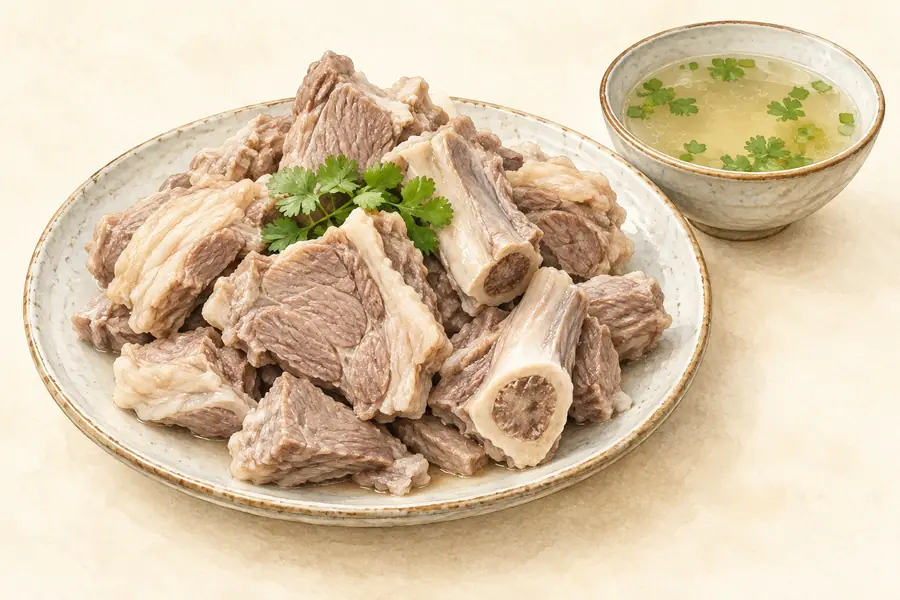 Huzhu Hand-Grabbed Mutton 互助手抓羊肉AI illustration · AI 示意图(仅供参考,非实拍)
Huzhu Hand-Grabbed Mutton (互助手抓羊肉) is listed among the local specialties of Haidong, Qinghai. The name includes 羊肉 (lamb or mutton).
Read the dish guide →Minhe Mutton 民和羊肉AI illustration · AI 示意图(仅供参考,非实拍)
Minhe Mutton (民和羊肉) is listed among the local specialties of Haidong, Qinghai. The name includes 羊肉 (lamb or mutton).
Read the dish guide →Xunhua Salar Hand-Grabbed Mutton 循化撒拉族手抓AI illustration · AI 示意图(仅供参考,非实拍)
Xunhua Salar Hand-Grabbed Mutton (循化撒拉族手抓) is a central meat course in the Salar banquet tradition of Xunhua (循化).
Read the dish guide → Hualong Beef Noodles 化隆牛肉面Reference photo of a similar dish · 同类菜品参考照片
Hualong Beef Noodles (化隆牛肉面) belongs to the pulled-noodle trade of Hualong Hui Autonomous County (化隆回族自治县), in Haidong (海东), Qinghai (青海). The name is also a registered brand used in the county's noodle-shop network.
Read the dish guide →
Photo adjustments
Full frame retained; EXIF orientation normalized, proportionally resized to at most 800 pixels and converted to WebP. No generated pixels or subject changes. Cards may crop the display.
 Ledu Stir-Fried Mutton with Long Chilies 乐都长辣椒炒羊肉AI illustration · AI 示意图(仅供参考,非实拍)
Ledu Stir-Fried Mutton with Long Chilies (乐都长辣椒炒羊肉) is listed among the local specialties of Haidong, Qinghai. The name includes 羊肉 (lamb or mutton). 炒 describes stir-frying.
Read the dish guide →Ping'an Selenium-Rich Mutton 平安富硒羊肉AI illustration · AI 示意图(仅供参考,非实拍)
Ping'an Selenium-Rich Mutton (平安富硒羊肉) is listed among the local specialties of Haidong, Qinghai. The name includes 羊肉 (lamb or mutton).
Read the dish guide →All dish names · 全部菜名 (11)
- Hehuang lamb fazi · 河湟羊肉筏子
- Qinghai mingxi grain spirit · 青海酩醯酒
- Huzhu Hand-Grabbed Mutton · 互助手抓羊肉
- Minhe Mutton · 民和羊肉
- Xunhua Salar Hand-Grabbed Mutton · 循化撒拉族手抓
- Hualong Beef Noodles · 化隆牛肉面
- Ledu Stir-Fried Mutton with Long Chilies · 乐都长辣椒炒羊肉
- Ping'an Selenium-Rich Mutton · 平安富硒羊肉
- Sweet Fermented Highland Barley · 青稞甜醅
- Niangpi noodle sheets · 酿皮
- Tu Fried Flatbread · 土族油饼
More dishes from across Qinghai are in the Qinghai food guide.
Counties & districts in Haidong
6 areas belong directly to Haidong.
6 areas
Ledu District 乐都区
Ledu District is a district of the city of Haidong, Qinghai province, China. Nearby are Ping'an District and the city of Xining. Ledu used to be named Nianbo county before 1929. The county dates back to 1724.
Explore the area →DistrictPing'an District 平安区
Ping'an District (simplified Chinese: 平安区; traditional Chinese: 平安區; pinyin: Píng'ān Qū) formerly known as Ping'anyi (simplified Chinese: 平安驿; traditional Chinese: 平安驛; pinyin: Píng'ānyì), is an…
Explore the area →Autonomous countyMinhe Hui and Tu Autonomous County 民和回族土族自治县
Minhe Hui and Tu Autonomous County, known in Tibetan as Kamalog, is the easternmost county in Qinghai Province, China. It is under the administration of Haidong (lit. Eastern Qinghai) city.
Explore the area →Autonomous countyHuzhu Tu Autonomous County 互助土族自治县
Huzhu Tu Autonomous County, or in short Huzhu County (互助县), is an autonomous county under the jurisdiction of the prefecture-level city of Haidong, in the east of Qinghai province, China, bordering Gansu…
Explore the area →Show fewer areas
Hualong Hui Autonomous County 化隆回族自治县
Hualong Hui Autonomous County (simplified Chinese: 化隆回族自治县; traditional Chinese: 化隆回族自治縣; pinyin: Huàlóng Huízú Zìzhìxiàn; Xiao'erjing: خُوَلْو خُوِذُو ذِجِشِیًا) is a county in the east of Qinghai Province…
Explore the area →Autonomous countyXunhua Salar Autonomous County 循化撒拉族自治县
Xunhua Salar Autonomous County (Amdo Tibetan: ཡ་རྫི, Amdo Tibetan pronunciation: [jaɦdzə]) is an autonomous county in the southeast of Haidong Prefecture, in Qinghai province, China.
Explore the area →No areas match this name.
Plan your visit
Getting there
Search for 海东市 in a map app to find stations and your accommodation.
Where to stay →Build your route
Qutan Temple and Xunhua are about 60 km apart in a straight line. The linked place guides have entrance and visit details.
Continue with Qinghai →More in Qinghai
Sources & geographic information
Administrative names and parent areas: Official geographic directory · Reference date 2026-09-06.
Background text adapted from Haidong — Wikipedia contributors, under CC BY-SA 4.0. Text has been shortened and reorganized; source revision 1321647535.
Photo: Qutan Temple · Andreas Gruschke (Freiburg) · CC BY-SA 3.0. Proportionally resized and converted to WebP without cropping, retouching or changing the photographed subject.

Photo: Xunhua · Dominique Roux · CC BY-SA 4.0. Full frame retained; resized proportionally to a maximum dimension of 960 pixels and converted to WebP quality 88. No crop, retouch, generated elements, or subject alteration. Final website rendition: full frame retained, proportionally resized to at most 720 pixels and converted to WebP. No additional retouching or subject alteration. Card displays may crop the view.

Photo: Xining Caojiabao Airport · 西安兵马俑 · CC BY-SA 4.0. Full frame retained; proportionally resized and converted to WebP. No retouching or changes to the photographed subject. Card displays may crop the view.

Photo: Beishan National Forest Park · Source photographer · License not provided. EXIF orientation normalized; resized without changing aspect ratio; converted to WebP. No subject edits.
Photo: Qunke New District Yellow River Waterfront · Source photographer · License not provided. EXIF orientation normalized; resized without changing aspect ratio; converted to WebP. No subject edits.
Photo: Mengda Heavenly Lake · Source photographer · License not provided. EXIF orientation normalized; resized without changing aspect ratio; converted to WebP. No subject edits.
Photo: Jiezi Great Mosque and Salar Folk Culture · Source photographer · License not provided. EXIF orientation normalized; resized without changing aspect ratio; converted to WebP. No subject edits.
Photo: Lajia Site Museum · Source photographer · License not provided. EXIF orientation normalized; resized without changing aspect ratio; converted to WebP. No subject edits.
Map data © OpenStreetMap contributors. Pins mark approximate centres, not entrances or boundaries.