


Get to know Gonghe County
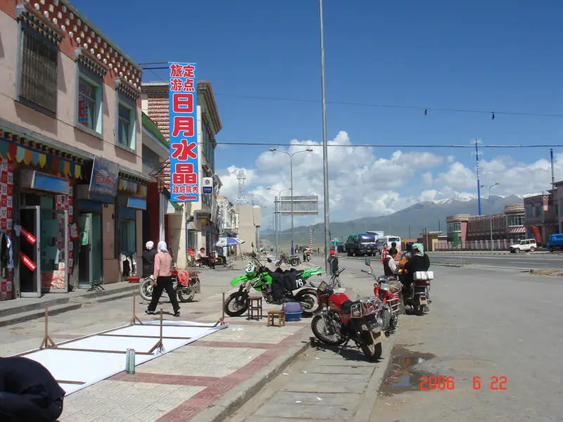
Photo adjustments
Full frame retained; EXIF orientation normalized, proportionally resized to at most 800 pixels and converted to WebP. No generated pixels or subject changes. Cards may crop the display.
- Administrative area
- County · 县
- Part of
- Hainan Tibetan Autonomous Prefecture
- Chinese name
- 共和县
- Local areas
- County guide
Area & population
- Area in the source
- 16,364.00 km²
- Population · 2020
- 133,409
- Administrative seat
- Qabqa
Source: cited geographic source, as of the dates shown.
Setting and landscape
The county falls into three bands: the Riyue Mountain (日月山) uplift and the Qinghai Lake basin in the north, the Qinghai Nanshan (青海南山) range and the Gonghe Basin (共和盆地) in the middle, and the Ela Mountains (鄂拉山) and Yellow River valley in the south. Average altitude is 3,200 metres; the top is Qielonggang (切龙岗) in the Ela range at 5,290 metres and the lowest point is the Longyang Gorge (龙羊峡) at 2,460 metres. The Yellow River runs 90 km through the county. The climate is dry and cool with strong sunshine, about 2,908 hours a year, and a third of the county, including the Talatan (塔拉滩) and Qiejitan (切吉滩) flats, is suited to solar and wind power.
History
In 540 the Tuyuhun (吐谷浑) ruler Kualü (夸吕) made Fuqi City (伏俟城), in today's Tiebujia village (铁卜加村), his capital; the name means "city of kings" in the Xianbei language. Its walls measure 220 by 200 metres, with a single gate on the south side, and the site became a Qinghai provincial heritage site in 1986. The Tang princess Wencheng crossed Riyue Mountain on her way to marry into the Tibetan court. The modern county was created on 11 July 1929 at Qugou (曲沟), named for the Republican slogan of "five races under one republic" (五族共和).
What to see
Qinghai Lake was listed as a wetland of international importance in 1992 and became a national 5A scenic area in 2011. On its south-eastern shore, Erlangjian (二郎剑) is a narrow spit about 25 km long that was once China's first torpedo test base, called Base 151 for its 151 km distance from Xining (西宁). Riyue Mountain, anciently Chiling (赤岭, "red ridge") after its red soil, was the Tibetan–Han boundary and a tea-and-horse market; Sun and Moon pavilions stand at the pass. Near the road from Daotanghe (倒淌河) to the lake, a mani stone site gathers carved prayer stones, a white stupa and prayer wheels. Longyangxia hydropower station, the first large cascade station on the upper Yellow River, is a national AAA scenic area, and its reservoir covers 380 square kilometres.
Getting oriented
The county seat is Qabqa (恰卜恰镇), and the county lies 142 km from the provincial capital, Xining. National highways 109 and 214, the Beijing–Tibet Expressway and the Gongyu Expressway cross the county. The Waliguan Baseline Observatory (瓦里关大气本底基准观测站), set up in 1994, is one of 29 global baseline stations of the World Meteorological Organization's atmosphere watch.
Highlights
- Fuqi City ruins 伏俟城遗址: Tuyuhun capital from 540; provincial heritage site since 1986.
- Erlangjian 二郎剑: A 25 km spit into Qinghai Lake, once China's first torpedo test base.
- Riyue Mountain 日月山: Tibetan–Han boundary and tea-horse market on Princess Wencheng's route.
- Longyangxia hydropower station 龙羊峡水电站: First large cascade dam on the upper Yellow River; AAA scenic area since 2008.
- Longyangxia salmon 龙羊峡三文鱼: Named a Chinese characteristic farm-product zone in 2020.
Sources for this guide
共和县_各县概况_圣洁海南_海南藏族自治州人民政府 · Hainan Tibetan Autonomous Prefecture People's Government
共和县 - 维基百科,自由的百科全书 · Wikipedia (Chinese) · CC BY-SA 4.0
Original English written from the listed sources and checked sentence by sentence against quoted extracts by a separate reviewer. Updated 2026-09-26.
Explore Gonghe County
Core places to explore, with English and Chinese names.
Places to explore around Gonghe County
 The Longyang Gorge marker overlooking the reservoir on the Yellow River, Gonghe County ·
 Plan your visit
Getting there
Gonghe County covers the centre of Hainan Tibetan Autonomous Prefecture. Search for 共和县 in a map app to find stations and your accommodation.
Where to stay →Build your route
Start with Longyangxia Gorge. The linked place guides have entrance and visit details.
Continue with Hainan Tibetan Autonomous Prefecture →More in Hainan Tibetan Autonomous Prefecture
Sources & geographic information
Administrative names and parent areas: Official geographic directory · Reference date 2026-09-06.
Some facts checked against 共和县 — Wikipedia contributors, CC BY-SA 4.0.
Photo: Longyangxia Gorge · 伊盛昌 · CC BY 3.0. Full frame retained; proportionally resized and converted to WebP. No retouching or changes to the photographed subject. Card displays may crop the view.

Map data © OpenStreetMap contributors. Pins mark approximate centres, not entrances or boundaries.