


Get to know Tongde County
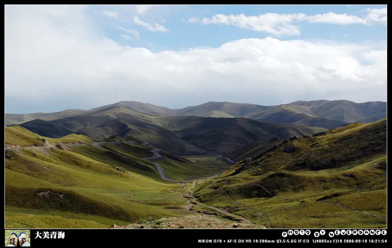
Photo adjustments
EXIF orientation normalized; resized without changing aspect ratio; converted to WebP. No subject edits.
- Administrative area
- County · 县
- Part of
- Hainan Tibetan Autonomous Prefecture
- Chinese name
- 同德县
- Local areas
- County guide
Area & population
- Area in the source
- 4,758.00 km²
- Population · 2020
- 60,268
- Administrative seat
- Gabasumdo
Source: cited geographic source, as of the dates shown.
Setting and landscape
Tongde sits on the second bend of the Yellow River's "nine bends". The land is high in the south-east and low in the north-west, with grassland flats in the middle; heights range from 2,648 to 4,671 metres, and the county seat, Gabasongduo (尕巴松多镇), stands at 3,060 metres. The Yellow River enters from Henan Mongol Autonomous County (河南蒙古族自治县) and flows 208 km through four townships; the county counts 48 rivers and tributaries, with the Yellow River as their trunk. Winters are long and dry, summers short and cool. Just over a quarter of the county, 1,238 square kilometres, belongs to the Sanjiangyuan (三江源) national nature reserve.
History
The Zongri culture (宗日文化) originated in Bagou township (巴沟乡) about 5,000 years ago. Its painted pottery basins, one decorated with dancing figures and one with two people carrying a load between them, are called the "crown of national treasures" by the county government. Tongde County was split from Guide (贵德) in the Republican period, with its first seat at Lajia Monastery (拉加寺), now in Maqin; the government moved to Gabasongduo in 1953. The county passed to Golog in 1959 and returned to Hainan in 1962.
What to see
Shizang Danxia (石藏丹霞) in Hebei township (河北乡) became a national geopark in March 2020. The county government describes it as China's only Danxia-landform national geopark with an average altitude above 3,000 metres, combining Danxia cliffs and gorges with traces of Quaternary glaciers and a Yellow River canyon. Hebei township also has juniper forests. The county's three main monasteries are Shizang (石藏寺), founded in 1765, Sailihai (赛力亥寺) and Xiangchi (香池寺). The Batan grassland (巴滩草原) is another of the landscapes the county promotes.
Food and local products
Tongde is mainly a herding county and calls itself China's "capital of improved yak breeds". Yaks, Tibetan sheep, highland barley, rapeseed and fodder are its five main farm products. Felt hat making and traditional butter making are on Qinghai's provincial intangible heritage list.
Highlights
- Shizang Danxia National Geopark 石藏丹霞国家地质公园: High-altitude Danxia geopark, designated in March 2020.
- Zongri culture site 宗日文化遗址: Prehistoric culture of about 5,000 years ago, known for painted pottery.
- Shizang Monastery 石藏寺: Founded in 1765, one of the county's three main monasteries.
- Felt hat making 毡帽制作: On Qinghai's provincial intangible heritage list.
Sources for this guide
同德县情概况_同德概况_同德概况_同德县人民政府 · Tongde County People's Government
河北乡简介_乡镇概况_同德概况_同德县人民政府 · Tongde County People's Government
同德县_各县概况_圣洁海南_海南藏族自治州人民政府 · Hainan Tibetan Autonomous Prefecture People's Government
同德县 - 维基百科,自由的百科全书 · Wikipedia (Chinese) · CC BY-SA 4.0
Original English written from the listed sources and checked sentence by sentence against quoted extracts by a separate reviewer. Updated 2026-09-26.
Explore Tongde County
Core places to explore, with English and Chinese names.
Places to explore around Tongde County
 Shicang Danxia Geopark ·
 Plan your visit
Getting there
Tongde County is about 145 km in a straight line from central Hainan Tibetan Autonomous Prefecture. Search for 同德县 in a map app to find stations and your accommodation.
Where to stay →Build your route
Start with Shicang Danxia Geopark. The linked place guides have entrance and visit details.
Continue with Hainan Tibetan Autonomous Prefecture →More in Hainan Tibetan Autonomous Prefecture
Sources & geographic information
Administrative names and parent areas: Official geographic directory · Reference date 2026-09-06.
Some facts checked against 同德县 — Wikipedia contributors, CC BY-SA 4.0.
Photo: Shicang Danxia Geopark · Source photographer · License not provided. EXIF orientation normalized; resized without changing aspect ratio; converted to WebP. No subject edits.
Map data © OpenStreetMap contributors. Pins mark approximate centres, not entrances or boundaries.