


Get to know Guide County
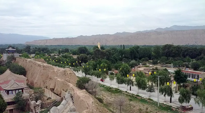
Photo adjustments
Full frame retained; proportionally resized and converted to WebP. No retouching or changes to the photographed subject. Card displays may crop the view.
- Administrative area
- County · 县
- Part of
- Hainan Tibetan Autonomous Prefecture
- Chinese name
- 贵德县
- Local areas
- County guide
Area & population
- Area in the source
- 3,504.00 km²
- Population · 2020
- 105,645
- Administrative seat
- Qusib (Heyin)
Source: cited geographic source, as of the dates shown.
Setting and landscape
Guide sits on the transition between the Loess Plateau and the Qinghai-Tibet Plateau. The land is high to the north and south and low in the middle, and the county town stands at about 2,200 metres. Heights range from 2,170 metres at the mouth of the Songba Gorge (松巴峡) to 5,011 metres. The county's Danxia landforms, the Yellow River valley and the wind-eroded Mawu Gorge (麻吾峡) make up a national geopark, and the river and its banks form a national wetland park. Among the hot springs, Zhacanggou (扎仓沟) emerges at 92°C.
History
People lived here in the Neolithic, and remains of the Majiayao (马家窑) and Kayue (卡约) cultures have been found. The Western Han placed Heguan County (河关县) here, the Yuan set up Guide Prefecture (贵德州) in 1271 and the Republic made it a county. The county government says Silk Road and Tang-Tibet Ancient Road (唐蕃古道) routes crossed the area. The Ming city wall was begun in 1374 and finished in 1380. Mastodon fossils have been dug up at Wulukou (吾路口) in Hexi Township (河西乡).
What to see
The Ming-era Yuhuang Pavilion (玉皇阁) and the Tang-period Zanggai ancient town (藏盖古城) are among 17 sites under provincial protection. The county government names its best-known scenes as including the clear Yellow River, pear blossom, old waterwheels, Danxia landforms, Yellow River stones and the Yuhuang Pavilion. The Laxiwa Hydropower Station (拉西瓦水电站), with 4.2 million kilowatts installed, is described by the county government as the largest on the upper Yellow River by installed capacity.
Food and local products
Fruit growing here goes back more than 300 years, in warm valley land below 2,600 metres, with 57 apple and 34 pear varieties. Local vegetables include the Guide long aubergine (贵德棒茄), and Guide honey (贵德蜂蜜) is a national geographical-indication product.
Highlights
- Yuhuang Pavilion 贵德玉皇阁: Ming-era building under provincial protection, one of the county's best-known scenes.
- Guide National Geopark 贵德国家地质公园: Danxia landforms, the Yellow River valley and the wind-eroded Mawu Gorge.
- Laxiwa Hydropower Station 拉西瓦水电站: 4.2 million kilowatts, described as the largest on the upper Yellow River.
- Guide honey 贵德蜂蜜: National geographical-indication product.
Sources for this guide
贵德概况_走进贵德_贵德县人民政府 · Guide County People's Government
历史文化_走进贵德_贵德县人民政府 · Guide County People's Government
自然资源_走进贵德_贵德县人民政府 · Guide County People's Government
贵德县 - 维基百科,自由的百科全书 · Chinese Wikipedia · CC BY-SA 4.0
Original English written from the listed sources and checked sentence by sentence against quoted extracts by a separate reviewer. Updated 2026-09-25.
Explore Guide County
Core places to explore, with English and Chinese names.
Places to explore around Guide County
 Guide National Geopark Ashigong · 贵德国家地质公园阿什贡
Guide National Geopark Ashigong贵德国家地质公园阿什贡
Ashigong Qicai Fengcong (阿什贡七彩峰丛) is the core scenic area of the Guide national geopark, in Ashigong village, Garang township, Guide County, Hainan Tibetan Autonomous Prefecture, Qinghai.
Read the place guide →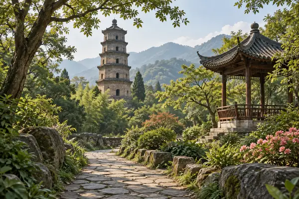 AI illustration · AI 示意图(仅供参考,非该地点实拍)
Guide Jade Emperor Pavilion贵德玉皇阁
Guide’s Jade Emperor Pavilion belongs to a larger historic complex combining the Confucian temple, Guanyue Temple and Wanshou Temple. Their different dedications make the visit more than a climb to one tower. The group…
Read the place guide →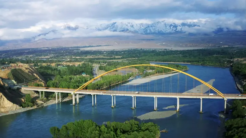 Yellow River Clear Water Scenic Area · 黄河清水景观区
Yellow River Clear Water Scenic Area黄河清水景观区
The clear-water stretch of the Yellow River at Guide (黄河清水景观区) is the county's section of the river in Hainan Tibetan Autonomous Prefecture, Qinghai, the water the county's own tourism account describes as carrying a reputation for being the clearest under heaven within Guide.
Read the place guide →Plan your visit
Getting there
Guide County is about 85 km in a straight line from central Hainan Tibetan Autonomous Prefecture. Search for 贵德县 in a map app to find stations and your accommodation.
Where to stay →Build your route
Guide National Geopark Ashigong and Guide Jade Emperor Pavilion are both listed here. The linked place guides have entrance and visit details.
Continue with Hainan Tibetan Autonomous Prefecture →More in Hainan Tibetan Autonomous Prefecture
Sources & geographic information
Administrative names and parent areas: Official geographic directory · Reference date 2026-09-06.
Some facts checked against 贵德县 — Wikipedia contributors, CC BY-SA 4.0.
Photo: Guide National Geopark Ashigong · Source photographer · License not provided. EXIF orientation normalized; resized without changing aspect ratio; converted to WebP. No subject edits.
Photo: Yellow River Clear Water Scenic Area · Source photographer · License not provided. EXIF orientation normalized; resized without changing aspect ratio; converted to WebP. No subject edits.
Map data © OpenStreetMap contributors. Pins mark approximate centres, not entrances or boundaries.