


Get to know Guinan County
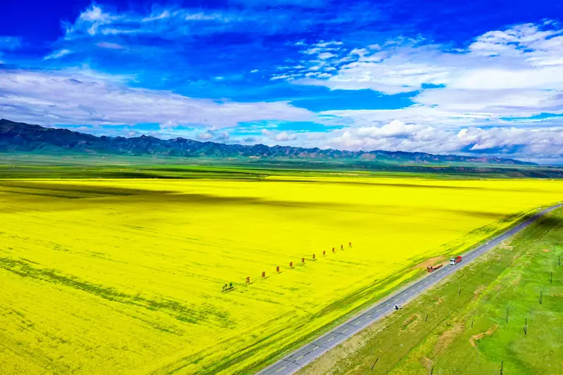
Photo adjustments
EXIF orientation normalized; resized without changing aspect ratio; converted to WebP. No subject edits.
- Administrative area
- County · 县
- Part of
- Hainan Tibetan Autonomous Prefecture
- Chinese name
- 贵南县
- Local areas
- County guide
Area & population
- Area in the source
- 6,647.00 km²
- Population · 2020
- 71,841
- Administrative seat
- Mangqu
Source: cited geographic source, as of the dates shown.
Setting and landscape
The county sits in the transition between the edge of the Qilian range and the Kunlun, within the Gonghe Basin (共和盆地). High mountains fill the south, part of the Xiqing fold plateau, where Zhihai Peak (直亥山峰) reaches 5,011 metres. The middle of the county is open, level plateau flats, including the Mugetan desert (木格滩沙漠), an inland sandy flat of dunes scattered with pasture. The Yellow River and its tributaries, the Shagou (沙沟河) and Mangla (茫拉河) rivers, have cut terraces and valleys; the lowest point, 2,222 metres, is on the Yellow River at Laxiwa (拉西瓦) in the north. The Longyangxia Reservoir (龙羊峡水库), the largest on the upper Yellow River, lies on the northern border with Gonghe. Winters are long and summers short, with a mean annual temperature of 2.3°C.
History
For centuries the area was governed from Guide: the Ming made Guide a garrison post in 1375, and the Qing turned it into a sub-prefecture in 1792 with Guinan still under it. A Lucang (鲁仓) administrative district was set up in 1913, and a Nanping (南屏) office ran the Lucang and Mangla areas from 1939 until 1944. On 15 July 1953 pastoral areas of Guide were split off to form Guinan County, which became one of the five counties of Hainan prefecture.
What to see
Taxiu Monastery (塔秀寺) stands 15 km south-west of the county seat in a valley enclosed by hills on three sides. It holds more than 30 statues, including Shakyamuni, Tsongkhapa and Maitreya, of which a Shakyamuni figure four chi (Chinese feet) tall is prized most, and keeps three sets of the Buddhist canon. Lucang Monastery (鲁仓寺) lies about 2 km north-west of Mangla at the foot of Hamairi hill (哈买日山); its assembly hall and two main chapels are the core of a complex of 955 rooms. The prefecture government also lists sites of the Kayue culture (卡约文化), the most numerous and widespread of Qinghai's ancient cultures.
Food and local products
The prefecture government describes the climate as suited to grassland herding. Pastures carry Tibetan sheep, yaks, goats and Hequ horses (河曲马), while farming areas keep donkeys, mules and cattle, including Holstein dairy cows, and Wangshike village (汪什科村) in Shagou township still has a few camels. The Mangla and Shagou valleys are the county's key farming areas. Caterpillar fungus grows on alpine meadows between 3,800 and 5,000 metres and is made into cordyceps liquor.
Highlights
- Taxiu Monastery 塔秀寺: Valley monastery 15 km south-west of the county seat with over 30 statues.
- Lucang Monastery 鲁仓寺: Complex of 955 rooms at the foot of Hamairi hill.
- Mugetan desert 木格滩沙漠: Inland dune field on the county's central plateau flats.
- Hequ horse 河曲马: One of the main livestock breeds of the county's pastures.
Sources for this guide
贵南县_各县概况_圣洁海南_海南藏族自治州人民政府 · Hainan Tibetan Autonomous Prefecture People's Government
贵南县 - 维基百科,自由的百科全书 · Wikipedia (Chinese) · CC BY-SA 4.0
Original English written from the listed sources and checked sentence by sentence against quoted extracts by a separate reviewer. Updated 2026-09-26.
Explore Guinan County
Core places to explore, with English and Chinese names.
Guinan County 贵南县
Plan your visit
Getting there
Guinan County is about 80 km in a straight line from central Hainan Tibetan Autonomous Prefecture. Search for 贵南县 in a map app to find stations and your accommodation.
Where to stay →More in Hainan Tibetan Autonomous Prefecture
Sources & geographic information
Administrative names and parent areas: Official geographic directory · Reference date 2026-09-06.
Some facts checked against 贵南县 — Wikipedia contributors, CC BY-SA 4.0.
Map data © OpenStreetMap contributors. Pins mark approximate centres, not entrances or boundaries.