


Get to know Luonan County
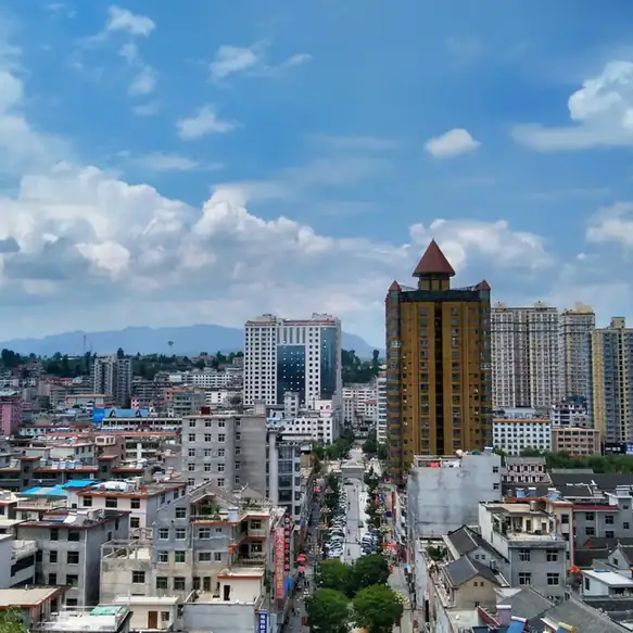
Photo adjustments
EXIF orientation normalized; resized without changing aspect ratio; converted to WebP. No subject edits.
- Administrative area
- County · 县
- Part of
- Shangluo
- Chinese name
- 洛南县
- Local areas
- County guide
Area & population
- Area in the source
- 2,562.00 km²
- Population · 2020
- 460,000
Source: cited geographic source, as of the dates shown.
What to see
Luonan Confucian Temple (洛南文庙) was built in 1370, while Huayan Temple (华严寺) and the Daziliang stone-house village remains (鞑子梁石板房古村落遗址) add other historical sites. For a newer cultural setting, Music Town (音乐小镇), in Nangou Community (南沟社区), Sihao Subdistrict (四皓街办), has an open-air music square, a music factory and an artists’ commune. Flower fields, a flower-garden café and guesthouses form part of the same development.
Food and local products
Walnuts and tofu are named local products of Luonan. Its broader mountain landscape includes Laojun Mountain (老君山), Yupingchuan (禹平川) and Caolian Ridge (草链岭), where the Luo River (洛河) rises.
Sources for this guide
洛南概况-洛南县人民政府 · Luonan County Government
商洛“22℃商洛•中国康养之都”秦岭康养清凉之旅 · Ministry of Culture and Tourism
Original English written from the listed sources and checked sentence by sentence against quoted extracts by a separate reviewer. Updated 2026-09-26.
Explore Luonan County
Core places to explore, with English and Chinese names.
Luonan County 洛南县
Plan your visit
Getting there
Luonan County is about 30 km in a straight line from central Shangluo. Search for 洛南县 in a map app to find stations and your accommodation.
Where to stay →More in Shangluo
Sources & geographic information
Administrative names and parent areas: Official geographic directory · Reference date 2026-09-06.
Map data © OpenStreetMap contributors. Pins mark approximate centres, not entrances or boundaries.