


Get to know Zhashui County
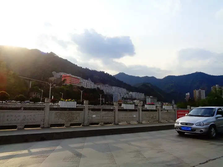
Photo adjustments
Full frame retained; resized proportionally to a maximum dimension of 960 pixels and converted to WebP quality 88. No crop, retouch, generated elements, or subject alteration. Final website rendition: full frame retained, proportionally resized to at most 720 pixels and converted to WebP. No additional retouching or subject alteration. Card displays may crop the view.
- Administrative area
- County · 县
- Part of
- Shangluo
- Chinese name
- 柞水县
- Local areas
- County guide
Area & population
- Area in the source
- 2,322.00 km²
- Population · 2004
- 160,000
Source: cited geographic source, as of the dates shown.
Setting and landscape
The county sits on the southern side of the Qinling, cut by winding ravines, and its highest peak is Niubeiliang (牛背梁) at 2,802.1 m. The county government puts vegetation cover at 88 per cent and notes that the Niubeiliang national nature reserve has been taken into a world biosphere reserve. Zhashui is also an important water conservation area for the middle route of the South–North Water Transfer Project.
History
Long an important gateway to the old capital at Chang'an, the area was known as the "throat of Qin and Chu" (秦楚咽喉) and the "first town of Zhongnan" (终南首邑). In the early Ming its north-west belonged to Xianning County (咸宁县) and its north-east to Lantian. In 1783 the Qing formed Xiaoyi sub-prefecture (孝义厅) from parts of Xianning, Lantian and Zhen'an (镇安县); it became Xiaoyi County in 1913 and was renamed Zhashui in 1914. In 1935 the Red 25th Army set up a Communist county committee and soviet government for Wuxing County (五星县) at Hongyansi (红岩寺). Zhashui was merged into Zhen'an in December 1958 and restored in September 1961.
What to see
The Zhashui karst caves (柞水溶洞) and Niubeiliang National Forest Park (牛背梁国家森林公园) are both national 4A scenic areas. The caves lie in the Qinling Dongtian Fudi scenic area (秦岭洞天福地景区) at Xialiang (下梁镇); the Ministry of Culture and Tourism describes a year-round temperature of about 22°C and stone columns of many shapes, with the Gudaoling (古道岭) attractions outside.
Fenghuang ancient town (凤凰古镇), 45 km from the county town, dates back to the Tang dynasty and keeps 148 Ming and Qing buildings. The county government's page on the town calls them the largest and most complete group of Jianghan and Huizhou-style old buildings in north-west China, and the town is listed as a national historic and cultural town. Each year from the Laba festival to the Lantern Festival, residents and visitors come to trade at its market.
Food and local products
Zhashui wood-ear fungus (柞水木耳) is known across China. Local crafts include bark paper (皮纸), straw weaving and wine-making, and the Zhashui "thirteen flowers" (柞水十三花) is listed with them among folk skills. The county is called the "home of Chinese yugu culture": Zhashui yugu (渔鼓, literally "fishing drum") is on the provincial intangible heritage list and is staged at the caves during the Spring Festival.
Getting oriented
The county is 68 km from Xi'an. The Baotou–Maoming (包茂) and Shuiyang (水阳) expressways cross it, and the Xi'an–Chongqing high-speed railway (西渝高铁) has two stations in the county.
Highlights
- Zhashui karst caves 柞水溶洞: National 4A scenic area at Xialiang, about 22°C all year according to the Ministry of Culture and Tourism.
- Niubeiliang 牛背梁: Highest peak of the county at 2,802.1 m; its nature reserve is part of a world biosphere reserve.
- Fenghuang ancient town 凤凰古镇: Tang-era market town with 148 Ming and Qing buildings; a national historic and cultural town.
- Zhashui wood-ear fungus 柞水木耳: Wood-ear fungus known across China.
Sources for this guide
柞水县情概况-柞水县人民政府 · Zhashui County People's Government
凤凰镇-柞水县人民政府 · Zhashui County People's Government
柞水县 - 维基百科 · Wikipedia (Chinese) · CC BY-SA 4.0
陕西·秦风楚韵 年味商洛 · Ministry of Culture and Tourism of the People's Republic of China
“定制化”旅游服务 带来出行新体验【3】 · People's Daily Online, Shaanxi channel
Original English written from the listed sources and checked sentence by sentence against quoted extracts by a separate reviewer. Updated 2026-09-25.
Explore Zhashui County
Core places to explore, with English and Chinese names.
Places to explore around Zhashui County
 AI illustration · AI 示意图(仅供参考,非该地点实拍)
Fenghuang Ancient Town凤凰古镇
Fenghuang Ancient Town (凤凰古镇) is a historic town in Zhashui County, Shangluo, Shaanxi, whose main street is paved in stone slabs and lined with Ming and Qing Hui-style dwellings. Zhashui County lists its core historic area under a protection regime of its own.
Read the place guide →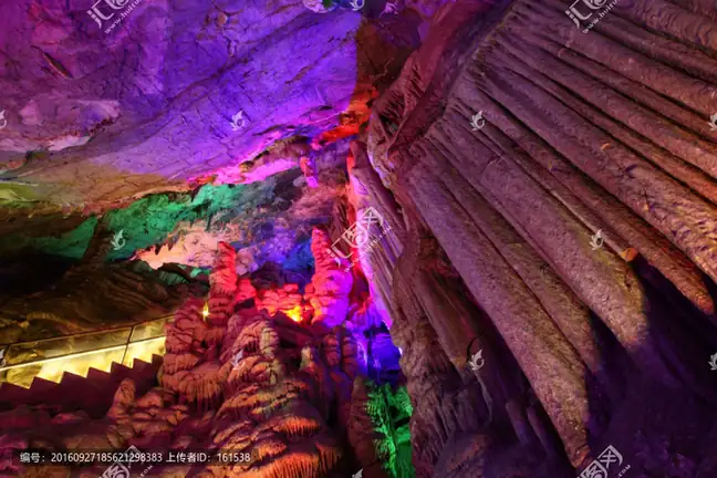 Zhashui Cave Scenic Area · 柞水溶洞
Zhashui Cave Scenic Area柞水溶洞
Zhashui’s cave attraction introduces the limestone landscapes on the southern side of the Qinling. The best-known developed chambers are associated with Buddha Cave and Heaven Cave, where mineral deposits form columns…
Read the place guide →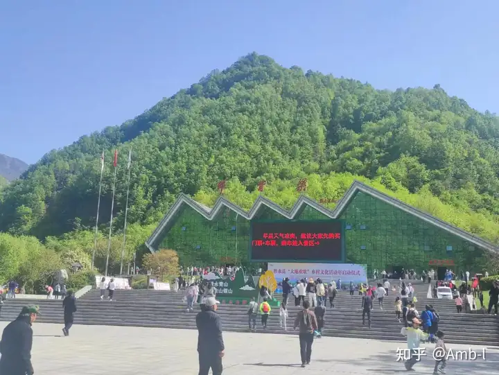 Niubeiliang Scenic Area · 牛背梁
Niubeiliang Scenic Area牛背梁
Niubeiliang (牛背梁) is a mountain area in Zhashui County, Shangluo, Shaanxi, named for a ridge shaped like an ox's back. A national nature reserve established in 1980 and a national forest park both carry the name; the reserve is 16,418 hectares and its forest coverage is given as 92.29 per cent.
Read the place guide →Plan your visit
Getting there
Zhashui County is about 75 km in a straight line from central Shangluo. Search for 柞水县 in a map app to find stations and your accommodation.
Where to stay →Build your route
Fenghuang Ancient Town and Zhashui Cave Scenic Area are both listed here. The linked place guides have entrance and visit details.
Continue with Shangluo →More in Shangluo
Sources & geographic information
Administrative names and parent areas: Official geographic directory · Reference date 2026-09-06.
Some facts checked against 柞水县 — Wikipedia contributors, CC BY-SA 4.0.
Photo: Zhashui Cave Scenic Area · Source photographer · License not provided. EXIF orientation normalized; resized without changing aspect ratio; converted to WebP. No subject edits.
Photo: Niubeiliang Scenic Area · Source photographer · License not provided. EXIF orientation normalized; resized without changing aspect ratio; converted to WebP. No subject edits.
Map data © OpenStreetMap contributors. Pins mark approximate centres, not entrances or boundaries.