


Get to know Yintai District
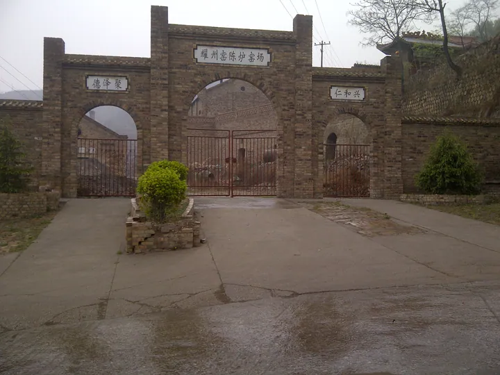
Photo adjustments
Full frame retained; proportionally resized and converted to WebP. No retouching or changes to the photographed subject. Card displays may crop the view.
- Administrative area
- District · 市辖区
- Part of
- Tongchuan
- Chinese name
- 印台区
- Local areas
- District guide
Area & population
- Area in the source
- 627.00 km²
- Population · 2002
- 230,000
Source: cited geographic source, as of the dates shown.
Clay and kiln remains
At Chenlu, the production sequence runs from throwing and trimming clay to carving, glazing and firing. The town’s surviving ceramic landscape includes forty old kilns, thirty-four firing areas, workshop remains and accumulated pottery deposits. In the Wang family workshop (王家瓷坊), makers produce objects such as the Fengming pot (凤鸣壶), whose opening sounds when water is gently moved inside it.
Stone peaks and wooded valleys
Jinsuoguan has projecting stone peaks and layered rock walls, with a glass bridge among its visitor structures. Yuhua Palace (玉华宫) provides a different setting: wooded paths and streams in Guoyugou (郭玉沟), boating on Yuhua Lake (玉华湖), and the remains of Sucheng Courtyard (肃成院).
Sources for this guide
铜川印台“五一”文旅盛宴精彩纷呈 收获满满好评_中国网 · China.org.cn
中国城市报-人民网 · China City News / People’s Daily
陕西铜川:千年耀瓷再出发-新华网 · Xinhua
Original English written from the listed sources and checked sentence by sentence against quoted extracts by a separate reviewer. Updated 2026-09-27.
Explore Yintai District
Core places to explore, with English and Chinese names.
Yintai District 印台区
Plan your visit
Getting there
Yintai District is about 30 km in a straight line from central Tongchuan. Search for 印台区 in a map app to find stations and your accommodation.
Where to stay →More in Tongchuan
Sources & geographic information
Administrative names and parent areas: Official geographic directory · Reference date 2026-09-06.
Map data © OpenStreetMap contributors. Pins mark approximate centres, not entrances or boundaries.