


Get to know Huaiyin District
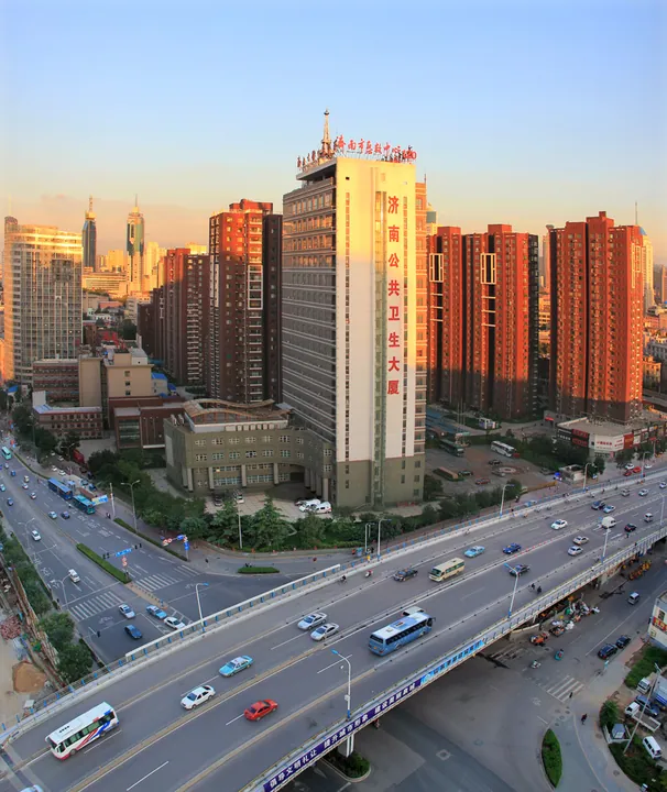
Photo adjustments
Full frame retained; proportionally resized and converted to WebP. No retouching or changes to the photographed subject. Card displays may crop the view.
- Administrative area
- District · 市辖区
- Part of
- Jinan
- Chinese name
- 槐荫区
- Local areas
- District guide
Area & population
- Area in the source
- 151.65 km²
- Population · 2020
- 532,000
Source: cited geographic source, as of the dates shown.
History
Before the Ming the area was a group of villages centred on Panlongzhuang (盘龙庄); in 1573, in the Wanli reign, the name changed to Dahuaishu village (大槐树庄), "Big Pagoda Tree village". After Jinan opened its commercial port (商埠) in 1904 the district gradually became a residential quarter of the city, and it took the name Huaiyin in 1955. Older remains include the Tianjiazhuang site (田家庄遗址) on the Yufu River (玉符河), which the district government lists as the earliest cultural site found in the Jinan area, with remains of the Beixin culture (about 6,500 years ago), the Longshan culture and the Shang.
What to see
The district keeps dozens of old buildings from the commercial-port era. Hongjitang Xiji (宏济堂西记) is the only surviving branch of Hongjitang, a pharmacy once ranked with Beijing's Tongrentang and Hangzhou's Hu Qingyu Tang as China's three great drug stores. Fuchengxin Dongji (阜成信东记), a merchant house on Jing'er Road (经二路), dates from 1909. The Christian Self-Reliance Church (基督教自立会礼拜堂) at 425 Jingsi Road (经四路) was built in 1924-1926 and seats more than 1,400 people; the district ranks it first among Jinan's Protestant churches. The former Shandong Fengda Bank (山东丰大银行旧址) of 1919 is described by the district as the only example of southern European Baroque in Jinan; it was moved about 15 metres west in 2005 when Weiliu Road (纬六路) was widened.
Other historic buildings include the former Japanese Consulate-General on Jingsan Road (经三路), the former Mingxing Cinema (明星电影院), successor to Jinan's first cinema of 1920, and the German-built Jinpu Railway locomotive works (津浦铁路局济南机车厂) begun in 1910.
The Jixi Wetland Park (济西湿地公园) lies on the western side of the district, which also has the Fantawild Oriental Heritage (方特东方神画), a national 4A scenic area. Kuangshan (匡山), Lashan (腊山) and Emei (峨嵋) hills and the Yuqing (玉清湖) and Meili (美里湖) lakes are also in the district. Cultural venues include the Shandong Grand Theatre (山东省会大剧院), the Jinan Library and the Jinan Art Museum.
Getting oriented
Huaiyin borders Tianqiao (天桥区) and Shizhong (市中区) districts to the east and Changqing District (长清区) to the west. Jinan West Station is one of the five hub stations on the Beijing-Shanghai high-speed railway and connects with the metro, long-distance coaches and city buses.
Highlights
- Hongjitang Xiji 宏济堂西记: Only surviving branch of the historic Hongjitang pharmacy.
- Christian Self-Reliance Church 基督教自立会礼拜堂: 1924-1926 church on Jingsi Road seating over 1,400.
- Former Shandong Fengda Bank 山东丰大银行旧址: 1919 Baroque bank building moved 15 m in 2005.
- Tianjiazhuang site 田家庄遗址: Earliest cultural site found in the Jinan area.
- Jixi Wetland Park 济西湿地公园: National wetland park on the district's western side.
Sources for this guide
槐荫区 - 维基百科,自由的百科全书 · Wikipedia (Chinese) · CC BY-SA 4.0
槐荫概况 - 济南市槐荫区人民政府 · Huaiyin District People's Government, Jinan
古遗址 - 济南市槐荫区人民政府 · Huaiyin District People's Government, Jinan
近现代重要建筑 - 济南市槐荫区人民政府 · Huaiyin District People's Government, Jinan
Original English written from the listed sources and checked sentence by sentence against quoted extracts by a separate reviewer. Updated 2026-09-26.
Explore Huaiyin District
Core places to explore, with English and Chinese names.
Huaiyin District 槐荫区
Plan your visit
Getting there
Huaiyin District is about 10 km in a straight line from central Jinan. Search for 槐荫区 in a map app to find stations and your accommodation.
Where to stay →More in Jinan
Sources & geographic information
Administrative names and parent areas: Official geographic directory · Reference date 2026-09-06.
Some facts checked against 槐荫区 — Wikipedia contributors, CC BY-SA 4.0.
Map data © OpenStreetMap contributors. Pins mark approximate centres, not entrances or boundaries.