


Get to know Jiyang District
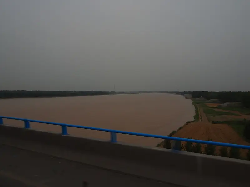
Photo adjustments
Full frame retained; EXIF orientation normalized, proportionally resized to at most 800 pixels and converted to WebP. No generated pixels or subject changes. Cards may crop the display.
- Administrative area
- District · 市辖区
- Part of
- Jinan
- Chinese name
- 济阳区
- Local areas
- District guide
Area & population
- Area in the source
- 1,097.15 km²
- Population · 2019
- 597,200
Source: cited geographic source, as of the dates shown.
History
Jiyang was created as a county on 20 November 1129 from parts of Zhangqiu (章丘) and Linyi (临邑), and it was named for its position north of the Ji River (济水). It was placed under Jinan in 1990 and became a district in 2018.
The district has 20 ancient sites, among them a Western Zhou noble cemetery and Yuhuangzhong (玉皇冢), as well as the site of the Wenshao Terrace (闻韶台) linked to Confucius. Bronzes from the Liutaizi site (刘台子遗址) mostly carry the character "Feng" (夆). The Jiyang culture and tourism bureau reads this as a sign that the Feng state (逄国) had moved here from the east of the Shandong Peninsula more than 3,000 years ago. One bronze inscribed with the same character is an early Western Zhou rectangular ding cauldron whose corners and four feet are cast as elephant heads with upcurled trunks, and the Jiyang District Museum displays Western Zhou bronzes.
Folk arts
Jiyang Guzi Yangge (济阳鼓子秧歌) was added to the national intangible heritage list in 2008. Tradition dates it to the Yongle reign of the Ming, and it was widespread by the Qing. Troupes are built from umbrella, drum, stick and "flower" dancers, and perform in two ways: jietongzi (街筒子), moving through the streets with the drum band in front, and paochangzi (跑场子), running set floor patterns once they reach an open ground. The floor patterns fall into civil and martial sets, and performers say: "in the martial set, watch the strikes; in the civil set, watch the steps". Black pottery is the district's other noted craft.
Getting oriented
The district centre is about 45 km from urban Jinan and 8 km from Jinan Yaoqiang International Airport (济南遥墙国际机场). Shanghe (商河) lies to the north and Linyi County to the northwest. The Qilu Yellow River Bridge (齐鲁黄河大桥), the third Yellow River bridge and the northern third ring expressway link it to the city.
Highlights
- Jiyang Guzi Yangge 济阳鼓子秧歌: Umbrella-and-drum yangge dance on the national heritage list since 2008.
- Liutaizi site 刘台子遗址: Source of Western Zhou bronzes inscribed with the character Feng.
- Elephant-trunk-foot ding 象鼻足鼎: Early Western Zhou rectangular cauldron with elephant-head feet.
- Wenshao Terrace site 孔子闻韶台遗址: Ancient site linked to Confucius.
Sources for this guide
济阳区 - 维基百科,自由的百科全书 · Wikipedia (Chinese) · CC BY-SA 4.0
秧歌(济阳鼓子秧歌) - 中国非物质文化遗产网·中国非物质文化遗产数字博物馆 · China Intangible Cultural Heritage Network (ihchina.cn)
云上展厅欣赏西周青铜礼器——象鼻足鼎 · Jiyang District Culture and Tourism Bureau (Jiyang District People's Government portal)
Original English written from the listed sources and checked sentence by sentence against quoted extracts by a separate reviewer. Updated 2026-09-26.
Explore Jiyang District
Core places to explore, with English and Chinese names.
Jiyang District 济阳区
Plan your visit
Getting there
Jiyang District is about 40 km in a straight line from central Jinan. Search for 济阳区 in a map app to find stations and your accommodation.
Where to stay →More in Jinan
Sources & geographic information
Administrative names and parent areas: Official geographic directory · Reference date 2026-09-06.
Some facts checked against 济阳区 — Wikipedia contributors, CC BY-SA 4.0.
Map data © OpenStreetMap contributors. Pins mark approximate centres, not entrances or boundaries.