


Get to know Liangshan County
- Administrative area
- County · 县
- Part of
- Jining
- Chinese name
- 梁山县
- Local areas
- County guide
Area & population
- Area in the source
- 961.00 km²
- Population · 2019
- 847,894
Source: cited geographic source, as of the dates shown.
Setting and landscape
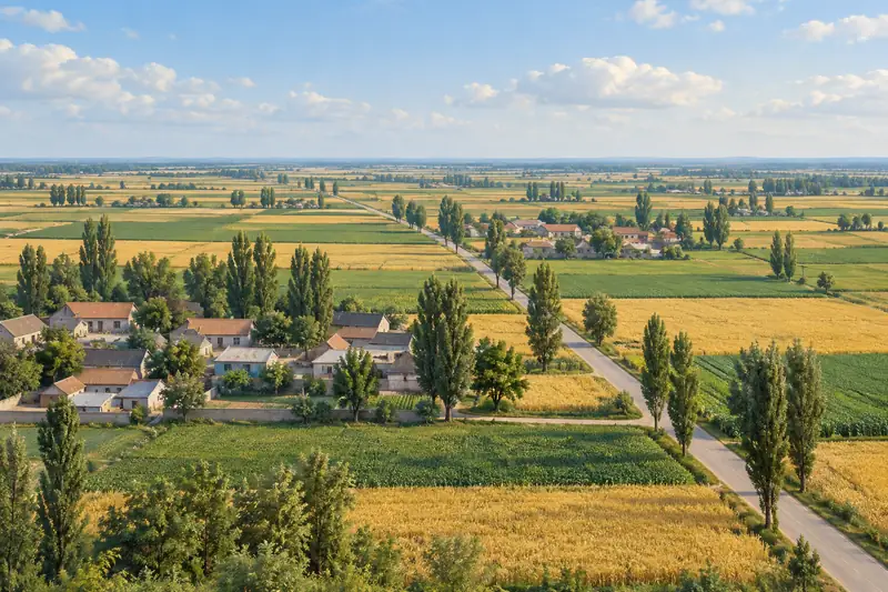
The county is mostly low plain, higher in the southwest than the northeast, with six small hills: Liang, Fenghuang (凤凰山), Gui (龟山), Xiao'anshan (小安山), Du (独山) and Tu (土山). Mount Liang is the highest at 197.9 metres. The Yellow River runs for 25 kilometres along the northwest edge, and the old course of the Grand Canal crosses the county, so the county government speaks of canal and river meeting at Liangshan. Wetlands survive at the site of the old Liangshan Marsh (梁山泊).
History
The hill was first called Liangshan with a different character (良山). It took its present name from Prince Xiao of Liang (梁孝王), son of Emperor Wen of Han, who hunted here when the area was a royal hunting ground and, in the county's account, was buried at its foot. Under the Sui and Tang, Liantai Temple (莲台寺) made the area a Buddhist centre. From the Five Dynasties to the Northern Song, repeated Yellow River breaches pooled at the foot of the hill into the '800-li marsh'. The county places Song Jiang (宋江) and his band here in the Xuanhe years of the Northern Song, the story the Ming writer Shi Nai'an (施耐庵) shaped into Water Margin. The Qinggudui (青堌堆) ancient site is on the national heritage list. During the Chinese Civil War the armies of Liu Bocheng (刘伯承) and Deng Xiaoping (邓小平) crossed the Yellow River at the Cailou ferry (蔡楼渡口), remembered locally as the 'Generals' Ferry'. The present county was set up in 1941 as Kunshan County (昆山县) and renamed Liangshan in 1949.
What to see and local customs
The Water Margin Liangshan Scenic Area (水泊梁山景区) on the mountain was rated 4A in 2008. The county has also built Water Margin projects including a new Liangshan Marsh, Juyi Lake (聚义湖) and a Water Margin film and culture park. Liangshan is also known for martial arts: Liangshan kung fu, or Ziwumen (子午门功夫), is on Shandong's provincial intangible heritage list. At the Laba festival, besides Laba porridge and vinegar-soaked garlic, ram-fighting fairs are held in which hundreds, sometimes over a thousand, Small-tailed Han sheep (小尾寒羊) compete for the title of king of rams, and at Spring Festival crowds climb the mountain together.
Getting oriented
The county sits where Jining, Tai'an (泰安), Heze (菏泽) and Puyang (濮阳) meet. The Beijing–Kowloon (京九) and Wari (瓦日) railways both have stations in Liangshan.
Highlights
- Water Margin Liangshan Scenic Area 水泊梁山景区: The Water Margin mountain, 197.9 metres high, rated 4A in 2008.
- Liangshan kung fu (Ziwumen) 梁山功夫(子午门功夫): Local martial art on Shandong's provincial intangible heritage list.
- Laba ram fights 斗羊会: Hundreds of Small-tailed Han sheep compete for king of rams every Laba festival.
- Qinggudui site 青堌堆遗址: Ancient site on the national heritage list.
Sources for this guide
梁山县人民政府 梁山概况 梁山概况 · Liangshan County People's Government
梁山县人民政府 自然环境 自然环境 · Liangshan County People's Government
梁山县 - 维基百科,自由的百科全书 · Wikipedia (Chinese) · CC BY-SA 4.0
Original English written from the listed sources and checked sentence by sentence against quoted extracts by a separate reviewer. Updated 2026-09-23.
Explore Liangshan County
Core places to explore, with English and Chinese names.
Places to explore around Liangshan County
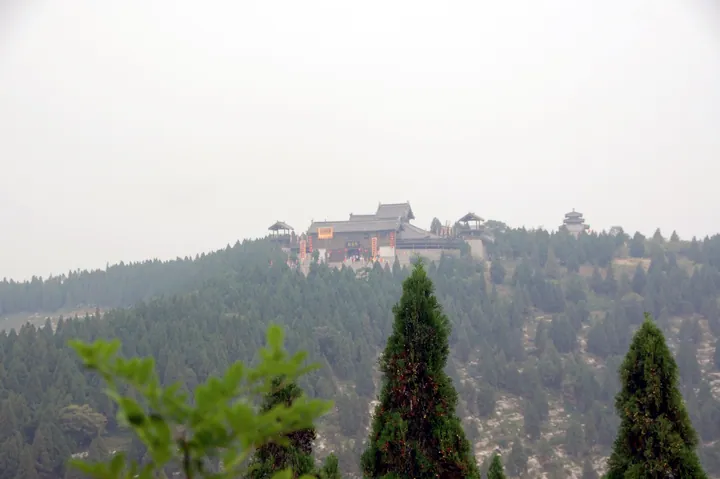 A hilltop temple complex on Mount Liang, the Shuipo Liangshan scenic area ·
 Plan your visit
Getting there
Liangshan County is about 60 km in a straight line from central Jining. Search for 梁山县 in a map app to find stations and your accommodation.
Where to stay →Build your route
Start with Liangshan Marsh Scenic Area. The linked place guides have entrance and visit details.
Continue with Jining →More in Jining
Sources & geographic information
Administrative names and parent areas: Official geographic directory · Reference date 2026-09-06.
Some facts checked against 梁山县 — Wikipedia contributors, CC BY-SA 4.0.
Photo: Liangshan Marsh Scenic Area · kanegen from Tokyo, Japan · CC BY 2.0. Full frame retained; proportionally resized and converted to WebP. No retouching or changes to the photographed subject. Card displays may crop the view.
.jpg)
Map data © OpenStreetMap contributors. Pins mark approximate centres, not entrances or boundaries.