


Get to know Mengyin County
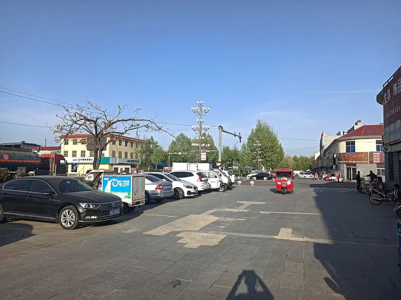
Photo adjustments
Full frame retained; EXIF orientation normalized, proportionally resized to at most 800 pixels and converted to WebP. No generated pixels or subject changes. Cards may crop the display.
- Administrative area
- County · 县
- Part of
- Linyi
- Chinese name
- 蒙阴县
- Local areas
- County guide
Area & population
- Area in the source
- 1,602.00 km²
- Population · 2019
- 528,000
Source: cited geographic source, as of the dates shown.
Setting and landscape
The county counts more than 520 peaks, 179 rivers and 103 reservoirs. The county describes Mount Meng as the second-highest mountain in Shandong and Yunmeng Lake (云蒙湖) as the province's second-largest reservoir. Daigu Town (岱崮镇) alone has more than 30 flat-topped peaks ringed by sheer cliffs above gentler slopes. The Chinese Academy of Sciences named them the Daigu landform (岱崮地貌), placing it alongside Danxia, Zhangjiajie, Zhangshiyan and karst as a fifth type of rock landform in China.
History
A county was first set up here early in the Western Han. Mengyin is the home of the Qin general Meng Tian (蒙恬) and of Liu Hong (刘洪), the Eastern Han astronomer and mathematician remembered as the "sage of calculation" and credited with inventing abacus arithmetic. In the war years the county was the core of the Yimeng Mountains revolutionary base; it saw two defences of the Daigu peaks and the Battle of Menglianggu (孟良崮战役), and produced the Six Sisters of Yimeng (沂蒙六姐妹), celebrated for supporting the front. In 1959 the building of the Andi Reservoir (岸堤水库) displaced 38,000 people.
What to see
The Yunmeng Scenic Area of Mount Yimeng (沂蒙山云蒙景区), 18 kilometres south of the county town, is a 5A scenic area, part of a world geopark and a national forest park. Its sights include the Big and Small Yunmeng peaks, Tianhu Peak (天壶峰) and the Rain King Temple (雨王庙).
The Menglianggu scenic area lies 30 kilometres south of the county town. A martyrs' cemetery was built there with state funds in 1954; the Menglianggu Battle Memorial Hall (孟良崮战役纪念馆) stands at the foot and the battle monument on the summit, reached by a 3.5-kilometre path of 13,868 granite steps that follows the attack route of the Sixth Column of the East China Field Army. The Daigu Landform scenic area (4A) in Daigu Town has a geological museum and the sites of the Daigu battles.
Food and local products
Mengyin peaches (蒙阴蜜桃) are a national geographical indication product, with more than 200 varieties of downy peach, nectarine and flat peach that ripen from late May to late October. Mengyin bachelor chicken (蒙阴光棍鸡) is Mount Meng free-range rooster fried and simmered over a wood fire with a seasoning of thirty medicinal herbs; the joking name comes from the all-male kitchen staff and the use of cockerels only.
Getting oriented
National Highways 205 and 342 cross the county. The Menglianggu exit of the Beijing–Shanghai Expressway is 2 kilometres from the Menglianggu scenic area, which lies 50 kilometres north of central Linyi.
Highlights
- Yunmeng Scenic Area of Mount Yimeng 沂蒙山云蒙景区: 5A forest and mountain area 18 km south of the county town.
- Menglianggu Battle Memorial Hall 孟良崮战役纪念馆: Memorial hall at the foot of Menglianggu, with the battle monument on the summit.
- Daigu landform 岱崮地貌: More than 30 flat-topped, cliff-ringed peaks around Daigu Town.
- Mengyin peaches 蒙阴蜜桃: Geographical indication product with more than 200 varieties.
- Mengyin bachelor chicken 蒙阴光棍鸡: Rooster cooked over a wood fire with thirty medicinal herbs.
Sources for this guide
蒙阴县 - 维基百科,自由的百科全书 · Chinese Wikipedia · CC BY-SA 4.0
蒙阴概况-蒙阴县人民政府 · Mengyin County People's Government
“蒙阴人游蒙阴”——岱崮地貌景区-蒙阴县人民政府 · Mengyin County People's Government
“蒙阴人游蒙阴”——沂蒙山云蒙景区-蒙阴县人民政府 · Mengyin County People's Government
孟良崮旅游区-蒙阴县人民政府 · Mengyin County People's Government
蒙阴蜜桃-蒙阴县人民政府 · Mengyin County People's Government
蒙阴光棍鸡-蒙阴县人民政府 · Mengyin County People's Government
Original English written from the listed sources and checked sentence by sentence against quoted extracts by a separate reviewer. Updated 2026-09-23.
Explore Mengyin County
Core places to explore, with English and Chinese names.
Places to explore around Mengyin County
 AI illustration · AI 示意图(仅供参考,非该地点实拍)
Mengshan Yunmeng Scenic Area蒙山云蒙景区
Yunmeng (云蒙景区) is the Mengshan scenic area on the Mengyin County side of the range, north-west of Linyi in Shandong, and Mengyin County gives its address as Mengshan National Forest Park.
Read the place guide →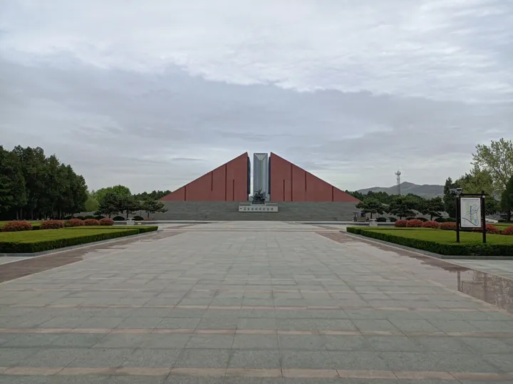 The Menglianggu Battle Memorial Hall in Mengyin County · 蒙阴县孟良崮战役纪念馆 Source-recorded photograph date: 2024-04-19 17:17:25.
Menglianggu Campaign Memorial Hall孟良崮战役纪念馆
The Menglianggu Battle Memorial Hall (孟良崮战役纪念馆) stands at Quanqiao village in Duozhuang Town, Mengyin County, Linyi, Shandong, on the ground where the East China Field Army destroyed a Nationalist division in May 1947.
Read the place guide →Plan your visit
Getting there
Mengyin County is about 75 km in a straight line from central Linyi. Search for 蒙阴县 in a map app to find stations and your accommodation.
Where to stay →Build your route
Mengshan Yunmeng Scenic Area and Menglianggu Campaign Memorial Hall are both listed here. The linked place guides have entrance and visit details.
Continue with Linyi →More in Linyi
Sources & geographic information
Administrative names and parent areas: Official geographic directory · Reference date 2026-09-06.
Some facts checked against 蒙阴县 — Wikipedia contributors, CC BY-SA 4.0.
Photo: Menglianggu Campaign Memorial Hall · Sprt98 · CC BY-SA 4.0. Full frame retained; proportionally resized and converted to WebP. No retouching or changes to the photographed subject. Card displays may crop the view.

Map data © OpenStreetMap contributors. Pins mark approximate centres, not entrances or boundaries.