


Get to know Gaoqing County
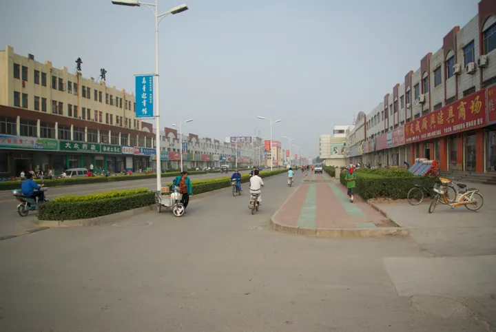
Photo adjustments
Full frame retained; proportionally resized and converted to WebP. No retouching or changes to the photographed subject. Card displays may crop the view.
- Administrative area
- County · 县
- Part of
- Zibo
- Chinese name
- 高青县
- Local areas
- County guide
Area & population
- Area in the source
- 831.00 km²
Source: cited geographic source, as of the dates shown.
Setting and landscape
The whole county is plain, built up by silt from the Yellow River's many breaches and changes of course. The ground slopes gently from about 16.5 metres above sea level in the west to 7.5 metres in the east, and three low ridges, the Jinling, Yinling and Tieling (金岭、银岭、铁岭), the "gold", "silver" and "iron" ridges, lie across it in that order from south to north. The Yellow River runs 45.6 kilometres along the northern edge, about 70 kilometres above its mouth, and supplies more than 60 per cent of the county's water. Changjia town (常家镇) beside the river is a rice-growing area. The Dalu Lake Reservoir (大芦湖水库), rebuilt from the former Dalu Lake, stores Yellow River water for Zibo. Summers are rainy and winters and springs dry, with a mean annual temperature of 13.2°C.
History
The county's own history places Yingqiu (营丘), the capital that Jiang Ziya (姜子牙) built when he was enfeoffed with Qi, at today's Chenzhuang (陈庄) in Gaoqing. Around 800 BC the Changdi (长狄) people set up the state of Souman (鄋瞒) with its seat at Diyi (狄邑), now Gaocheng town (高城镇); Qi destroyed it in 607 BC, and the Qin made the area Di County (狄县). In 209 BC the brothers Tian Dan (田儋), Tian Rong (田荣) and Tian Heng (田横) of Di killed the county magistrate and rose in revolt, restoring the state of Qi.
Gaoqing takes its name from two older counties, Gaoyuan (高苑) and Qingcheng (青城), merged in April 1948. It was folded into Qidong County (齐东县) in 1956, restored in 1961 and transferred to Zibo on 1 January 1990.
What to see
The Yuming Folk Museum (玉明民俗博物馆), a national third-grade museum, displays 5,661 objects in halls on weaving, farm courtyards, household goods and farm tools. The Shuqing Antiquities Museum (述青藏古博物馆) is described as Shandong's only non-state museum devoted to collecting and studying inscribed steles, with more than 300 steles and over 500 carved stones, and the Dadi Huangheqing Museum (大地黄河情博物馆) covers Yellow River records and anti-Japanese war relics.
Food and local products
Gaoqing black cattle (高青黑牛) were bred from 2003 by crossing Japanese Wagyu bulls with the local Bohai black cattle (渤海黑牛). The beef is finely marbled, and it was served as a "Dongpo beef steak" at the state banquet of the 2016 G20 summit in Hangzhou. The cattle are fed steam-flaked maize and barley with apple pomace and distillers' grains.
Highlights
- Yellow River 黄河: The river runs 45.6 km along the county's northern edge, about 70 km above its mouth.
- Dalu Lake Reservoir 大芦湖水库: Reservoir rebuilt from the former Dalu Lake, storing Yellow River water for Zibo.
- Yuming Folk Museum 玉明民俗博物馆: National third-grade museum with 5,661 objects, presented as a record of farming life in northern Shandong.
- Gaoqing black cattle 高青黑牛: Wagyu-cross beef served at the 2016 G20 state banquet in Hangzhou.
Sources for this guide
高青县人民政府 高青概况 · Gaoqing County People's Government
高青县人民政府 自然环境 · Gaoqing County People's Government
高青县人民政府 历史沿革 · Gaoqing County People's Government
高青这些小众又惊艳的文化打卡地,你了解吗? · Gaoqing County People's Government
高青黑牛,舌尖上的中国味道 · Gaoqing County People's Government
高青县 - 维基百科,自由的百科全书 · Wikipedia (Chinese) · CC BY-SA 4.0
Original English written from the listed sources and checked sentence by sentence against quoted extracts by a separate reviewer. Updated 2026-09-23.
Explore Gaoqing County
Core places to explore, with English and Chinese names.
Gaoqing County 高青县
Plan your visit
Getting there
Gaoqing County is about 45 km in a straight line from central Zibo. Search for 高青县 in a map app to find stations and your accommodation.
Where to stay →More in Zibo
Sources & geographic information
Administrative names and parent areas: Official geographic directory · Reference date 2026-09-06.
Some facts checked against 高青县 — Wikipedia contributors, CC BY-SA 4.0.
Map data © OpenStreetMap contributors. Pins mark approximate centres, not entrances or boundaries.