


Get to know Taigu District
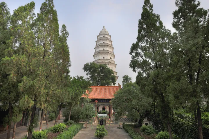
Photo adjustments
Full frame retained; proportionally resized and converted to WebP. No retouching or changes to the photographed subject. Card displays may crop the view.
- Administrative area
- District · 市辖区
- Part of
- Jinzhong
- Chinese name
- 太谷区
- Local areas
- District guide
Area & population
- Area in the source
- 1,034.00 km²
Source: cited geographic source, as of the dates shown.
The old city
Taigu’s old city began in the Northern Zhou Jiande reign. Three principal streets radiate east, south and west from the Drum Tower, with the former county offices to its north. North Street meets the middle of West Street. Many streets and lanes run at right angles, dividing the residential areas into blocks.
Courtyards and temples
The Kong Xiangxi Residence was built between the Qing Qianlong and Xianfeng reigns. It originally belonged to Meng Guangyu (孟广誉); Kong Xiangxi (孔祥熙) purchased it in 1930. Its combination of northern house design and southern garden features distinguishes the residence.
Sources for this guide
孔祥熙宅院(太谷) - 山西省人民政府 · Shanxi Provincial Government
山西·晋中太谷非遗研学之旅 · Ministry of Culture and Tourism
Original English written from the listed sources and checked sentence by sentence against quoted extracts by a separate reviewer. Updated 2026-09-26.
Explore Taigu District
Core places to explore, with English and Chinese names.
Taigu District 太谷区
Plan your visit
Getting there
Taigu District is about 35 km in a straight line from central Jinzhong. Search for 太谷区 in a map app to find stations and your accommodation.
Where to stay →More in Jinzhong
Sources & geographic information
Administrative names and parent areas: Official geographic directory · Reference date 2026-09-06.
Map data © OpenStreetMap contributors. Pins mark approximate centres, not entrances or boundaries.