


Get to know Pianguan County
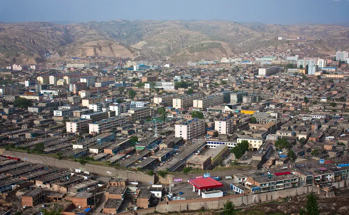
Photo adjustments
Full frame retained; proportionally resized and converted to WebP. No retouching or changes to the photographed subject. Card displays may crop the view.
- Administrative area
- County · 县
- Part of
- Xinzhou
- Chinese name
- 偏关县
- Local areas
- County guide
History
The name comes from Piantou Pass (偏头关), the "tilted-head pass", so called because the land rises in the east and dips in the west. In 951 the Northern Han ruler Liu Chong built the Piantou stockade (偏头寨) on a ridge just east of the present town, and in 1299 the Yuan raised it to a pass. With the Ningwu (宁武关) and Yanmen (雁门关) passes it formed the three outer passes of the Great Wall, and in the Ming the Shanxi garrison (山西镇) was stationed here. The Yang family generals (杨家将) fought the Khitans in this area.
The county government counts 126 kilometres of Great Wall, 29 forts and 247 beacon towers within the county, and says the Yellow River and the Wall run side by side for 32 kilometres.
What to see
Laoniuwan (老牛湾), a 4A scenic area, is where the Yellow River enters Shanxi, where the inner and outer lines of the Great Wall meet, and where the Shanxi–Shaanxi–Inner Mongolia Grand Canyon (晋陕蒙大峡谷) begins. The Laoniuwan fort (老牛湾堡), built in 1636, has stone outer walls over 560 metres round, a gate with a barbican, a 300-metre flagstone street, two temples and an opera stage. Since the Wanjiazhai (万家寨) dam and the Yellow River diversion project were built, the gorge here has become a lake.
The county also points to the looping Qiankun Bend (乾坤湾) and to the "underground Great Wall" at Hongmenkou (红门口) in Shuiquan (水泉).
Food and local products
Pianguan's signature dish is sour laofan (偏关酸捞饭), made from broomcorn millet soaked for four to eight hours in a sour liquid until it ferments, boiled until about 80 per cent done, then lifted out and steamed; it is eaten with a mixed stew. The same soaked millet is cooked into a sour porridge with potato or sweet potato, and households keep a "sour-rice jar" (酸米罐) on the stove. Migrants who went "beyond the west pass" carried the dish to Inner Mongolia.
In 2023 the China National Grain Industry Association named Pianguan China's home of broomcorn millet (中国糜子之乡). Pianguan millet and Pianguan mutton carry national geographical-indication status, and the county also names its tofu, wild mountain mushrooms and Wanjiazhai Yellow River carp.
Highlights
- Laoniuwan 老牛湾: 4A scenic area where the Yellow River enters Shanxi and the Great Wall meets the river.
- Laoniuwan fort 老牛湾堡: Stone-walled Ming fort of 1636 with a barbican, flagstone street and opera stage.
- Piantou Pass 偏头关: One of the three outer passes of the Great Wall, raised from a Northern Han stockade in 1299.
- Sour laofan 偏关酸捞饭: Fermented broomcorn millet, part-boiled then steamed, eaten with a stew.
Sources for this guide
偏关概况 · Pianguan County People's Government
历史沿革 · Pianguan County People's Government
老牛湾景区简介(4A) · Xinzhou Municipal People's Government
偏关酸捞饭 · Pianguan County People's Government
山西省偏关县被命名为“中国糜子之乡” · Pianguan County People's Government
Original English written from the listed sources and checked sentence by sentence against quoted extracts by a separate reviewer. Updated 2026-09-26.
Explore Pianguan County
Core places to explore, with English and Chinese names.
Places to explore around Pianguan County
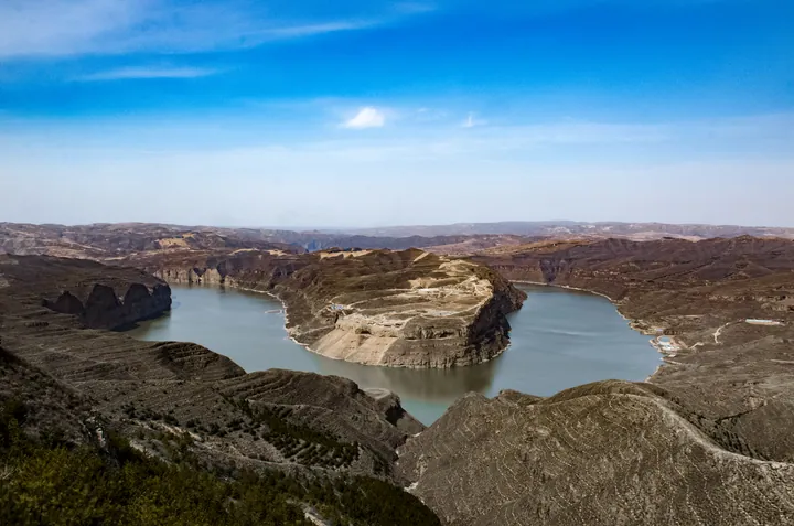 The horseshoe bend of the Yellow River at Laoniuwan, Pianguan County, Xinzhou ·
 Plan your visit
Getting there
Pianguan County is about 155 km in a straight line from central Xinzhou. Search for 偏关县 in a map app to find stations and your accommodation.
Where to stay →Build your route
Start with Laoniuwan Yellow River Bend. The linked place guides have entrance and visit details.
Continue with Xinzhou →More in Xinzhou
Sources & geographic information
Administrative names and parent areas: Official geographic directory · Reference date 2026-09-06.
Photo: Laoniuwan Yellow River Bend · Hongwei Dong · CC BY 3.0. Full frame retained; proportionally resized and converted to WebP. No retouching or changes to the photographed subject. Card displays may crop the view.
.jpeg)
Map data © OpenStreetMap contributors. Pins mark approximate centres, not entrances or boundaries.