


Get to know Wutai County

Photo adjustments
Full frame retained; resized proportionally to a maximum dimension of 960 pixels and converted to WebP quality 88. No crop, retouch, generated elements, or subject alteration. Final website rendition: full frame retained, proportionally resized to at most 720 pixels and converted to WebP. No additional retouching or subject alteration. Card displays may crop the view.
- Administrative area
- County · 县
- Part of
- Xinzhou
- Chinese name
- 五台县
- Local areas
- County guide
Area & population
- Area in the source
- 2,865.00 km²
- Population · 2018
- 307,200
Source: cited geographic source, as of the dates shown.
Setting and landscape
The land is high in the north-east and falls to the south-west. Mount Wutai takes its name from five flat, treeless summits; the Xinzhou city government gives the North Terrace, Yedou Peak (叶斗峰), as 3,061 m and calls it the "roof of North China". It notes a drop of 2,437 m from the summit to Pingshang village (坪上村), and snow even in summer, which gave the mountain its other name, Qingliang Shan (清凉山), the Cool Mountain.
History
A county called Lüyi (驴夷) was set up here in 486 under the Northern Wei, and it was renamed Wutai in 607 under the Sui. Under the Jin dynasty it was raised to Taizhou (台州) in 1216, and in 1369, early in the Ming, it became Wutai County again. The national protected sites in the county include the former home of Xu Xiangqian (徐向前), the former Bethune model ward and the former Eighth Route Army headquarters at Nanru (南茹).
What to see
Mount Wutai is revered as the seat of the bodhisattva Manjushri (文殊). The Xinzhou government counts 68 monasteries there, 14 of them national protected sites, and more than 150 pagodas. It was named a national scenic area in 1982, one of the first 5A scenic areas in 2007, and entered the World Heritage List in 2009.
Nanchan Temple stands north-west of Lijiazhuang village (李家庄村) in Yangbai township (阳白乡). Its main hall was rebuilt in 782 under the Tang, and Chinese Wikipedia calls it the oldest surviving timber building in China. The three-bay hall keeps 17 painted figures of the same period. Foguang Temple, in Foguang village of Doucun town (豆村镇), is built on a west-facing slope. Its East Hall was put up in 857 with money from Ning Gongyu (宁公遇), a Buddhist woman from Chang'an, and keeps Tang sculptures, murals and ink inscriptions; Chinese Wikipedia ranks it as the third-oldest surviving timber building in China, after the Nanchan hall and the Guangren Wang Temple (广仁王庙) in Ruicheng (芮城). The architect Liang Sicheng (梁思成) and his colleagues surveyed it in June 1937 and dated it from those inscriptions.
Highlights
- Mount Wutai 五台山: Five-terraced Buddhist mountain of Manjushri; World Heritage site since 2009, with 68 monasteries by the Xinzhou government's count.
- Nanchan Temple 南禅寺: Tang main hall of 782 near Lijiazhuang village, with 17 painted figures of the same period.
- Foguang Temple 佛光寺: East Hall of 857 in Doucun town, with Tang sculptures, murals and inscriptions; surveyed by Liang Sicheng in 1937.
Sources for this guide
五台山景区简介(5A) · Xinzhou Municipal People's Government
五台县 · Wikipedia (Chinese) · CC BY-SA 4.0
南禅寺 (五台) · Wikipedia (Chinese) · CC BY-SA 4.0
佛光寺 (五台山) · Wikipedia (Chinese) · CC BY-SA 4.0
Original English written from the listed sources and checked sentence by sentence against quoted extracts by a separate reviewer. Updated 2026-09-25.
Explore Wutai County
Core places to explore, with English and Chinese names.
Places to explore around Wutai County
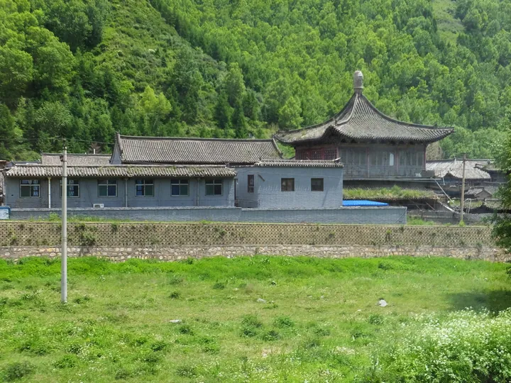 A monastery complex nestled in the forested slopes of Mount Wutai, Shanxi · 山西五台山山林间的寺院建筑群 Source-recorded photograph date: Taken on 17 June 2016.
Mount Wutai五台山
Mount Wutai is a Buddhist cultural landscape in northeastern Shanxi, centred on five broad, flat summits and the temple settlements below them.
Read the place guide →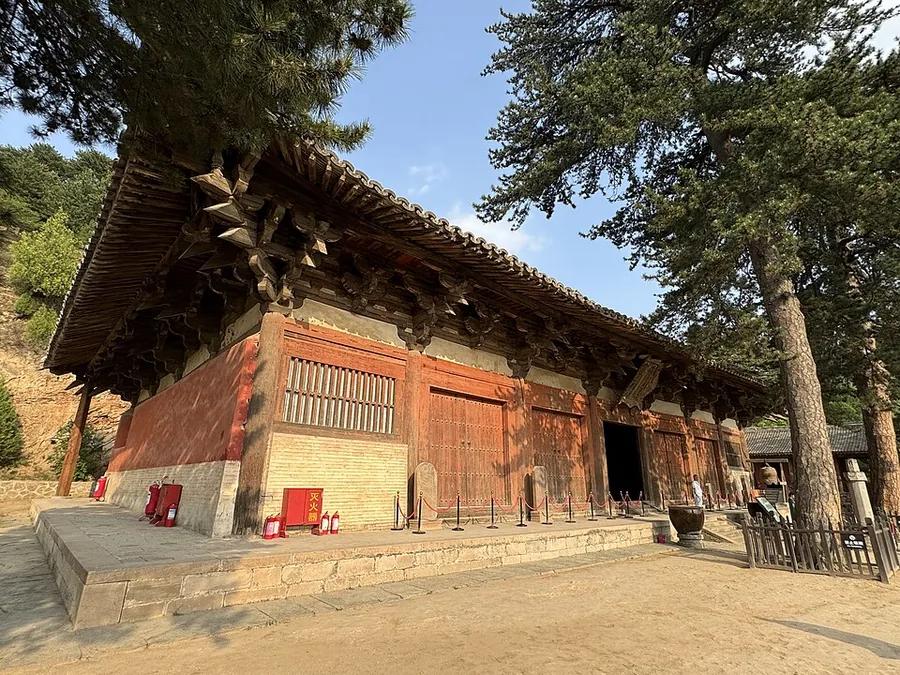 The East Great Hall of Foguang Temple, Wutai, Shanxi, viewed from its left side.
Foguang Temple佛光寺
Foguang Temple's East Great Hall preserves an extraordinary combination of Tang timber construction, sculpture, painting and inscriptions. Its broad seven-bay front stands above a hillside courtyard, giving the hall a commanding…
Read the place guide →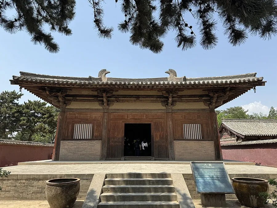 The main hall of Nanchan Temple in Wutai, Shanxi.
Nanchan Temple南禅寺
Nanchan Temple's Great Buddha Hall is modest in size but unusually revealing about Tang timber building. The square, three-bay hall has no interior column forest, allowing the roof structure and sculptural platform to be read…
Read the place guide →Plan your visit
Getting there
Wutai County is about 55 km in a straight line from central Xinzhou. Search for 五台县 in a map app to find stations and your accommodation.
Where to stay →Build your route
Mount Wutai and Foguang Temple are both listed here. The linked place guides have entrance and visit details.
Continue with Xinzhou →More in Xinzhou
Sources & geographic information
Administrative names and parent areas: Official geographic directory · Reference date 2026-09-06.
Some facts checked against 五台县 — Wikipedia contributors, CC BY-SA 4.0.
Some facts checked against 南禅寺 (五台) — Wikipedia contributors, CC BY-SA 4.0.
Some facts checked against 佛光寺 (五台山) — Wikipedia contributors, CC BY-SA 4.0.
Photo: Mount Wutai · lienyuan lee · CC BY 3.0. Full frame retained; proportionally resized and converted to WebP. No retouching or changes to the photographed subject. Card displays may crop the view.

Photo: Foguang Temple · Patrick20242023 · CC BY-SA 4.0. Proportionally resized and converted to WebP without cropping, retouching or changing the photographed subject.

Photo: Nanchan Temple · Patrick20242023 · CC BY-SA 4.0. Proportionally resized and converted to WebP without cropping, retouching or changing the photographed subject.

Map data © OpenStreetMap contributors. Pins mark approximate centres, not entrances or boundaries.