


Get to know Chengqu
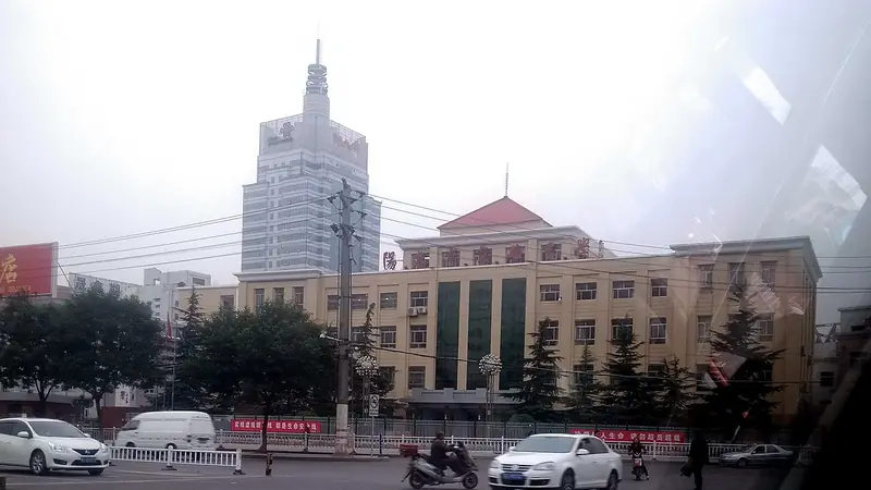
Photo adjustments
Full frame retained; EXIF orientation normalized, proportionally resized to at most 800 pixels and converted to WebP. No generated pixels or subject changes. Cards may crop the display.
- Administrative area
- District · 市辖区
- Part of
- Yangquan
- Chinese name
- 城区
- Local areas
- District guide
Area & population
- Area in the source
- 19.28 km²
- Population · 2020
- 225,443
Source: cited geographic source, as of the dates shown.
River, railway and loess hills
The Shijiazhuang–Taiyuan railway (石太铁路) follows the same east–west valley as the river. Terrain steps down from west to east, with thick loess deposits cut into ridges and gullies. Chengqu government identifies Laoniu Mountain (老牛山), also known as Nanshan (南山), as the district’s highest point at 744.4 metres. The Wudu River (五渡河) marks a natural boundary with neighbouring Jiaoqu (郊区).
From Pingding to Yangquan
Before Yangquan became a city in May 1947, the present district belonged to Pingding (平定). Its administrative predecessors were reorganised several times. The name Chengqu replaced Zhanshang District (站上区) in January 1969.
Sources for this guide
自然地理_阳泉城区政府网 · Yangquan Chengqu Government
建置沿革_阳泉城区政府网 · Yangquan Chengqu Government
Original English written from the listed sources and checked sentence by sentence against quoted extracts by a separate reviewer. Updated 2026-09-26.
Explore Chengqu
Core places to explore, with English and Chinese names.
Plan your visit
Getting there
Chengqu covers the centre of Yangquan. Search for 城区 in a map app to find stations and your accommodation.
Where to stay →More in Yangquan
Sources & geographic information
Administrative names and parent areas: Official geographic directory · Reference date 2026-09-06.
Map data © OpenStreetMap contributors. Pins mark approximate centres, not entrances or boundaries.