


Get to know Renhe District
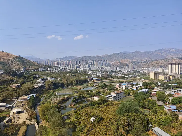
Photo adjustments
Full-frame source proportionally resized and converted to WebP for display. No subject alteration. Source-supplied marks and edits remain; cards may crop the view.
- Administrative area
- District · 市辖区
- Part of
- Panzhihua
- Chinese name
- 仁和区
- Local areas
- District guide
Area & population
- Area in the source
- 1,727.00 km²
- Population · 2018
- 276,000
Source: cited geographic source, as of the dates shown.
Getting oriented
Yongren County (永仁县) lies to the south and Huaping County (华坪县) to the west, both in Yunnan (云南). Huili (会理市) borders the district on the east, while Yanbian County (盐边县) lies to the north. The district government describes Renhe as a longstanding passage and trading point between Sichuan and Yunnan.
What to see
Yishala Village (迤沙拉村) stands near the Jinsha River (金沙江) on this provincial border. Yi (彝族) cultural traditions are part of its identity, including sheepskin-drum dancing and Tanjing ancient music (谈经古乐). Its lanes and courtyards contain houses with blue-tiled roofs and projecting eaves. The Ministry of Culture and Tourism highlights the interplay of these buildings with the village’s diverse cultural traditions.
Sources for this guide
印象仁和·攀枝花市仁和区人民政府 · Renhe District Government
“阳光康养 欢喜过年”之旅 · Ministry of Culture and Tourism
Original English written from the listed sources and checked sentence by sentence against quoted extracts by a separate reviewer. Updated 2026-09-27.
Explore Renhe District
Core places to explore, with English and Chinese names.
Renhe District 仁和区
Plan your visit
Getting there
Renhe District is about 10 km in a straight line from central Panzhihua. Search for 仁和区 in a map app to find stations and your accommodation.
Where to stay →More in Panzhihua
Sources & geographic information
Administrative names and parent areas: Official geographic directory (dmfw.mca.gov.cn) · Reference date 2026-09-06.
Map data © OpenStreetMap contributors. Pins mark approximate centres, not entrances or boundaries.