


Get to know Dalin Township
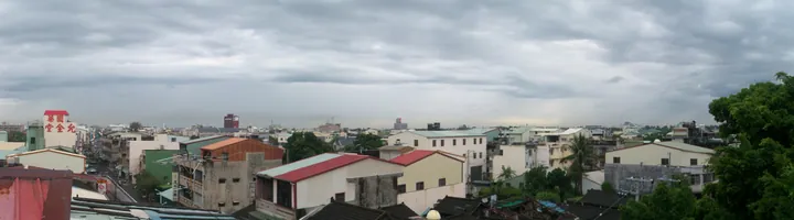
Photo adjustments
Full frame retained; proportionally resized and converted to WebP. No retouching or changes to the photographed subject. Card displays may crop the view.
- Administrative area
- Township · 鎮
- Part of
- Chiayi County
- Chinese name
- 大林鎮
- Local areas
- Township guide
Area & population
- Area in the source
- 64.00 km²
Source: cited geographic source, as of the dates shown.
The sugar-factory route
The Dalin Cycleway (大林自行車道) starts at Dalin Sugar Factory (大林糖廠). It passes through Datang (大糖里) and Hubei (湖北里), then uses an underpass to cross Provincial Highway 1 and the railway before reaching Sancun (三村里) and Sanjiao (三角里). A short stretch of overhanging trees forms a leafy tunnel along the route. Sanjiao also appears in the university’s collection as a rice-harvesting landscape.
Wetlands, lakes and an old tree
Minghua Wetland Ecological Park (明華濕地生態園區), associated with Sandie Stream (三疊溪), was converted from disused land through cooperation between the county and township governments. Zhonglin Lakeside Park (中林湖畔公園) has a lake, a landscape bridge and a pavilion maintained within the local community. In Sanjiao’s Dinglintou (頂林頭) area, the university’s photographic description identifies an old jiadong tree (茄冬樹) and describes it as more than five hundred years old.
Sources for this guide
大林慢城攝影比賽得獎作品 · Nanhua University Dalin Slow City programme
Original English written from the listed sources and checked sentence by sentence against quoted extracts by a separate reviewer. Updated 2026-09-30.
Explore Dalin Township
Core places to explore, with English and Chinese names.
Dalin Township 大林鎮
Plan your visit
Getting there
Dalin Township is about 20 km in a straight line from central Chiayi County. Search for 大林鎮 in a map app to find stations and your accommodation.
Where to stay →More in Chiayi County
Sources & geographic information
Administrative names and parent areas: Official geographic directory · Reference date 2026-09-06.
Map data © OpenStreetMap contributors. Pins mark approximate centres, not entrances or boundaries.