


Get to know Cihtong Township
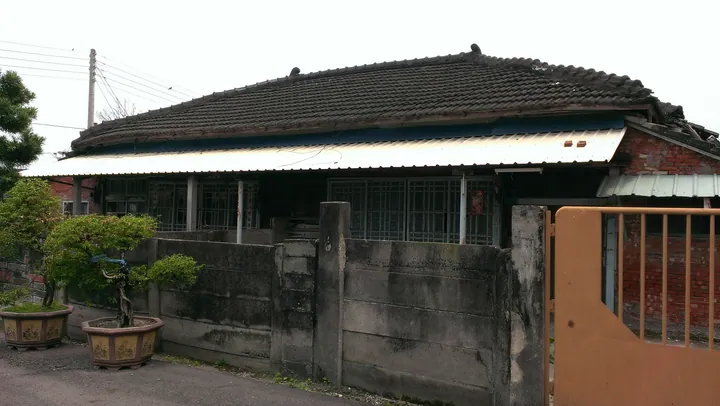
Photo adjustments
Full frame retained; proportionally resized and converted to WebP. No retouching or changes to the photographed subject. Card displays may crop the view.
- Administrative area
- Rural township · 鄉
- Part of
- Yunlin County
- Chinese name
- 莿桐鄉
- Local areas
- Rural township guide
Area & population
- Area in the source
- 51.00 km²
Source: cited geographic source, as of the dates shown.
Irrigation and village names
Early irrigation drew water from a tributary of the Huwei River to fields around Citong, Haishali (孩沙里) and Raopingcuo (饒平厝). Rice, peanuts, garlic, starfruit and vegetables are local products. Mayuan village (麻園村) includes the Hakka settlement of Piliao (埤寮), while Ganxi’s (甘西) Zhongcun (中村) retains Japanese-period road planning and some Japanese-style buildings.
Riverside and religious landmarks
Raoping village’s Shuzijiao community (樹仔腳) developed beside a Zhuoshui River ferry crossing. Its Catholic church opened in 1890, and the riverside park is another local place. Tianyao Temple (天瑤宮) worships Mazu; Fengyi Temple (鳳儀宮) honours the Third Prince (中壇元帥). The Lin Ben old house (林本古厝) and Tingfu Embankment monument (庭甫堤紀念碑) add historical landmarks.
Sources for this guide
莿桐鄉 - 维基百科,自由的百科全书 · Wikipedia contributors · CC BY-SA 4.0
Cihtong · Wikipedia contributors · CC BY-SA 4.0
Original English written from the listed sources and checked sentence by sentence against quoted extracts by a separate reviewer. Updated 2026-09-30.
Explore Cihtong Township
Core places to explore, with English and Chinese names.
Cihtong Township 莿桐鄉
Plan your visit
Getting there
Cihtong Township is about 9 km in a straight line from central Yunlin County. Search for 莿桐鄉 in a map app to find stations and your accommodation.
Where to stay →More in Yunlin County
Sources & geographic information
Administrative names and parent areas: Official geographic directory · Reference date 2026-09-06.
Some facts checked against 莿桐鄉 — Wikipedia contributors, CC BY-SA 4.0.
Some facts checked against Cihtong — Wikipedia contributors, CC BY-SA 4.0.
Map data © OpenStreetMap contributors. Pins mark approximate centres, not entrances or boundaries.