


Get to know Dongshi Township
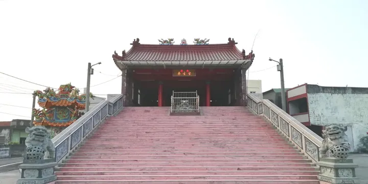
Photo adjustments
Full frame retained; proportionally resized and converted to WebP. No retouching or changes to the photographed subject. Card displays may crop the view.
- Administrative area
- Rural township · 鄉
- Part of
- Yunlin County
- Chinese name
- 東勢鄉
- Local areas
- Rural township guide
Area & population
- Area in the source
- 48.00 km²
Source: cited geographic source, as of the dates shown.
Fields and the former sugar railway
Local crops include rice, peanuts, carrots, garlic and sugarcane, with peanut sweets and tea-flavoured goose among its food specialities. Dongshi’s cycling route partly follows the old Magongcuo sugar-railway line (馬公厝線). Preserved cane-loading facilities and interpretation panels explain the connection between the flatland fields and Huwei’s (虎尾) sugar industry.
Meals carried into the fields
The Chifandan (吃飯擔) custom links villages in Dongshi and Baozhong around the Mamingshan Royal Lords procession (馬鳴山五年千歲). Host villages rotate, providing food in the fields for procession groups and visitors. Dishes carried on shoulder poles have included seasoned rice, lamb soup, rice cakes, meat stew and bamboo-shoot soup. Dongshi Presbyterian Church (東勢教會) dates to 1930.
Sources for this guide
東勢鄉 - 维基百科,自由的百科全书 · Wikipedia contributors · CC BY-SA 4.0
Dongshi, Yunlin · Wikipedia contributors · CC BY-SA 4.0
Original English written from the listed sources and checked sentence by sentence against quoted extracts by a separate reviewer. Updated 2026-09-30.
Explore Dongshi Township
Core places to explore, with English and Chinese names.
Dongshi Township 東勢鄉
Plan your visit
Getting there
Dongshi Township is about 20 km in a straight line from central Yunlin County. Search for 東勢鄉 in a map app to find stations and your accommodation.
Where to stay →More in Yunlin County
Sources & geographic information
Administrative names and parent areas: Official geographic directory · Reference date 2026-09-06.
Some facts checked against 東勢鄉 — Wikipedia contributors, CC BY-SA 4.0.
Some facts checked against Dongshi, Yunlin — Wikipedia contributors, CC BY-SA 4.0.
Map data © OpenStreetMap contributors. Pins mark approximate centres, not entrances or boundaries.