


Get to know Baodi District
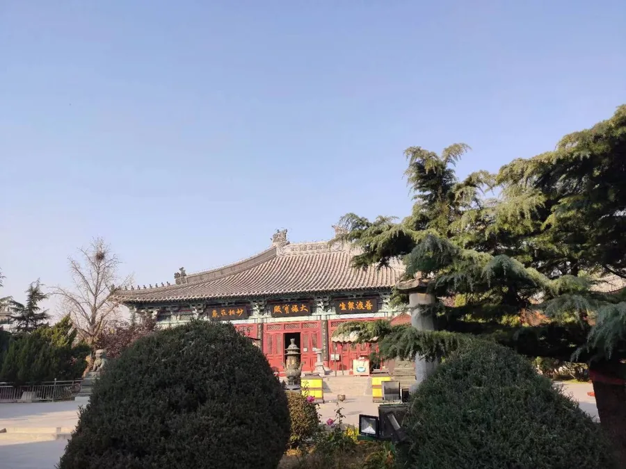
Photo adjustments
Proportionally resized and converted to WebP without cropping, retouching or changing the photographed subject.
- Administrative area
- District · 市辖区
- Part of
- Tianjin
- Chinese name
- 宝坻区
- Local areas
- District guide
Area & population
- Population · 2017
- 926,700
Source: cited geographic source, as of the dates shown.
Rebuilt temples
Guangji Temple (广济寺) and Dajue Chan Temple (大觉禅寺) originated in the Liao dynasty. Architect Liang Sicheng (梁思成) visited Guangji in 1932 to examine its Three Bodhisattvas Hall (三大士殿). The surviving Liao building was subsequently destroyed before 1949; both temples were later reconstructed to their original appearance.
River scenery and village arts
Along Baodi’s stretch of the Chaobai, upstream flats and wetlands give way to broader water downstream. Pingju opera (评剧) and Jingdong dagu (京东大鼓) developed among village communities, using local speech and drawing their subjects from everyday lives and social relationships. Traditional hand weaving uses reeds, willow branches, wheat stalks and maize husks to make practical objects and decorative pieces.
Sources for this guide
人文|宝坻印象 · Tianjin Commission for Discipline Inspection; Baodi District Commission for Discipline Inspection
Original English written from the listed sources and checked sentence by sentence against quoted extracts by a separate reviewer. Updated 2026-09-27.
Explore Baodi District
Core places to explore, with English and Chinese names.
Places to explore around Baodi District
Plan your visit
Getting there
Baodi District is about 65 km in a straight line from central Tianjin. Search for 宝坻区 in a map app to find stations and your accommodation.
Where to stay →Build your route
Start with Guangji Temple in Baodi. The linked place guides have entrance and visit details.
Continue with Tianjin →More in Tianjin
Sources & geographic information
Administrative names and parent areas: Official geographic directory · Reference date 2026-09-06.
Photo: Guangji Temple in Baodi · Nianhuoshao · CC BY-SA 4.0. Proportionally resized and converted to WebP without cropping, retouching or changing the photographed subject.
.jpg)
Map data © OpenStreetMap contributors. Pins mark approximate centres, not entrances or boundaries.