


Get to know Jizhou District
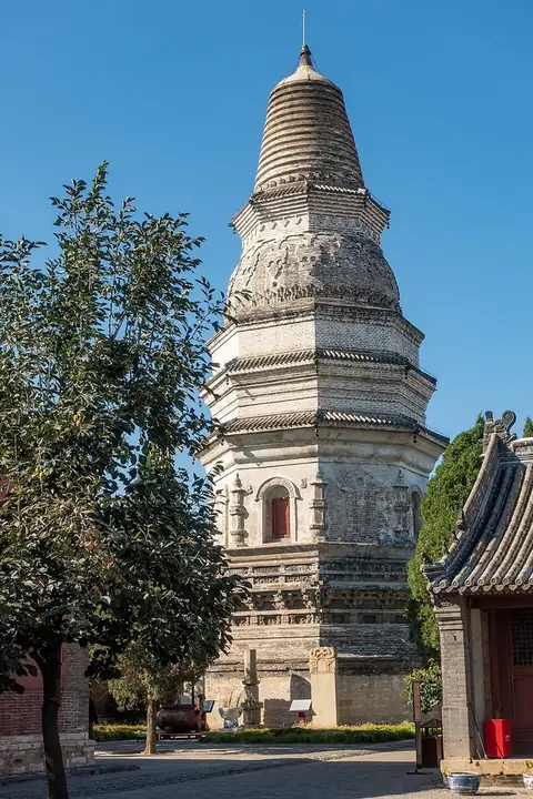
Photo adjustments
Full frame retained; resized proportionally to a maximum dimension of 960 pixels and converted to WebP quality 88. No crop, retouch, generated elements, or subject alteration. Final website rendition: full frame retained, proportionally resized to at most 720 pixels and converted to WebP. No additional retouching or subject alteration. Card displays may crop the view.
- Administrative area
- District · 市辖区
- Part of
- Tianjin
- Chinese name
- 蓟州区
- Local areas
- District guide
Area & population
- Area in the source
- 1,590.00 km²
- Population · 2020
- 795,516
- Administrative seat
- Wenchang Subdistrict (文昌街道)
Source: cited geographic source, as of the dates shown.
Setting and landscape
The land steps down from north to south, from Jiushanding (九山顶) at 1,078.5 metres to Macaowa (马槽洼) at 1.8 metres. Mountains cover about 28 percent of the 1,590 square kilometres, water about 10 percent and the southern plain the rest. The Ji Canal (蓟运河), Zhou River (州河) and Ju River (泃河) cross the district, and Yuqiao Reservoir (于桥水库), begun in 1959, is known as Tianjin's "big water jar". The district government says the Middle-Upper Proterozoic strata here, 1.8 billion to 800 million years old, form a well-known standard section.
History
The place was the state of Wuzhong (无终) in the Spring and Autumn period, became Yuyang (渔阳) under the Sui and was made Jizhou prefecture in 730 under the Tang; it was renamed Ji County in 1913. The Qingchi site (青池遗址) on the Zhou River shows farming about 8,000 years ago. Ji County was part of Hebei province until September 1973, when it passed to Tianjin.
What to see
Dule Temple (独乐寺), on the north side of West Street in the old town, was rebuilt in 984 under the Liao. Its gate is the earliest surviving gate with a hip roof in China, and the Guanyin Pavilion (观音阁), 23 metres high, is the oldest surviving wooden multi-storey building in China. Inside stands a 16-metre clay Eleven-Headed Guanyin, rising through the upper floors, with murals of the Sixteen Arhats on the lower walls.
Mount Pan (盘山), 12 kilometres north-west of the town, is known for its five peaks and eight rocks. Temples were built there from the Wei and Jin dynasties onward. In the Qianlong reign the royal garden of Jingji Mountain Villa (静寄山庄) was laid out there, and the emperor stayed more than thirty times. Republican-era fighting left few of its historic sites; in the 1980s the Tianjin government restored the Tiancheng (天成寺), Wansong (万松寺) and Yunzhao (云罩寺) temples.
The district government lists Huangyaguan (黄崖关) on the Great Wall as World Heritage, Mount Pan as a national scenic area, the Proterozoic strata as a national geopark, Baxian Mountain (八仙山) as a national nature reserve and Jiulong Mountain (九龙山) as a national forest park. The White Pagoda Temple (白塔寺) is also in the town.
Food and local products
Mount Pan persimmons are prized for size and sweetness, and chestnuts have long been grown along the Great Wall. Gonglating (公乐亭) rice was once sent to the Qing court, as were golden-fin carp from the Zhou River.
Highlights
- Dule Temple 独乐寺: Rebuilt in 984; its Guanyin Pavilion is China's oldest surviving wooden multi-storey building.
- Mount Pan 盘山: National scenic area 12 km north-west of the town, with the Qianlong-era Jingji Mountain Villa.
- Huangyaguan 黄崖关: Section of the Great Wall listed as World Heritage.
- Yuqiao Reservoir 于桥水库: Begun in 1959; known as Tianjin's big water jar.
- Mount Pan persimmons 盘山柿子: Known for their size and sweetness.
Sources for this guide
蓟州区简介_蓟州简介__天津市蓟州区人民政府 · Jizhou District People's Government, Tianjin
历史沿革_历史沿革__天津市蓟州区人民政府 · Jizhou District People's Government, Tianjin
蓟州区自然地理_自然地理__天津市蓟州区人民政府 · Jizhou District People's Government, Tianjin
独乐寺_蓟州古迹__天津市蓟州区人民政府 · Jizhou District Culture and Tourism Bureau, via the district government portal
盘山_蓟州古迹__天津市蓟州区人民政府 · Jizhou District Culture and Tourism Bureau, via the district government portal
Original English written from the listed sources and checked sentence by sentence against quoted extracts by a separate reviewer. Updated 2026-09-25.
Explore Jizhou District
Core places to explore, with English and Chinese names.
Places to explore around Jizhou District
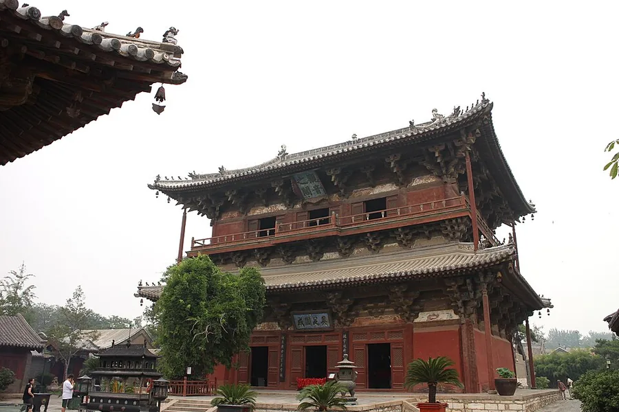 Guanyin Pavilion at Dule Temple, Tianjin.
Dule Temple独乐寺
Dule Temple in Jizhou is distinguished by two surviving timber structures from the Liao period: the mountain gate and Guanyin Pavilion. The pavilion shelters a colossal clay image of eleven-headed Guanyin, making the…
Read the place guide → Huangyaguan · 黄崖关长城
Huangyaguan黄崖关长城
Huangyaguan takes its name from the yellowish cliffs around a Great Wall pass in northern Jizhou. The defenses combine a mountain ridge, towers and a water pass, so the visit shows how the wall handled both steep land and…
Read the place guide → The summit area of Mount Pan near Tianjin, with a hilltop pagoda above autumn foliage. Photographed on 18 October 2015.
Mount Pan盘山
Mount Pan combines wooded slopes, distinctive boulders and temple sites in western Jizhou. Its traditional description divides the mountain into lower water scenery, middle rock scenery and upper pine scenery. Tiancheng Temple's…
Read the place guide →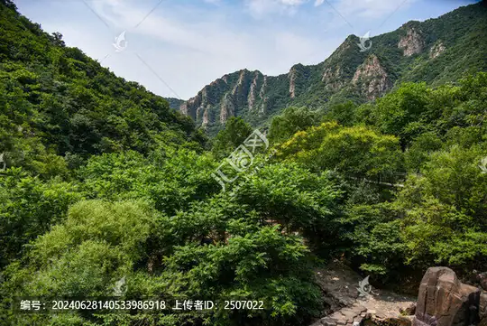 Limutai Scenic Area · 梨木台
Limutai Scenic Area梨木台
Limutai is a forested mountain and gorge landscape in Xiaying Town, northern Jizhou District.
Read the place guide →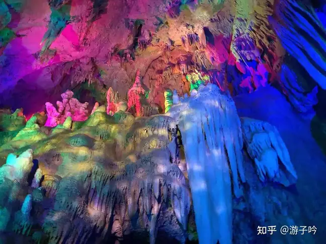 Jizhou Karst Cave · 蓟州溶洞
Jizhou Karst Cave蓟州溶洞
Jizhou Karst Cave is a developed cave attraction near Hongshuizhuang Village in Luozhuangzi, Jizhou District.
Read the place guide →Local life & food
Jizhou District local specialties
蓟州区特色美食 · 1 specialties to discover
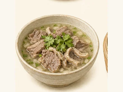 Bangjun lamb soup 邦均羊汤AI dish illustration / AI 菜品示意图
The appeal is the warming, distinctly lamb-flavoured broth. Pepper and fresh herbs can be more noticeable than chilli.
Source ↗Read the dish guide →All dish names · 全部菜名 (1)
More dishes from across Tianjin are in the Tianjin food guide.
Plan your visit
Getting there
Jizhou District is about 105 km in a straight line from central Tianjin. Search for 蓟州区 in a map app to find stations and your accommodation.
Where to stay →Build your route
Dule Temple and Huangyaguan are about 20 km apart in a straight line. The linked place guides have entrance and visit details.
Continue with Tianjin →More in Tianjin
Sources & geographic information
Administrative names and parent areas: Official geographic directory · Reference date 2026-09-06.
Photo: Dule Temple · Xin · CC BY-SA 4.0. Proportionally resized and converted to WebP without cropping, retouching or changing the photographed subject.

Photo: Huangyaguan · Ronnie Macdonald from Chelmsford, United Kingdom · CC BY 2.0. Wikimedia thumbnail; fitted to the ranking-card frame.
.jpg)
Photo: Mount Pan · rheins · CC BY 3.0. Proportionally resized and converted to WebP without cropping, retouching or changing the photographed subject.

Photo: Limutai Scenic Area · Source photographer · License not provided. EXIF orientation normalized; resized without changing aspect ratio; converted to WebP. No subject edits.
Photo: Jizhou Karst Cave · Source photographer · License not provided. EXIF orientation normalized; resized without changing aspect ratio; converted to WebP. No subject edits.
Map data © OpenStreetMap contributors. Pins mark approximate centres, not entrances or boundaries.