


Get to know Orku

Photo adjustments
Full frame retained; proportionally resized and converted to WebP. No retouching or changes to the photographed subject. Card displays may crop the view.
- Administrative area
- District · 市辖区
- Part of
- Karamay
- Chinese name
- 乌尔禾区
- Local areas
- District guide
Area & population
- Area in the source
- 2,233.00 km²
- Population · 2020
- 17,940
- Administrative seat
- Liushu Street Subdistrict
Source: cited geographic source, as of the dates shown.
Wind-shaped rock groups
World Devil City stands on the northwestern margin of the Junggar Basin (准噶尔盆地), roughly 100 kilometres from urban Karamay. Its landscape consists of differently shaped yardang rock groups eroded by wind. A geological science exhibition, film locations and a sightseeing train route form part of the attraction. The site received national AAAAA scenic-area designation in 2020.
Woodland and wetland recovery
The poplar woods grow in dispersed stands rather than a single continuous forest. Ailik Lake (艾里克湖) dried up in the late 1990s, affecting the local woodland ecosystem. Restoration undertaken in the early twenty-first century brought back wetland habitat. Autumn colour combines yellow poplar foliage, red tamarisk and saxaul against the Gobi landscape.
Sources for this guide
政府信息公开_克拉玛依市人民政府 · Karamay Municipal Government
天山南北赏胡杨 - 喀什旅游 - 喀什地区行政公署 · Xinjiang Daily, republished by Kashgar Prefectural Government
Original English written from the listed sources and checked sentence by sentence against quoted extracts by a separate reviewer. Updated 2026-09-27.
Explore Orku
Core places to explore, with English and Chinese names.
Places to explore around Orku
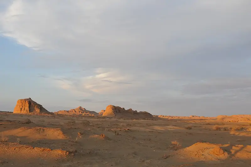 World Devil City · 世界魔鬼城
World Devil City世界魔鬼城
World Devil City (世界魔鬼城), also called Wuerhe Wind City (乌尔禾风城), is a wind-eroded yardang landscape in Wuerhe District (乌尔禾区), Karamay (克拉玛依市), Xinjiang.
Read the place guide →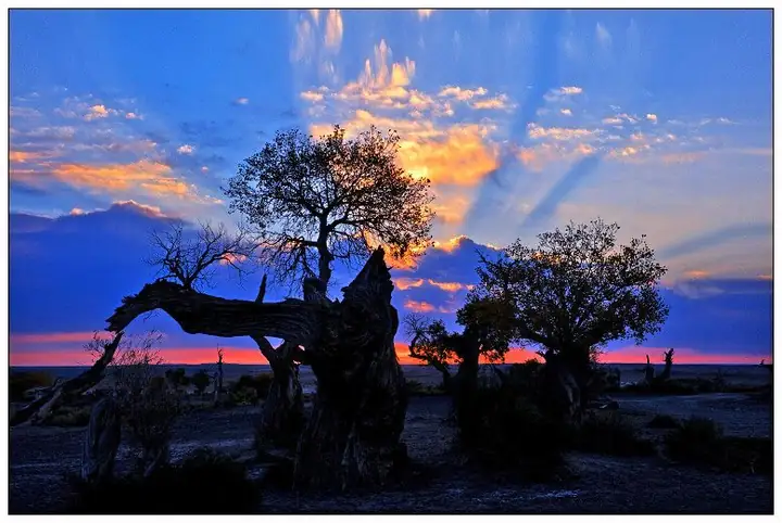 Urho Poplar Forest · 乌尔禾胡杨林
Urho Poplar Forest乌尔禾胡杨林
Wuerhe poplar forest (乌尔禾胡杨林) is the Euphrates poplar woodland of Wuerhe District (乌尔禾区), Karamay (克拉玛依市), Xinjiang, covering 300,000 mu.
Read the place guide →Plan your visit
Getting there
Orku is about 85 km in a straight line from central Karamay. Search for 乌尔禾区 in a map app to find stations and your accommodation.
Where to stay →Build your route
World Devil City and Urho Poplar Forest are both listed here. The linked place guides have entrance and visit details.
Continue with Karamay →More in Karamay
Sources & geographic information
Administrative names and parent areas: Official geographic directory · Reference date 2026-09-06.
Photo: World Devil City · 罗布泊 · CC BY 3.0. EXIF orientation normalized; resized without changing aspect ratio; converted to WebP. No subject edits.

Photo: Urho Poplar Forest · Source photographer · License not provided. EXIF orientation normalized; resized without changing aspect ratio; converted to WebP. No subject edits.
Map data © OpenStreetMap contributors. Pins mark approximate centres, not entrances or boundaries.