


Get to know Ulugqat County
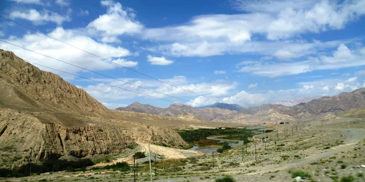
Photo adjustments
Full frame retained; proportionally resized and converted to WebP. No retouching or changes to the photographed subject. Card displays may crop the view.
- Administrative area
- County · 县
- Part of
- Kizilsu Kyrgyz Autonomous Prefecture
- Chinese name
- 乌恰县
- Local areas
- County guide
Area & population
- Area in the source
- 19,118.00 km²
- Population · 2020
- 60,912
Source: cited geographic source, as of the dates shown.
A high basin with wooded slopes
Xiaoshanghai is in Bostanterek Township (波斯坦铁列克乡), 94 kilometres from the county seat. Its name is rendered from Kyrgyz as grassland beside a cliff. At an elevation of 3,150 metres, the scenic area has a broad, relatively flat basin surrounded by mountains. Snow remains on the peaks throughout the year, while the slopes carry pines, cypresses and spruce. Cattle and sheep walk through the woodland.
A tower aligned with the sun
Xiji Tower (西极塔) in Jigen has a modern monumental form and a sphere representing the sun near its upper centre. The structure is aligned east to west so that sunlight produces reflections from different angles. Hongshan Valley (红山谷), in Tuoyun Township (托云乡), offers another geological feature: wind-shaped formations with outlines resembling animals and relief sculptures.
Sources for this guide
乌恰县人民政府 · Ulugqat County Culture, Sports, Radio, Television and Tourism Bureau
乌恰县人民政府 · Ulugqat County Culture, Sports, Radio, Television and Tourism Bureau
Original English written from the listed sources and checked sentence by sentence against quoted extracts by a separate reviewer. Updated 2026-09-27.
Explore Ulugqat County
Core places to explore, with English and Chinese names.
Ulugqat County 乌恰县
Plan your visit
Getting there
Ulugqat County is about 80 km in a straight line from central Kizilsu Kyrgyz Autonomous Prefecture. Search for 乌恰县 in a map app to find stations and your accommodation.
Where to stay →More in Kizilsu Kyrgyz Autonomous Prefecture
Sources & geographic information
Administrative names and parent areas: Official geographic directory (dmfw.mca.gov.cn) · Reference date 2026-09-06.
Map data © OpenStreetMap contributors. Pins mark approximate centres, not entrances or boundaries.