


Get to know Shidian County
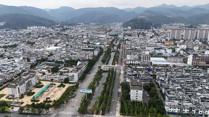
Photo adjustments
Full frame retained; proportionally resized and converted to WebP. No retouching or changes to the photographed subject. Card displays may crop the view.
- Administrative area
- County · 县
- Part of
- Baoshan
- Chinese name
- 施甸县
- Local areas
- County guide
Area & population
- Area in the source
- 2,009.00 km²
Source: cited geographic source, as of the dates shown.
Gorge and wartime traces
The gorge extends for more than one hundred kilometres within the county. Numerous wartime sites survive along the river, while other remains are distributed through old villages in the basin townships. Shidian’s cultural landscape also includes the Yang Shanzhou Former Residence (善洲故居) in Doupo Village (陡坡村), Yaoguan Town (姚关镇).
Clan halls and wetlands
Khitan-related sites include the Mulan Yelü Ancestral Hall (木兰耶律宗祠), the Yelü Ancestral Hall in Dawuyi Village (大乌邑村耶律宗祠), and Shaobao Temple (少保寺) in Youwang (由旺). Mulan (木兰) and Dawuyi (大乌邑) are two principal settlements of Khitan descendants. Yaoguan’s Wild Duck Lake Wetland (野鸭湖湿地) covers more than 3,500 mu. Its surroundings include Qingping Cave (清平洞), Huoxing Mountain (火星山), the former residence and the Dawuyi settlement.
Sources for this guide
施甸县旅游资源分布情况-施甸县人民政府门户网站 · Shidian Culture and Tourism Bureau
Original English written from the listed sources and checked sentence by sentence against quoted extracts by a separate reviewer. Updated 2026-09-27.
Explore Shidian County
Core places to explore, with English and Chinese names.
Shidian County 施甸县
Plan your visit
Getting there
Shidian County is about 45 km in a straight line from central Baoshan. Search for 施甸县 in a map app to find stations and your accommodation.
Where to stay →More in Baoshan
Sources & geographic information
Administrative names and parent areas: Official geographic directory · Reference date 2026-09-06.
Map data © OpenStreetMap contributors. Pins mark approximate centres, not entrances or boundaries.