


Get to know Tengchong
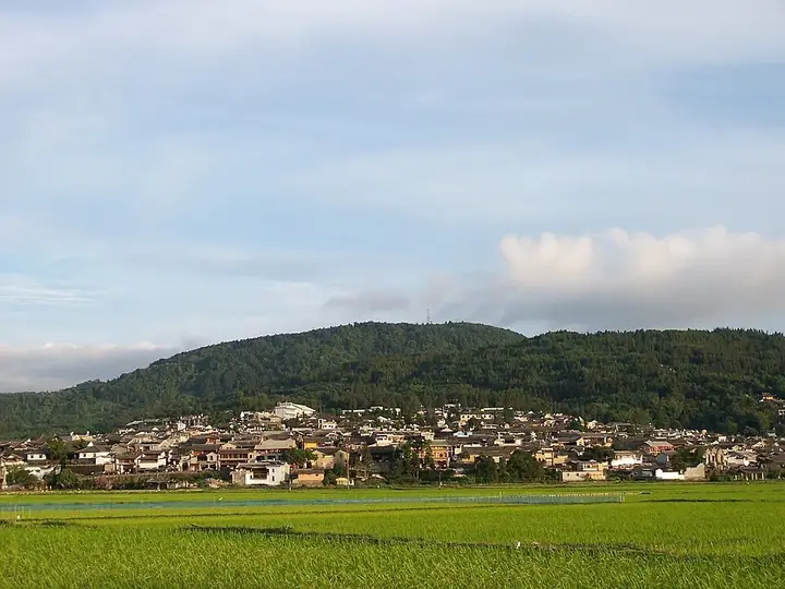
Photo adjustments
Full frame retained; resized proportionally to a maximum dimension of 960 pixels and converted to WebP quality 88. No crop, retouch, generated elements, or subject alteration. Final website rendition: full frame retained, proportionally resized to at most 720 pixels and converted to WebP. No additional retouching or subject alteration. Card displays may crop the view.
- Administrative area
- County-level city · 县级市
- Part of
- Baoshan
- Chinese name
- 腾冲市
- Local areas
- County-level city guide
Area & population
- Area in the source
- 5,845.00 km²
Source: cited geographic source, as of the dates shown.
Setting and landscape
The city government counts 99 volcanoes and 88 hot-spring sites and describes Tengchong as one of China's youngest volcanic areas; the Tengchong Volcano and Geothermal National Geopark (云南腾冲火山地热国家地质公园) is built around them. Climate and vegetation change markedly with altitude. The year divides into a wet season from May to October and a dry season from November to April. Tengchong marks the south-western end of the Heihe–Tengchong line (黑河—腾冲线), also called the Hu Huanyong line (胡焕庸线), which divides China's population map.
History
The Yuan made the area Tengchong prefecture (腾冲府), and under the Qing it was the Tengyue sub-prefecture (腾越厅). By the late 19th century it was a key trading post for Yunnan's trade with Burma and India; Britain opened a consulate here in 1899, and Tengchong customs was set up in 1902. The Tengyue uprising (腾越起义) of 1911 was Yunnan's first rising of the 1911 Revolution. From 1942 Tengchong was a main battlefield of the western Yunnan campaign, and on 14 September 1944 the Chinese Expeditionary Force (中国远征军) retook the town after 127 days of fighting. The county became a city in August 2015.
What to see
Two national 5A scenic areas are here: the Volcano and Rehai geothermal area (火山热海) and Heshun Old Town (和顺古镇), a well-known home town of overseas Chinese. The national protected sites are the Guoshang Cemetery (国殇墓园), the Heshun Library (和顺图书馆) and the former home of the philosopher Ai Siqi (艾思奇故居). The columnar rock jointing of Shenzhu Gorge (神柱谷) is listed among the national key scenic areas. Jiangdong Ginkgo Village (江东银杏村) is billed by the city as China's leading ginkgo village.
Food and local products
The city government credits Tengchong people with discovering jadeite and starting its cutting and trade some 600 years ago. The Asian Jewellery Federation named it "China's first jadeite city" (中国翡翠第一城), and the China National Light Industry Council gave it the title of "amber capital of China" (中国琥珀之都). Hemu Camellia Village (和睦茶花村) is billed by the city as China's leading village for red-flowered oil camellia.
Highlights
- Volcano and Rehai geothermal area 火山热海: National 5A scenic area in a field of 99 volcanoes and 88 hot-spring sites.
- Heshun Old Town 和顺古镇: National 5A scenic area and a well-known home town of overseas Chinese.
- Guoshang Cemetery 国殇墓园: National protected site in Tengchong.
- Heshun Library 和顺图书馆: One of three national protected sites listed for Tengchong.
- Jiangdong Ginkgo Village 江东银杏村: Billed by the city as China's leading ginkgo village.
- Jadeite 翡翠: Some 600 years of jade cutting and trade, according to the city government.
Sources for this guide
腾冲市概况-腾冲市人民政府网 · Tengchong City People's Government
腾冲市 - 维基百科,自由的百科全书 · Chinese Wikipedia · CC BY-SA 4.0
Original English written from the listed sources and checked sentence by sentence against quoted extracts by a separate reviewer. Updated 2026-09-25.
Explore Tengchong
Core places to explore, with English and Chinese names.
Tengchong Volcano and Rehai Geothermal Area 腾冲火山热海旅游区
Beihai Wetland 北海湿地
Heshun Town 和顺古镇
Guoshang Cemetery and West Yunnan War Memorial Hall 国殇墓园与滇西抗战纪念馆
Tengchong Volcano Geopark 腾冲火山地质公园
Tengchong Rehai Geothermal Area 腾冲热海
Jiangdong Ginkgo Village 银杏村
Gaoligong Mountains Baihualing Nature Trail 高黎贡山百花岭正规自然观察线路
Places to explore around Tengchong
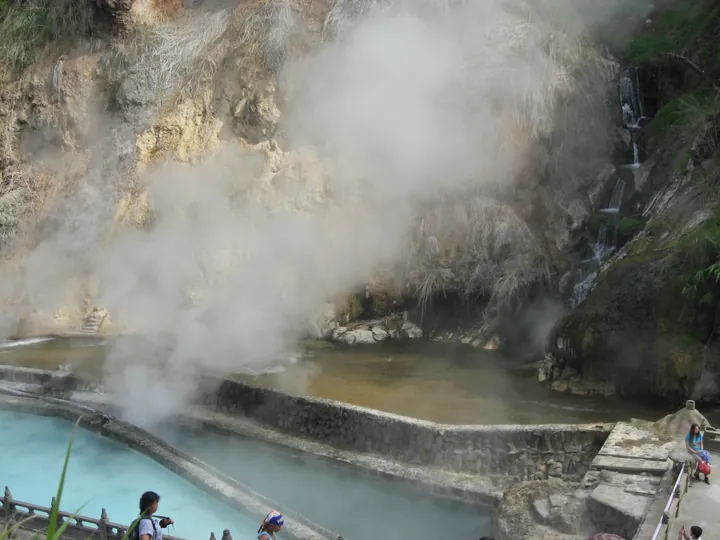 Steaming hot spring pools and a cascading stream at the Rehai geothermal area, Tengchong · 腾冲热海地热区温泉水潭及跌水 Source-recorded photograph date: 2013-08-04 10:51:18.
Tengchong Volcano and Rehai Geothermal Area腾冲火山热海旅游区
Tengchong's Volcano and Rehai tourism area combines volcanic landforms with a separate geothermal landscape.
Read the place guide → AI illustration · AI 示意图(仅供参考,非该地点实拍)
Beihai Wetland北海湿地
Beihai Wetland is a nature reserve in Tengchong, Baoshan, centred on the Beihai volcanic dammed lake and the Qinghai crater lake, one of 33 nationally key-protected wetlands in China and, according to Tengchong's own government, the only volcanic dammed lake in southwest China and Yunnan's only nationally protected wetland.
Read the place guide →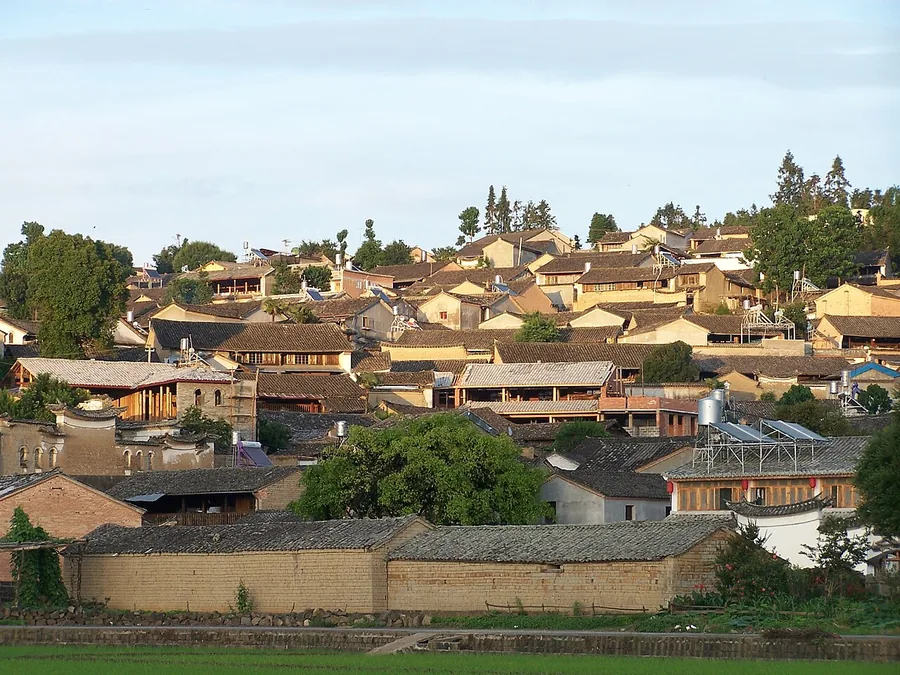 Traditional tiled roofs on the hillside of Heshun near Tengchong, June 2011.
Heshun Town和顺古镇
Heshun rises above wetland and cultivated land outside Tengchong. Its lanes connect hillside courtyard houses with family and community buildings, while laundry pavilions along the water reveal an everyday use of the town’s…
Read the place guide → AI illustration · AI 示意图(仅供参考,非该地点实拍)
Guoshang Cemetery and West Yunnan War Memorial Hall国殇墓园与滇西抗战纪念馆
Guoshang Cemetery and the adjoining War of Resistance Museum in West Yunnan stand together one kilometre southwest of Tengchong city, Baoshan, commemorating the Chinese Expeditionary Force soldiers who died retaking Tengchong from Japanese occupation in 1944. The cemetery was built in 1944-1945 at the advocacy of Li Genyuan; the museum, a separate building completed in 2013, stands on its east side.
Read the place guide →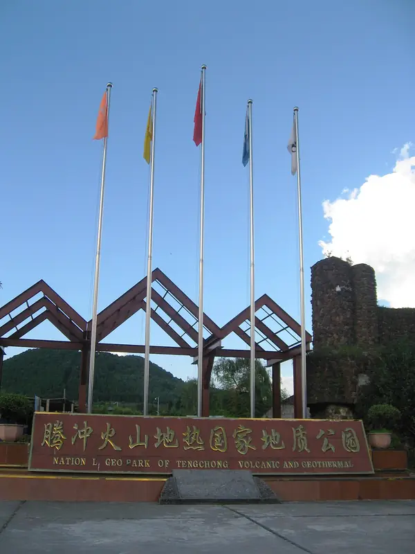 Tengchong Volcano Geopark · 腾冲火山地质公园
Tengchong Volcano Geopark腾冲火山地质公园
Tengchong's volcano scenic area, in Tengchong, Baoshan, is a field of Cenozoic dormant volcanoes covering 221.36 square kilometres, one of mainland China's four major volcanic groups, holding, according to the Baoshan tourism authority, 97 volcanoes of which 25 cones have well-preserved craters. The Ming-dynasty geographer Xu Xiake surveyed the volcanoes in 1639 and recorded them in his 'Travels of Xu Xiake'.
Read the place guide →Steaming hot-spring pools and terraces at Rehai (Tengchong Hot Sea), Tengchong, Baoshan · 保山市腾冲市腾冲热海景区蒸腾的温泉水池 Source-recorded photograph date: 2013-08-04 10:51:18.Tengchong Rehai Geothermal Area腾冲热海
Rehai (Hot Sea) is a geothermal scenic area about eight kilometres southwest of Tengchong city, Baoshan, roughly 1,520 metres above sea level and covering about 9 square kilometres, known in the Ming and Qing dynasties as 'a pool of hot sea', one of old Tengyue's twelve historic sights. The Ming-dynasty geographer Xu Xiake surveyed it in 1639 and described its geothermal landscape in detail.
Read the place guide → AI illustration · AI 示意图(仅供参考,非该地点实拍)
Jiangdong Ginkgo Village银杏村
Jiangdong Ginkgo Village is a scenic area 37 kilometres north of Tengchong city, Baoshan, adjacent to the national volcano geopark, comprising the four natural villages of Chenjiazhai, Baxin, Jiangyun and Sihe with a combined population of 4,012. It has a thousand-year farming history and is known for a natural contiguous ginkgo forest of over 10,000 mu with more than 30,000 trees, over 1,200 of them more than a century old.
Read the place guide →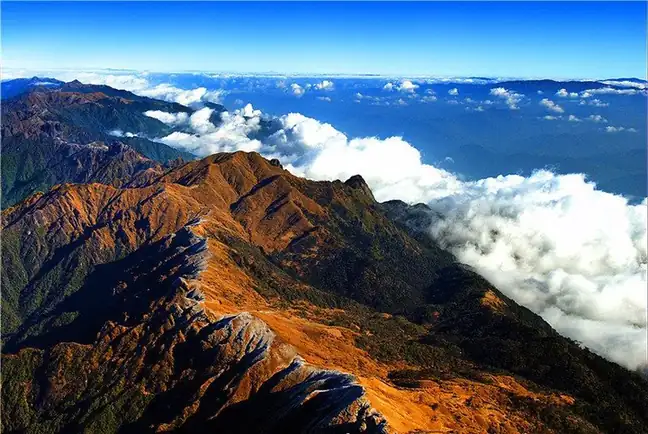 Gaoligong Mountains Baihualing Nature Trail · 高黎贡山百花岭正规自然观察线路
Gaoligong Mountains Baihualing Nature Trail高黎贡山百花岭正规自然观察线路
This route runs through Baihualing, a natural village of mixed Han, Lisu, Bai and other residents in Mangkuan township, Longyang district, Baoshan, on the eastern slope of the southern end of Gaoligong Mountain at about 1,400 metres elevation. The Baihualing area has 474 recorded bird species, 63.5 per cent of all bird species recorded across the Gaoligong Mountain region, and the Department of Natural Resources case study says it is acclaimed as 'China's five-star birdwatching sanctuary' and 'China's golden triangle of birdwatching'.
Read the place guide →Plan your visit
Getting there
Tengchong is about 70 km in a straight line from central Baoshan. Search for 腾冲市 in a map app to find stations and your accommodation.
Where to stay →Build your route
Tengchong Volcano and Rehai Geothermal Area and Beihai Wetland are both listed here. The linked place guides have entrance and visit details.
Continue with Baoshan →More in Baoshan
Sources & geographic information
Administrative names and parent areas: Official geographic directory · Reference date 2026-09-06.
Some facts checked against 腾冲市 — Wikipedia contributors, CC BY-SA 4.0.
Photo: Tengchong Volcano and Rehai Geothermal Area · Kcx36 · CC BY-SA 4.0. Full frame retained; proportionally resized and converted to WebP. No retouching or changes to the photographed subject. Card displays may crop the view.

Photo: Heshun Town · oldhouse.yin · CC BY-SA 3.0. Proportionally resized and converted to WebP without cropping, retouching or changing the photographed subject.

Photo: Tengchong Volcano Geopark · Kcx36 · CC BY-SA 4.0. EXIF orientation normalized; resized without changing aspect ratio; converted to WebP. No subject edits.

Photo: Tengchong Rehai Geothermal Area · Kcx36 · CC BY-SA 4.0. Full frame retained; proportionally resized and converted to WebP. No retouching or changes to the photographed subject. Card displays may crop the view.
Photo: Gaoligong Mountains Baihualing Nature Trail · Source photographer · License not provided. EXIF orientation normalized; resized without changing aspect ratio; converted to WebP. No subject edits.
Map data © OpenStreetMap contributors. Pins mark approximate centres, not entrances or boundaries.