


Get to know Wencheng County
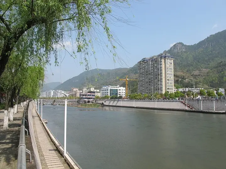
Photo adjustments
Full frame retained; resized proportionally to a maximum dimension of 960 pixels and converted to WebP quality 88. No crop, retouch, generated elements, or subject alteration. Final website rendition: full frame retained, proportionally resized to at most 720 pixels and converted to WebP. No additional retouching or subject alteration. Card displays may crop the view.
- Administrative area
- County · 县
- Part of
- Wenzhou
- Chinese name
- 文成县
- Local areas
- County guide
Area & population
- Area in the source
- 1,293.24 km²
- Population · 2020
- 288,200
Source: cited geographic source, as of the dates shown.
Setting and landscape
Mountains cover 82.5 percent of the county, summed up locally as "eight parts mountain, one part water, one part field". The land falls from northwest to southeast, from 1,362 metres at Yangding (杨顶) in the Shiyang forest farm (石垟林场) to 15 metres at Dayangkou (大垟口) in Pinghe Township (平和乡). North of the Feiyun the hills are a spur of the Donggong Mountains (洞宫山脉), south of it a spur of the Nanyandang range (南雁荡山); the Nantian (南田) plateau is the typical upland form. The Feiyun crosses the south of the county for 43.5 kilometres.
History and heritage
The county was formed in December 1946 from the border areas of Rui'an (瑞安), Qingtian (青田) and Taishun (泰顺), and its government opened on 1 July 1948. It was merged into Rui'an in October 1958 and separated again in September 1961.
Liu Ji came from Nantian, then part of Qingtian. A Yuan-era jinshi (进士) degree holder, he helped Zhu Yuanzhang (朱元璋) found the Ming, was made Earl of Chengyi (诚意伯) and was posthumously given the title Wencheng. The legends of Liu Bowen (刘伯温传说) entered the national intangible-heritage list in June 2008. The Taigong rite (太公祭), held at the Liu Ji Temple (刘基庙) since 1514, has a spring rite on the first day of the lunar year and an autumn rite on his birthday. It was listed nationally in 2011, and in December 2024 the Liu family's spring rite was included with the Spring Festival on UNESCO's Representative List.
She (畲族) families settled here in the Ming and Qing periods. Their song style known as the Wencheng tune (文成调) is sung mainly as antiphonal mountain songs.
What to see
Liu Ji's hometown (刘基故里) is one of four main scenic areas; its temple and tomb (刘基庙及墓) are a nationally protected monument. Baizhangji (百丈漈), a waterfall that Chinese Wikipedia gives as 207 metres high, forms a national key scenic area together with Feiyun Lake (飞云湖), the largest lake at about 35.4 square kilometres. Tongling Mountain (铜铃山) is a national forest park. The county museum has a She hall of more than 500 objects, including clothing, silver ornaments, ritual tools and song books.
Getting oriented
The county seat is Daxue (大峃镇), 62 kilometres in a straight line from central Wenzhou and 274 kilometres from Hangzhou (杭州). Rui'an lies to the east, Pingyang (平阳) and Cangnan (苍南) to the south, Taishun and Jingning (景宁) to the west, and Qingtian to the north.
Highlights
- Liu Ji Temple and tomb 刘基庙及墓: Nationally protected monument in Nantian; venue of the Taigong rite for Liu Bowen.
- Baizhangji 百丈漈: Waterfall given as 207 metres high; part of the Baizhangji-Feiyun Lake national key scenic area.
- Feiyun Lake 飞云湖: The county's largest lake, about 35.4 square kilometres.
- Tongling Mountain 铜铃山: National forest park.
- Taigong rite 太公祭: Rite for Liu Bowen held since 1514; national intangible heritage from 2011.
Sources for this guide
文成县 - 维基百科,自由的百科全书 · Chinese Wikipedia · CC BY-SA 4.0
文成县 · Wencheng County People's Government
文成县历史人文 · Wencheng County Culture, Radio, TV, Tourism and Sports Bureau (Wencheng County People's Government portal)
Original English written from the listed sources and checked sentence by sentence against quoted extracts by a separate reviewer. Updated 2026-09-25.
Explore Wencheng County
Core places to explore, with English and Chinese names.
Places to explore around Wencheng County
 Liu Bowen Hometown Scenic Area · 刘伯温故里景区
Liu Bowen Hometown Scenic Area刘伯温故里景区
The Liu Bowen Hometown attraction in Wencheng combines a memorial temple associated with Liu Ji, also known as Liu Bowen, and the Baizhangji waterfall landscape.
Read the place guide →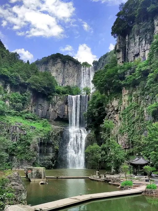 Baizhangji waterfall and pool, Wencheng · 文成百丈漈瀑布与水潭 Photograph date recorded by the source: 8 June 2019.
Baizhangxia百丈漈
Baizhangji in Wencheng descends through three contrasting waterfall stages within a deep valley. The first is a tall drop, the second combines falling water with an overhanging rock corridor, and the third spreads into a…
Read the place guide →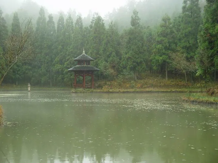 The Yao Pond area within the Hometown of Liu Bowen (Liu Ji) Scenic Area, Wencheng County · 文成县刘基故里景区内的瑶池 Source-recorded photograph date: Taken on 9 November 2003.
Liu Ji Hometown刘基故里
Liu Ji's hometown in Wencheng's Nantian area preserves memorials to the late Yuan and early Ming strategist and writer also known as Liu Bowen.
Read the place guide →Plan your visit
Getting there
Wencheng County is about 65 km in a straight line from central Wenzhou. Search for 文成县 in a map app to find stations and your accommodation.
Where to stay →Build your route
Liu Bowen Hometown Scenic Area and Baizhangxia are both listed here. The linked place guides have entrance and visit details.
Continue with Wenzhou →More in Wenzhou
Sources & geographic information
Administrative names and parent areas: Official geographic directory · Reference date 2026-09-06.
Some facts checked against 文成县 — Wikipedia contributors, CC BY-SA 4.0.
Photo: Liu Bowen Hometown Scenic Area · Source photographer · License not provided. EXIF orientation normalized; resized without changing aspect ratio; converted to WebP. No subject edits.
Photo: Baizhangxia · 黑揍红 · 黑揍红 — Baizhangji_waterfall_02.jpg — CC BY 2.5 · CC BY 2.5. Full frame retained; proportionally resized and converted to WebP. No retouching or changes to the photographed subject. Card displays may crop the view.

Photo: Liu Ji Hometown · 江上清风1961 · CC BY 3.0. Full frame retained; proportionally resized and converted to WebP. No retouching or changes to the photographed subject. Card displays may crop the view.

Map data © OpenStreetMap contributors. Pins mark approximate centres, not entrances or boundaries.