


Get to know Lai'an County
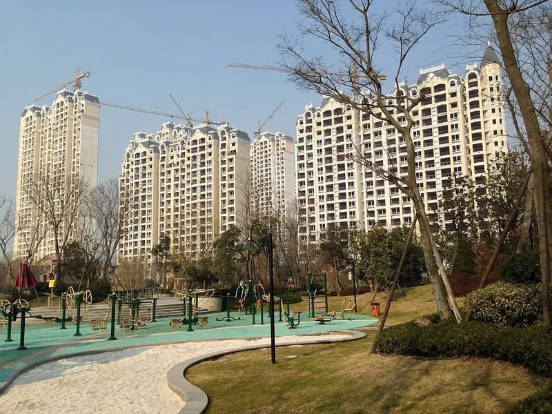
Photo adjustments
Full frame retained; EXIF orientation normalized, proportionally resized to at most 800 pixels and converted to WebP. No generated pixels or subject changes. Cards may crop the display.
- Administrative area
- County · 县
- Part of
- Chuzhou
- Chinese name
- 来安县
- Local areas
- County guide
Area & population
- Area in the source
- 1,481.00 km²
- Population · 2019
- 452,000
Source: cited geographic source, as of the dates shown.
Setting and landscape
The land falls from northwest to southeast, all below 220 metres. The north is hilly, the south is a rolling plain of low ridges and hollows, and broad valley floors follow the Chu (滁河), Pei (沛河) and Xinlai (新来河) rivers. Longwang Shan (龙王山), at 219 metres, is the highest hill. The line from Zhimaling (止马岭) to Changshan (长山) is the divide: land to the north drains to the Huai, land to the south to the Yangtze.
History
In 221 BC the Qin set up Jianyang County (建阳县) at Dongchenggeng in today's Shuikou (水口镇). A county named Yongyang (永阳县) was created in 709, the Southern Tang renamed it Lai'an in 958, and from 1148 the seat stood at Dayong, today's Xin'an (新安镇).
Banta (半塔), where five counties of two provinces meet, takes its name, "half pagoda", from a pagoda inscribed with the date 238 that lost three storeys. The New Fourth Army made Banta the centre of a base area in 1939, and on 21 March 1940 Nationalist forces under Han Deqin (韩德勤) laid siege to the town, opening what is known as the Banta Defence Battle.
What to see
The Wandong Martyrs' Cemetery (皖东烈士陵园) at Banta is a national 3A scenic area. Its memorial tower on Toudao Guangshan (头道光山), proposed in 1944, was finished in 1960, and the site holds halls on Liu Shaoqi's work in eastern Anhui, Banta's revolutionary history and the New Fourth Army's 2nd Division, headquartered at Daliuying (大刘郢) from 1943 until the war ended.
Chishan Lake (池杉湖), on the Jiangsu border by Luhe (六合), is a national wetland park of more than 50,000 pond cypresses, planted on waterlogged lowland in the 1970s and 1980s; the county portal calls it East China's largest pond-cypress forest, and 98 bird species are recorded there.
Hongshan opera (洪山戏), which grew out of Nuo ritual drama and took shape as a genre in the mid-Qing, has been on Anhui's provincial intangible heritage list since 2006. A troupe of the wartime Huainan base staged new modern plays in it at Banta in the early 1940s.
Food and local products
Leiguan (雷官镇), 30 kilometres southeast of the county town, is the home of Leiguan pressed duck (雷官板鸭). Local ducks are cured with dry-fried salt, steeped in an old master brine, hung to dry and simmered; the method is on the county and Chuzhou intangible heritage lists.
Getting oriented
The county town is 60 kilometres from central Nanjing and 145 kilometres from Hefei (合肥), and Chahe (汊河镇) lies 12 kilometres from the Nanjing Yangtze River Bridge.
Highlights
- Wandong Martyrs' Cemetery 皖东烈士陵园: National 3A site at Banta with the memorial tower and halls on the Banta battle and the 2nd Division.
- Chishan Lake National Wetland Park 池杉湖国家湿地公园: Pond-cypress "water forest" of more than 50,000 trees on the Jiangsu border.
- Leiguan pressed duck 雷官板鸭: Salted, brined and air-dried duck from Leiguan, on the Chuzhou intangible heritage list.
- Hongshan opera 洪山戏: Local opera grown from Nuo drama, provincial intangible heritage since 2006.
Sources for this guide
来安概况_来安县人民政府 · Lai'an County People's Government (county Party history and local gazetteer office)
建制区划_来安县人民政府 · Lai'an County People's Government (county Party history and local gazetteer office)
自然地理_来安县人民政府 · Lai'an County People's Government (county Party history and local gazetteer office)
半塔保卫战_来安县人民政府 · Lai'an County People's Government
皖东烈士陵园_来安县人民政府 · Lai'an County People's Government
池杉湖湿地公园_来安县人民政府 · Lai'an County People's Government
省级非物质文化遗产项目——洪山戏_来安县人民政府 · Lai'an County People's Government
雷官板鸭_来安县人民政府 · Lai'an County People's Government
Original English written from the listed sources and checked sentence by sentence against quoted extracts by a separate reviewer. Updated 2026-09-23.
Explore Lai'an County
Core places to explore, with English and Chinese names.
Lai'an County 来安县
Plan your visit
Getting there
Lai'an County is about 30 km in a straight line from central Chuzhou. Search for 来安县 in a map app to find stations and your accommodation.
Where to stay →More in Chuzhou
Sources & geographic information
Administrative names and parent areas: Official geographic directory · Reference date 2026-09-06.
Map data © OpenStreetMap contributors. Pins mark approximate centres, not entrances or boundaries.