


Get to know Langya District
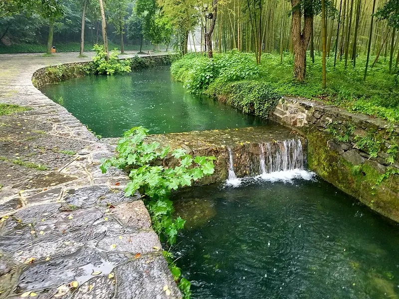
Photo adjustments
Full frame retained; proportionally resized and converted to WebP. No retouching or changes to the photographed subject. Card displays may crop the view.
- Administrative area
- District · 市辖区
- Part of
- Chuzhou
- Chinese name
- 琅琊区
- Local areas
- District guide
Area & population
- Area in the source
- 180.79 km²
- Population · 2019
- 329,000
Source: cited geographic source, as of the dates shown.
Setting and landscape
The district sits between the Yangtze and the Huai, on the north side of the lower Yangtze, and its hills and rivers run on towards Nanjing (南京). Its ground mixes low mountains, hills, gentle rises, flat-topped ridges and alluvial plain, under a transitional north-subtropical monsoon climate. A 40-square-kilometre national forest park adjoins the built-up area, and the Chu River (滁河) and Qingliu River (清流河) curve round the city on their way to the Yangtze.
History
The name recalls the Sima prince of Langya (琅琊王) of the Jin dynasty, who stayed on Langya Mountain before crossing the river to Nanjing and founding the Eastern Jin. In the Liang period the area became Nanqiao Prefecture (南谯州), which the Sui renamed Chuzhou in 583. The prefecture became Chu County (滁县) in April 1912 and a county-level city in November 1982; in January 1993 that city was divided into Langya and Nanqiao districts.
The district lists many noted officials who served in Chuzhou. Among them, the Tang official Wei Yingwu (韦应物) wrote the poem "West Stream at Chuzhou" (滁州西涧), Ouyang Xiu (欧阳修) wrote the "Old Toper's Pavilion" essay (醉翁亭记), and Wang Yangming (王阳明) lectured on his philosophy of mind at the Rang Spring (让泉). The Four Memorial Arches (四牌坊), honouring three generations of the Sun (孙) family who passed the imperial examinations, served as the landmark of old Chuzhou.
What to see
Langya Mountain is a national scenic area, a national forest park and a 4A tourist area, and holds the Old Toper's Pavilion (醉翁亭). Its cliff inscriptions and steles (琅琊山摩崖石刻及碑刻) are a national protected site; among them are seven Tang cliff carvings and a stele of Ouyang Xiu's essay in the hand of Su Shi (苏轼). The Tang-founded Langya Temple (琅琊寺), the Song-era Old Toper's Pavilion group and the Fengle Pavilion (丰乐亭) group are protected at provincial level.
Forest covers more than 85 percent of the mountain. The Langya elm (琅琊榆) and Zuiweng elm (醉翁榆) are named after it, and a plum tree known as the "Ou plum" (欧梅) is said to have been planted by Ouyang Xiu. Caves such as Guiyun Cave (归云洞) and Chongxi Cave (重熙洞) and springs such as Rang Spring form its group of "nine caves and eighteen springs" (九洞十八泉).
Highlights
- Langya Mountain 琅琊山: National scenic area and national forest park on the southwest side of Chuzhou; the district is named after it.
- Old Toper's Pavilion 醉翁亭: Song-era pavilion group linked to Ouyang Xiu's essay; protected at provincial level.
- Langya Mountain cliff inscriptions and steles 琅琊山摩崖石刻及碑刻: National protected site with seven Tang cliff carvings and Su Shi's stele of the pavilion essay.
- Langya Temple 琅琊寺: Tang-founded temple buildings protected at provincial level.
Sources for this guide
琅琊概况_琅琊区人民政府 · Langya District People's Government, Chuzhou
历史沿革_琅琊区人民政府 · Langya District People's Government, Chuzhou
自然地理_琅琊区人民政府 · Langya District People's Government, Chuzhou
人文历史_琅琊区人民政府 · Langya District People's Government, Chuzhou
琅琊山风景名胜区 - 生态中国网 · Eco China (eco.gov.cn)
Original English written from the listed sources and checked sentence by sentence against quoted extracts by a separate reviewer. Updated 2026-09-23.
Explore Langya District
Core places to explore, with English and Chinese names.
Places to explore around Langya District
Plan your visit
Getting there
Langya District is about 5 km in a straight line from central Chuzhou. Search for 琅琊区 in a map app to find stations and your accommodation.
Where to stay →Build your route
Start with Mount Langya. The linked place guides have entrance and visit details.
Continue with Chuzhou →More in Chuzhou
Sources & geographic information
Administrative names and parent areas: Official geographic directory · Reference date 2026-09-06.
Photo: Mount Langya · Virgil Guo · CC BY-SA 4.0. Full frame retained; proportionally resized and converted to WebP. No retouching or changes to the photographed subject. Card displays may crop the view.

Map data © OpenStreetMap contributors. Pins mark approximate centres, not entrances or boundaries.