


Get to know Nanqiao District
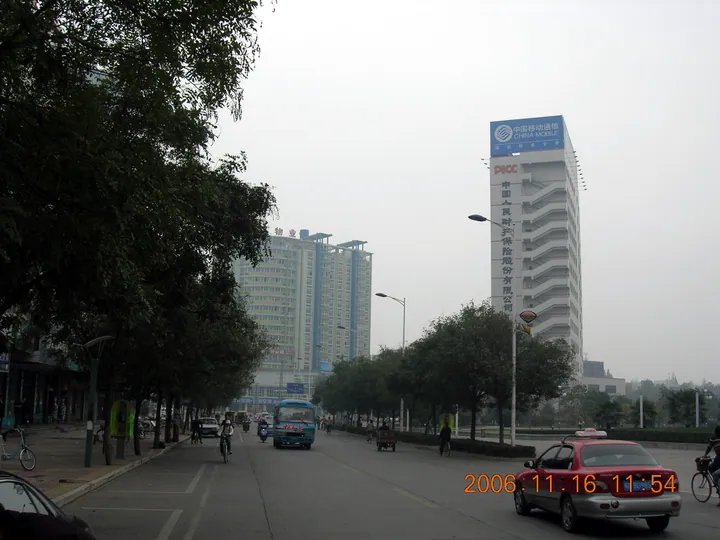
Photo adjustments
Full frame retained; proportionally resized and converted to WebP. No retouching or changes to the photographed subject. Card displays may crop the view.
- Administrative area
- District · 市辖区
- Part of
- Chuzhou
- Chinese name
- 南谯区
- Local areas
- District guide
Area & population
- Area in the source
- 1,187.11 km²
- Population · 2019
- 269,000
Source: cited geographic source, as of the dates shown.
Setting and landscape
The district is hill country that slopes from northwest to southeast. Low mountains and hills fill the west and northwest, where the Beijiangjun peak (北将军峰) of Huangfu Mountain (皇甫山), at 399.2 metres, is the highest point in Chuzhou. Huangfu Mountain and Mopan Mountain (磨盘山) form the divide between the Yangtze and Huai basins, although nearly 94 percent of the district drains to the Yangtze. In the northeast the Qingliu River (清流河) and Sha River (沙河) run between rolling ridges, while in the southeast the Chu River (滁河) loops through open, flat land long called a "land of fish and rice". Shaheji Reservoir (沙河集水库), also known as Gushan Lake (姑山湖), is counted among Anhui's ten major reservoirs.
What to see
The district government lists Huangfu Mountain National Forest Park (皇甫山国家森林公园), the old Qingliu Pass (清流关), Wuyi Old Street (乌衣老街), the Jinjia Stream (金甲溪) rafting run and the Zhangguang maple grove (章广万亩枫园) among its sights, and names the former seat of the Communist Party's Jiangsu–Anhui provincial committee (中共苏皖省委旧址) as a tourism site.
Qingliu Pass was first built under the Southern Tang as a defence against northern armies and a shield for Nanjing (南京), and became a provincial protected site in 1989. About 2.5 kilometres of the old post road survives, paved with bluestone and still marked by cart ruts. Ouyang Xiu (欧阳修) recorded that the Song founder, then leading Later Zhou troops, defeated 150,000 Southern Tang troops of Li Jing (李璟) below Qingliu mountain.
Food and local products
Chu chrysanthemum (滁菊), grown in the low hills, was a Qing tribute item, and the district government ranks it first among China's four famous chrysanthemums. Tea from around Mituo Temple (弥陀寺) on Huangfu Mountain was a tribute tea from the Ming; in 1992 the "Xijian Chunxue" (西涧春雪) tea was named a provincial famous tea. Zhangpuying (张浦郢) is known for small-mill sesame oil, and peanuts from Zhangguang (章广镇) were sold as far as Southeast Asia in the 1950s.
Getting oriented
Nanqiao meets Lai'an (来安) to the east, Dingyuan (定远) and Feidong (肥东) to the west, Quanjiao (全椒) to the south and Mingguang (明光) to the north, and faces Nanjing's Pukou District (浦口区) across the Chu River. The district seat at Wuyi (乌衣镇) is 56 kilometres from Nanjing and 149 kilometres by road from Hefei (合肥). The Beijing–Shanghai railway and high-speed railway both cross the district.
Highlights
- Qingliu Pass 清流关: Southern Tang pass and post road on the approach to Nanjing; provincial protected site since 1989.
- Huangfu Mountain National Forest Park 皇甫山国家森林公园: Its Beijiangjun peak, 399.2 metres, is the highest point in Chuzhou.
- Chu chrysanthemum 滁菊: Hill-grown chrysanthemum that was a Qing tribute item.
- Shaheji Reservoir (Gushan Lake) 沙河集水库: Counted among Anhui's ten major reservoirs.
Sources for this guide
南谯概况_滁州市南谯区人民政府 · Nanqiao District People's Government, Chuzhou
自然地理_滁州市南谯区人民政府 · Nanqiao District People's Government, Chuzhou
“金陵锁钥”清流关 · Anhuinews (中安在线), reprinted from Hefei Evening News
Original English written from the listed sources and checked sentence by sentence against quoted extracts by a separate reviewer. Updated 2026-09-23.
Explore Nanqiao District
Core places to explore, with English and Chinese names.
Nanqiao District 南谯区
Plan your visit
Getting there
Nanqiao District is about 7 km in a straight line from central Chuzhou. Search for 南谯区 in a map app to find stations and your accommodation.
Where to stay →More in Chuzhou
Sources & geographic information
Administrative names and parent areas: Official geographic directory (dmfw.mca.gov.cn) · Reference date 2026-09-06.
Map data © OpenStreetMap contributors. Pins mark approximate centres, not entrances or boundaries.