


Get to know Mingguang
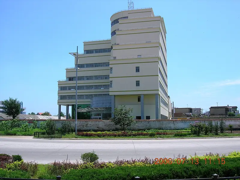
Photo adjustments
Full frame retained; EXIF orientation normalized, proportionally resized to at most 800 pixels and converted to WebP. No generated pixels or subject changes. Cards may crop the display.
- Administrative area
- County-level city · 县级市
- Part of
- Chuzhou
- Chinese name
- 明光市
- Local areas
- County-level city guide
Area & population
- Area in the source
- 2,335.00 km²
- Population · 2018
- 645,000
Source: cited geographic source, as of the dates shown.
Setting and landscape
The territory is long and narrow, rising in the south and falling to the north. Its southeast and south are high hills forming the watershed between the Yangtze and Huai basins; the centre and west are rolling hills; the north is an undulating plain, with a broad valley plain beside the Huai. The Chi River (池河) runs diagonally from the southwest through the city and on through Nüshan Lake (女山湖) into the Huai, whose main channel curves for more than 40 kilometres along the northern edge before passing Bogang (泊岗乡) into Hongze Lake (洪泽湖). The climate sits in the transition between the northern subtropics and the warm temperate zone, with a plum-rain season from late June to mid July.
History
The first county here was a Suining County (睢宁县) set up during the Southern and Northern Dynasties at Jiuxianji (旧县集), in today's Nüshan Lake town. Under the Sui and Tang, Zhaoyi County (招义县) was also seated in today's Nüshan Lake town; the Northern Song renamed it Zhaoxin (招信县), and it was abolished in 1283. In November 1932 Jiashan County (嘉山县) was carved from the edges of Xuyi, Chu, Dingyuan and Lai'an counties, with its seat at old Sanjie (老三界). Japanese troops took Sanjie in November 1937, and an anti-Japanese democratic government for Jiashan was set up at Zilaiqiao (自来桥) in March 1940. Jiashan County was abolished on 31 May 1994 and replaced by the county-level city of Mingguang.
What to see
Zhangbaling (张八岭镇), on the watershed, has developed forest scenery, farm stays and guesthouses. Chaiying village (柴郢村) is a national key village for rural tourism, and Baling Lake (八岭湖) is listed as a Yangtze Delta culture-and-tourism attraction; the town also has a memorial to the Jiashan anti-Japanese democratic government.
Food and local products
Nüshan Lake hairy crab (女山湖大闸蟹) is a Mingguang speciality. It gained national geographical-indication status in 2013 and was named one of China's ten famous crabs in 2023.
Getting oriented
Mingguang borders Chuzhou's Nanqiao District (南谯区) to the south, Wuhe County (五河县) to the north, Xuyi (盱眙) in Jiangsu to the east and Dingyuan (定远) and Fengyang (凤阳) to the west, and faces Sihong (泗洪) in Jiangsu across the water. The Beijing–Shanghai railway runs north–south through the city with a station here, and the Nanjing–Luoyang expressway passes around it. Nanjing is a little over 100 kilometres away.
Highlights
- Nüshan Lake hairy crab 女山湖大闸蟹: National geographical-indication product since 2013; named one of China's ten famous crabs in 2023.
- Nüshan Lake 女山湖: Lake through which the Chi River flows on its way to the Huai.
- Baling Lake 八岭湖: Listed as a Yangtze Delta culture-and-tourism attraction, in Zhangbaling on the watershed.
- Chaiying village 柴郢村: National key village for rural tourism in Zhangbaling.
Sources for this guide
明光概况_明光市人民政府 · Mingguang Municipal People's Government
历史沿革_明光市人民政府 · Mingguang Municipal People's Government
自然地理_明光市人民政府 · Mingguang Municipal People's Government
文旅融合创新路,全域旅游展新姿_明光市人民政府 · Mingguang Municipal People's Government
明光市举办2025年女山湖大闸蟹品牌推介会_明光市人民政府 · Mingguang Municipal People's Government
Original English written from the listed sources and checked sentence by sentence against quoted extracts by a separate reviewer. Updated 2026-09-23.
Explore Mingguang
Core places to explore, with English and Chinese names.
Mingguang 明光市
Plan your visit
Getting there
Mingguang is about 70 km in a straight line from central Chuzhou. Search for 明光市 in a map app to find stations and your accommodation.
Where to stay →More in Chuzhou
Sources & geographic information
Administrative names and parent areas: Official geographic directory · Reference date 2026-09-06.
Map data © OpenStreetMap contributors. Pins mark approximate centres, not entrances or boundaries.