


Get to know Fengtai County
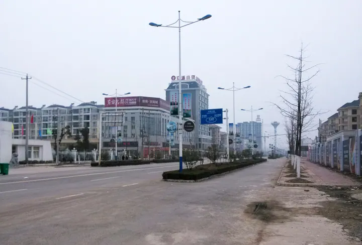
Photo adjustments
Full frame retained; proportionally resized and converted to WebP. No retouching or changes to the photographed subject. Card displays may crop the view.
- Administrative area
- County · 县
- Part of
- Huainan
- Chinese name
- 凤台县
- Local areas
- County guide
Area & population
- Area in the source
- 894.00 km²
- Population · 2020
- 633,385
- Administrative seat
- Fenghuang
Source: cited geographic source, as of the dates shown.
Setting and landscape
The county is low and flat, most of it below 25 metres above sea level. Besides the Huai, the Xifei River (西淝河), the Yongxing River (永幸河) and the Cihuai New River (茨淮新河) cross it, and its lakes include Jiaogang Lake (焦岗湖), Fenghuang Lake (凤凰湖) and Huajia Lake (花家湖). The climate is warm-temperate monsoon. Fengtai sits at the centre of the Huainan–Huaibei coalfield, and coal and power generation are its main industries.
History
In the Western Zhou this was the state of Zhoulai (州来). Wu destroyed Zhoulai in 529 BC, and in 493 BC the king of Wu moved the state of Cai (蔡国) here, after which the place was called Xiacai (下蔡); the Qin made it Xiacai County. In 957 the Later Zhou moved the seat of Shouzhou (寿州) to Xiacai, and when the Southern Song and the Jin divided the Huai between them, each side had its own Shouzhou on either bank.
The county itself was created in 1733, in the eleventh year of the Qing Yongzheng reign. The Qing imperial geography explains the name: the county had a Phoenix Terrace, where a phoenix was said to have alighted. At first the county was governed from the same city as Shouzhou; in 1865 its seat moved to Xiacai. The county government lists the Qin chancellor Gan Mao (甘茂), the boy minister Gan Luo (甘罗), the Three Kingdoms general Zhou Tai (周泰) and the Northern Song chief ministers Lü Yijian (吕夷简) and Lü Gongzhu (吕公著) among its natives.
What to see
The Maoxian Cave scenic area (茅仙洞风景区), a national 3A site, combines the old Maoxian cave, the Qingtian Temple (清天观), a Taoist foundation dated to the Western Han, and modern stone inscriptions. At Xiashankou (硖山口) two peaks face each other with the Huai running between them, a spot called the first gorge of the Huai, linked by water to the deep Heilongtan pool (黑龙潭). A ginkgo said to be a thousand years old and the tomb of the Warring States general Lian Po (廉颇) are also here, and the county identifies the area as the old battlefield of the Battle of Fei River (淝水之战).
Fengtai huagudeng (凤台花鼓灯), a flower-drum lantern dance, and the "fire tiger" (火老虎) performance are both on the national intangible cultural heritage list, and the county has been named a home of huagudeng folk art.
Highlights
- Maoxian Cave scenic area 茅仙洞风景区: National 3A site with the Maoxian cave, the Qingtian Temple and modern inscriptions.
- Xiashankou 硖山口: Gap where the Huai runs between two facing peaks, called the first gorge of the Huai.
- Fengtai huagudeng 凤台花鼓灯: Flower-drum lantern dance on the national intangible heritage list.
- Fire tiger 火老虎: Folk performance on the national intangible heritage list.
Sources for this guide
凤台简介_凤台县人民政府 · Fengtai County People's Government
凤台县 - 维基百科,自由的百科全书 · Wikipedia (Chinese) · CC BY-SA 4.0
Original English written from the listed sources and checked sentence by sentence against quoted extracts by a separate reviewer. Updated 2026-09-23.
Explore Fengtai County
Core places to explore, with English and Chinese names.
Fengtai County 凤台县
Plan your visit
Getting there
Fengtai County is about 30 km in a straight line from central Huainan. Search for 凤台县 in a map app to find stations and your accommodation.
Where to stay →More in Huainan
Sources & geographic information
Administrative names and parent areas: Official geographic directory · Reference date 2026-09-06.
Some facts checked against 凤台县 — Wikipedia contributors, CC BY-SA 4.0.
Map data © OpenStreetMap contributors. Pins mark approximate centres, not entrances or boundaries.