


Get to know Xiejiaji District
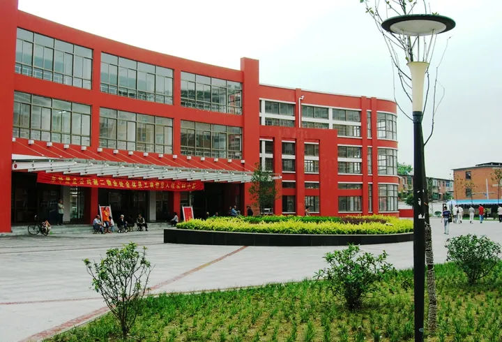
Photo adjustments
Full frame retained; proportionally resized and converted to WebP. No retouching or changes to the photographed subject. Card displays may crop the view.
- Administrative area
- District · 市辖区
- Part of
- Huainan
- Chinese name
- 谢家集区
- Local areas
- District guide
Area & population
- Area in the source
- 275.70 km²
- Population · 2020
- 221,589
- Administrative seat
- Pingshan Subdistrict
Source: cited geographic source, as of the dates shown.
Setting and landscape
A band of low hills, outliers of Mount Bagong and Shungeng Mountain (舜耕山), runs through the middle of the district; the highest, Lijian Mountain (犁锏山), reaches 200 metres. South of the hills a lakeside plain runs down to the north shore of Wabu Lake, and the lake and the Dongfei River (东淝河) form the border with Shou County (寿县). North of the hills the land tilts northward and is cut up by subsidence hollows left by coal mining. Water covers about 6 per cent of the district.
The district government lists Wolongshan Forest Park (卧龙山森林公园), a provincial scenic area, Chelu Mountain (车路山), Rushan Reservoir (乳山水库) and Wabu Lake, which it calls the second-largest freshwater lake in Anhui, among its natural sights.
History
After Chu (楚) moved its capital to Shouchun (寿春) in 241 BC, the area lay within the capital region. The district government says Liu An (刘安), King of Huainan, wrote the Huainanzi (淮南子) here. In 383 the Battle of the Fei River (淝水之战) was fought in the area, when Xie Xuan (谢玄) of the Eastern Jin defeated Fu Jian (苻坚) of the Former Qin; the idiom 'the sound of wind and the cry of cranes' (风声鹤唳) comes from it.
Five pairs of shafts, the Xiejiaji No. 1 to No. 3 and Liyingzi (李郢孜) No. 1 and No. 2 mines, were built in the 1950s. The district was split from Bagongshan District (八公山区) on 1 October 1961. It was renamed Hongwei District (红卫区) in 1966 and got its name back in 1972. In 2004 Yanggong Town (杨公镇), Gudui Township (孤堆乡) and Sunmiao Township (孙庙乡) were moved in from Changfeng County (长丰县).
What to see
Historic sites named by the district include the tomb of Huang Xie (黄歇), Lord Chunshen (春申君), one of the Four Lords of the Warring States; remains of the mausoleum of King You of Chu (楚幽王); the tomb of Yang Qizhen (杨歧珍), a Qing naval commander; and the Laishanji Mosque (赖山集清真寺).
Food and local products
Wabu Lake's whitebait (银鱼), shrimp (瓦虾) and tapertail anchovy (刀鱼) are known together as the 'three beauties of Wabu Lake' (瓦埠湖三秀). The farmland is known for beans, tubers and freshwater produce.
Getting oriented
The Shangqiu–Hefei–Hangzhou high-speed railway (商合杭高铁) and the Hefei–Huainan–Fuyang expressway (合淮阜高速) cross the district, whose government puts Hefei Xinqiao International Airport (合肥新桥国际机场) 70 kilometres away.
Highlights
- Tomb of Lord Chunshen 春申君墓: Tomb of Huang Xie, one of the Four Lords of the Warring States, listed among the district's historic sites.
- Wolongshan Forest Park 卧龙山森林公园: Provincial-level scenic area in the district.
- Wabu Lake 瓦埠湖: Forms the southern border; called the second-largest freshwater lake in Anhui by the district government.
- Three beauties of Wabu Lake 瓦埠湖三秀: Whitebait, shrimp and tapertail anchovy from the lake.
Sources for this guide
地理地貌_淮南市谢家集区人民政府 · Xiejiaji District People's Government, Huainan
谢区概况_淮南市谢家集区人民政府 · Xiejiaji District People's Government, Huainan
建置沿革_淮南市谢家集区人民政府 · Xiejiaji District People's Government, Huainan
自然资源_淮南市谢家集区人民政府 · Xiejiaji District People's Government, Huainan
Original English written from the listed sources and checked sentence by sentence against quoted extracts by a separate reviewer. Updated 2026-09-23.
Explore Xiejiaji District
Core places to explore, with English and Chinese names.
Xiejiaji District 谢家集区
Plan your visit
Getting there
Xiejiaji District is about 15 km in a straight line from central Huainan. Search for 谢家集区 in a map app to find stations and your accommodation.
Where to stay →More in Huainan
Sources & geographic information
Administrative names and parent areas: Official geographic directory · Reference date 2026-09-06.
Map data © OpenStreetMap contributors. Pins mark approximate centres, not entrances or boundaries.