


Get to know Chengde
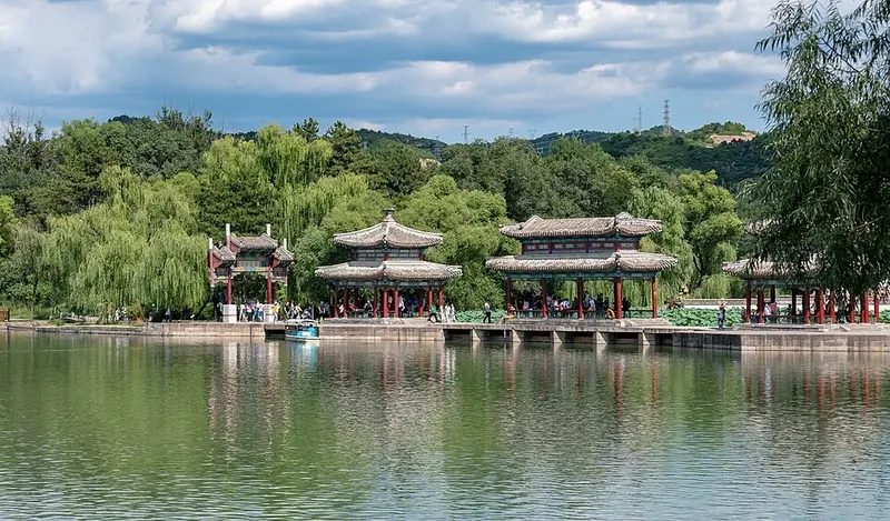
Photo adjustments
Full frame retained; proportionally resized and converted to WebP. No retouching or changes to the photographed subject. Card displays may crop the view.
- Administrative area
- Prefecture-level city · 地级市
- Part of
- Hebei
- Chinese name
- 承德市
- Local areas
- 11 local areas
Area & population
- Area in the source
- 39,519.00 km²
- Population · 2020
- 3,473,200
- Administrative seat
- Shuangqiao District
Source: cited geographic source, as of the dates shown.
Setting and landscape
The north of the prefecture is the southeastern edge of the Inner Mongolian Plateau, the middle is low mountain country and the south belongs to the Yan Mountains (燕山). Most land lies between 200 and 1,200 metres, and the city gives Wuling Mountain (雾灵山), at 2,118 metres, as its highest peak. The hills around the city are Danxia landforms, shaped into rock features such as Qingchui Peak (磬锤峰) and Shuangta Mountain (双塔山). The climate is continental monsoon, with four distinct seasons, rain arriving in the warm months and wide swings between day and night.
History
Until the early Qing the site was a hamlet called Rehe Shangying (热河上营). A travelling palace went up in 1703, and in 1733 the Yongzheng Emperor (雍正) created Chengde Department, choosing a name that means receiving the virtue of the ancestors. Qing emperors came to spend almost half of each year here, receiving ethnic-minority princes and foreign envoys; the city government recalls the visits of the Sixth Panchen Lama (六世班禅) and the British envoy Macartney. Chengde became capital of Rehe Province (热河省) under the Republic and passed to Hebei when that province was abolished in 1955. The Hebei government notes that it was a collection point for the standard pronunciation of Mandarin.
Manchu paper-cutting from Fengning (丰宁满族剪纸), begun in the Kangxi reign and cut mainly in positive line with long, fine fringes, joined the national intangible-heritage list in 2006.
What to see
The Mountain Resort and its outlying temples (避暑山庄及周围寺庙) were inscribed as a UNESCO World Heritage site in 1994 and rated a national 5A scenic area in 2007. The city government describes the temples as the largest surviving group of imperial temples in China; at Puning Temple (普宁寺) a gilded wooden Thousand-Armed Guanyin stands 27.21 metres high. The Jinshanling Great Wall (金山岭长城) became a 5A scenic area in 2020.
Getting oriented
Chengde lies 225 kilometres from Beijing and 435 from Shijiazhuang (石家庄), the provincial capital.
Highlights
- Chengde Mountain Resort 承德避暑山庄: Begun by the Kangxi Emperor in 1703; UNESCO World Heritage with its outlying temples since 1994.
- Puning Temple (Chengde) 普宁寺: Houses a gilded wooden Thousand-Armed Guanyin 27.21 metres high.
- Jinshanling Great Wall 金山岭长城: National 5A scenic area since 2020.
- Wuling Mountain 雾灵山: Given by the city government as its highest peak, at 2,118 metres.
- Qingchui Peak 磬锤峰: One of the Danxia rock features in the hills around the city.
Sources for this guide
承德市人民政府 承德概况 · Chengde Municipal People's Government
承德市人民政府 自然资源 · Chengde Municipal People's Government
承德市人民政府 承德历史 · Chengde Municipal People's Government
承 德 (走进河北 >> 历史文化 >> 历史名城) · Hebei Provincial People's Government
文化和旅游部数据服务栏目 (5A级旅游景区) · Ministry of Culture and Tourism of the People's Republic of China
剪纸(丰宁满族剪纸) - 中国非物质文化遗产网 · China Intangible Cultural Heritage Network (national list)
Original English written from the listed sources and checked sentence by sentence against quoted extracts by a separate reviewer. Updated 2026-10-01.
Explore Chengde
Core places to explore, with English and Chinese names.
Chengde 承德
Chengde Mountain Resort 承德避暑山庄
Jinshanling Great Wall 金山岭长城
Putuo Zongcheng Temple 普陀宗乘之庙
Puning Temple (Chengde) 普宁寺
Pule Temple 普乐寺
Xumi Fushou Temple 须弥福寿之庙
Saihanba National Forest Park 塞罕坝国家森林公园
Chengde Museum 承德博物馆
Jingbei First Grassland 京北第一草原
Great Khan's Palace 大汗行宫
Wuling Mountain 雾灵山
Xinglong Mountain Scenic Area 兴隆山
Qingchui Peak 磬锤峰
Shuangta Mountain 双塔山
Yudaokou Grassland and Forest 御道口草原森林
Panjiakou Reservoir Underwater Great Wall 潘家口水库水下长城观景区
Shuangqiao District 双桥区
Shuangluan District 双滦区
Yingshouyingzi Mining District 鹰手营子矿区
Chengde County 承德县
Xinglong County 兴隆县
Luanping County 滦平县
Longhua County 隆化县
Fengning Manchu Autonomous County 丰宁满族自治县
Kuancheng Manchu Autonomous County 宽城满族自治县
Weichang Manchu and Mongol Autonomous County 围场满族蒙古族自治县
Pingquan 平泉市
Places to explore around Chengde
 Dacheng Pavilion, Chengde · 承德
Chengde承德
Chengde's imperial landscape brings a palace garden and a ring of large Buddhist temples into the same mountain valley. The Mountain Resort combines formal rooms, lakes, open ground and wooded slopes; the outlying temples…
Read the place guide → Chengde Mountain Resort · 承德避暑山庄
Chengde Mountain Resort承德避暑山庄
Chengde Mountain Resort was both an imperial summer residence and a working Qing court. Its southern palace area leads into an expansive designed landscape of lakes, open ground and forested hills. The contrast is deliberate…
Read the place guide → Jinshanling Great Wall · 金山岭长城
Jinshanling Great Wall金山岭长城
Jinshanling follows a rugged ridge near the boundary of Luanping and Beijing's Miyun area. Its closely spaced towers, barrier walls and changes in masonry give a walk here a strong military-architecture focus as well as broad…
Read the place guide →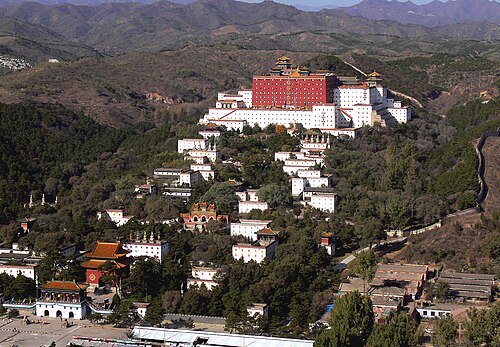 Putuo Zongcheng Temple · 普陀宗乘之庙
Putuo Zongcheng Temple普陀宗乘之庙
Putuo Zongcheng translates the visual language of Lhasa's Potala Palace into Chengde's imperial setting. A sequence of gateways and stepped white buildings rises towards the great red terrace, enclosing Wanfaguiyi Hall and its…
Read the place guide → Dacheng Pavilion at Puning Temple, Chengde, Hebei.
Puning Temple (Chengde)普宁寺
Puning Temple combines two different spatial traditions on a single rising axis. The front courts follow a Chinese Buddhist hall arrangement; behind them, a Tibetan-inspired mandala composition surrounds the towering Dacheng…
Read the place guide → Xuguang Pavilion at Pule Temple, Chengde; 21 September 2013.
Pule Temple普乐寺
Pule Temple stands on raised ground east of the Wulie River, with Bangchui Peak behind the surrounding landscape. Its lower halls lead to Xuguang Pavilion, a circular, double-eaved building on square terraces. The interplay of…
Read the place guide →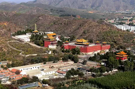 Xumi Fushou Temple · 须弥福寿之庙
Xumi Fushou Temple须弥福寿之庙
Xumi Fushou Temple was built in 1780 for the Sixth Panchen Lama's visit to the Qianlong emperor, taking inspiration from Tashilhunpo Monastery. Its red terrace encloses Miaogao Zhuangyan Hall, whose gilded roof carries large…
Read the place guide → Entrance archway and forested hillside at Saihanba Forest Park, photographed on 17 July 2005.
Saihanba National Forest Park塞罕坝国家森林公园
Saihanba's forest landscape is the result of sustained planting on the uplands north of Weichang. Forest, meadow and wetland meet here, so its appeal changes between the wooded slopes and the open water of places such as Qixing…
Read the place guide →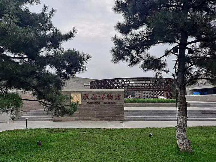 The modern Chengde Museum entrance on Puning Road · 普宁路承德博物馆现馆入口 Source-recorded photograph date: 2025-08-30 10:23:35.
Chengde Museum承德博物馆
Chengde's museum beside Puning Road provides an indoor counterpart to the Mountain Resort and surrounding temples. Its displays explore imperial garden culture, Qing court life and Tibetan-Han Buddhist art, helping explain the…
Read the place guide → Jingbei First Grassland · 京北第一草原
Jingbei First Grassland京北第一草原
Jingbei First Grassland (京北第一草原) is the Bashang plateau grassland landscape around Datan in Fengning Manchu Autonomous County, shaped by meadows, marshes and rivers.
Read the place guide → Great Khan's Palace · 大汗行宫
Great Khan's Palace大汗行宫
Dahan Xinggong (大汗行宫) is a modern Mongol–Yuan cultural attraction in Fengning's Datan grassland area, designed around a ceremonial palace and camp setting.
Read the place guide → Rocky summit view from Wuling Mountain in Xinglong County, Hebei · 河北省兴隆县雾灵山山顶景色 Source-recorded photograph date: Taken on 19 October 2008.
Wuling Mountain雾灵山
Wuling Mountain is a forested Yanshan mountain landscape centred on Xinglong County near the Beijing boundary.
Read the place guide → AI illustration · AI 示意图(仅供参考,非该地点实拍)
Xinglong Mountain Scenic Area兴隆山
Xinglongshan (兴隆山) is a rugged Yanshan mountain scenic area near Mizidi Village in Xinglong County, forming one of the four scenic sections of Hebei Xinglong National Geopark.
Read the place guide → Sledgehammer Peak (Qingchui Peak), a rock pillar on a ridge in Chengde · 承德磬锤峰,立于山脊之上的石柱 Source-recorded photograph date: 2004-01-01 00:00.
Qingchui Peak磬锤峰
Qingchui Peak is the conspicuous hammer-shaped rock rising east of Chengde’s Mountain Resort.
Read the place guide → A green wooded hillside with a tall rock pinnacle crowned by two small pagodas standing on its ridge, a town spreading below to the left, distant blue hills, and a carved stone marker reading 雙塔山留念 on a paved path in the foreground.
Shuangta Mountain双塔山
Shuangta Mountain in Chengde’s Shuangluan District is known for two prominent rock pillars, each carrying a small brick structure at its top.
Read the place guide →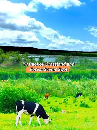 Yudaokou Grassland and Forest · 御道口草原森林
Yudaokou Grassland and Forest御道口草原森林
Yudaokou Grassland and Forest Scenic Area (御道口草原森林) is a Bashang landscape in the Mulan Weichang area, combining open meadows, sparse-tree grassland, woodland, wetlands and freshwater lakes.
Read the place guide → Panjiakou Reservoir Underwater Great Wall · 潘家口水库水下长城观景区
Panjiakou Reservoir Underwater Great Wall潘家口水库水下长城观景区
The Panjiakou Reservoir submerged Great Wall landscape (潘家口水库水下长城观景区) in Kuancheng brings Ming-period wall remains into a mountain reservoir setting.
Read the place guide →Local life & food
Chengde local specialties
承德市特色美食 · 15 specialties to discover
 Chengde fried buckwheat jelly 二仙居煎碗坨AI illustration · AI 示意图
The outside can acquire browned edges while the center remains smooth and dense. Tart dressing lifts the earthy buckwheat flavor.
Source ↗Read the dish guide → Chengde naked-oat rolls 莜面窝子AI illustration · AI 示意图
Their earthy grain flavor and dense, slightly coarse chew differ from wheat noodles. The hollow shape catches liquid and small pieces of topping.
Source ↗Read the dish guide → Chengde rose pastries 鲜花玫瑰饼AI illustration · AI 示意图
The floral aroma should be noticeable alongside the sweetness, while a flaky or crumbly shell gives the pastry structure.
Source ↗Read the dish guide → Chengde shredded pork with bamboo shoots 改刀肉AI illustration · AI 示意图
Tender pork brings savory richness while bamboo retains a cleaner, crisp bite. The sauce should coat the strips without burying that texture.
Source ↗Read the dish guide →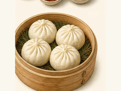 Chengde pine-twig steamed buns 承德松枝包子AI dish illustration / AI 菜品示意图
The chief contrast is fluffy dough against a juicy savoury centre. Any woody fragrance should be secondary to the filling.
Source ↗Read the dish guide → Manchu Eight-Bowl Banquet 满族八大碗AI illustration · AI 示意图(仅供参考,非实拍)
Manchu Eight-Bowl Banquet (满族八大碗) is a set of eight dishes served together in large matching bowls.
Read the dish guide → Imperial Clay Lotus-Leaf Chicken 御土荷叶鸡AI illustration · AI 示意图(仅供参考,非实拍)
Imperial Clay Lotus-Leaf Chicken (御土荷叶鸡) is Chengde’s (承德) version of beggar’s chicken (叫化鸡).
Read the dish guide → Chengde Soybean-Dusted Millet Rolls 承德驴打滚
Chengde Soybean-Dusted Millet Rolls (承德驴打滚) are an everyday snack of Chengde (承德), Hebei, made from the area's sticky broomcorn millet.
Read the dish guide →Photo adjustments
EXIF orientation normalized; resized without changing aspect ratio; converted to WebP. No subject edits.
All dish names · 全部菜名 (15)
- Chengde fried buckwheat jelly · 二仙居煎碗坨
- Chengde naked-oat rolls · 莜面窝子
- Chengde rose pastries · 鲜花玫瑰饼
- Chengde shredded pork with bamboo shoots · 改刀肉
- Chengde pine-twig steamed buns · 承德松枝包子
- Manchu Eight-Bowl Banquet · 满族八大碗
- Imperial Clay Lotus-Leaf Chicken · 御土荷叶鸡
- Chengde Soybean-Dusted Millet Rolls · 承德驴打滚
- Sweet Almond Drink · 杏仁茶
- Pingquan lamb soup · 平泉羊汤
- Fengning Roast Leg of Lamb · 丰宁烤羊腿
- Weichang Potato Banquet · 围场土豆宴
- Imperial Buckwheat Noodles · 御拨面
- Nansha Cake · 南沙饼
- Chengde Cold Starch Jelly · 承德凉粉
More dishes from across Hebei are in the Hebei food guide.
Counties & districts in Chengde
11 areas belong directly to Chengde.
11 areas
Shuangqiao District双桥区
Shuangqiao District (simplified Chinese: 双桥区; traditional Chinese: 雙橋區; pinyin: Shuāngqiáo Qū; lit. 'double bridge') is a district of Chengde, Hebei, China.
Explore the area →DistrictShuangluan District双滦区
Shuangluan District (simplified Chinese: 双滦区; traditional Chinese: 雙灤區; pinyin: Shuāngluán Qū) is a district of Chengde, Hebei province, China.
Explore the area →DistrictYingshouyingzi Mining District鹰手营子矿区
Yingshouyingzi Mining District (simplified Chinese: 鹰手营子矿区; traditional Chinese: 鷹手營子礦區; pinyin: Yīngshǒuyíngzǐ Kuàng Qū) is a district of Chengde, Hebei, China.
Explore the area →CountyChengde County承德县
Chengde County (simplified Chinese: 承德县; traditional Chinese: 承德縣; pinyin: Chéngdé Xiàn) is a county in the northeast of Hebei province, People's Republic of China.
Explore the area →Show fewer areas
Xinglong County兴隆县
Xinglong County (simplified Chinese: 兴隆县; traditional Chinese: 興隆縣; pinyin: Xīnglóng Xiàn) is a county in the northeast of Hebei province, bordering the municipalities of Beijing to the west and Tianjin to…
Explore the area →CountyLuanping County滦平县
Luanping County (simplified Chinese: 滦平县; traditional Chinese: 灤平縣; pinyin: Luánpíng Xiàn) is a county of northeastern Hebei Province, with the Great Wall of China demarcating its border with Miyun District…
Explore the area →CountyLonghua County隆化县
Longhua County (simplified Chinese: 隆化县; traditional Chinese: 隆化縣; pinyin: Lónghuà Xiàn) is a county in the northeast of Hebei province, China, bordering Inner Mongolia to the east.
Explore the area →Autonomous countyFengning Manchu Autonomous County丰宁满族自治县
Fengning Manchu Autonomous County is a Manchu autonomous county of northern Hebei province, bordering Beijing to the southwest and Inner Mongolia to the north, and lying under the administration of the…
Explore the area →Autonomous countyKuancheng Manchu Autonomous County宽城满族自治县
Kuancheng Manchu Autonomous County is a Manchu autonomous county of northeastern Hebei province, China, on the banks of the Luan River, bordering Liaoning to the east.
Explore the area →Autonomous countyWeichang Manchu and Mongol Autonomous County围场满族蒙古族自治县
Weichang Manchu and Mongol Autonomous County is a Manchu and Mongol autonomous county located in far northeastern Hebei province, China.
Explore the area →County-level cityPingquan平泉市
Pingquan is a county-level city of northeastern Hebei province, China, bordering Liaoning province to the east. It has a population of 400,000 (2020 census) residing in an area of 3,297 km² (1,273 sq mi).
Explore the area →No areas match this name.
Plan your visit
Getting there
Search for 承德市 in a map app to find stations and your accommodation.
Where to stay →Build your route
Chengde and Chengde Mountain Resort are about 4 km apart in a straight line. The linked place guides have entrance and visit details.
Continue with Hebei →More in Hebei
Sources & geographic information
Administrative names and parent areas: Official geographic directory · Reference date 2026-09-06.
Photo: Chengde · H2v5o68z · CC0. Resized and WebP compressed; subject not altered.

Photo: Chengde Mountain Resort · xiquinhosilva · CC BY 2.0. Wikimedia thumbnail; fitted to the ranking-card frame.
.jpg)
Photo: Jinshanling Great Wall · Georgio · CC BY-SA 3.0. Wikimedia thumbnail; fitted to the ranking-card frame.

Photo: Putuo Zongcheng Temple · Gisling · CC BY-SA 4.0. Wikimedia thumbnail; fitted to the ranking-card frame.

Photo: Puning Temple (Chengde) · ScareCriterion12 · CC BY-SA 4.0. Proportionally resized and converted to WebP without cropping, retouching or changing the photographed subject.

Photo: Pule Temple · 梓地 · CC BY-SA 3.0. Proportionally resized and converted to WebP without cropping, retouching or changing the photographed subject.

Photo: Xumi Fushou Temple · Gisling · CC BY-SA 3.0. Resized and WebP compressed; subject not altered.

Photo: Saihanba National Forest Park · 用心阁 · CC BY-SA 3.0. Proportionally resized and converted to WebP without cropping, retouching or changing the photographed subject.

Photo: Chengde Museum · H2v5o68z · CC0. Full-frame source proportionally resized and converted to WebP for display. No subject alteration. Source-supplied marks and edits remain; cards may crop the view.

Photo: Jingbei First Grassland · Source photographer · License not provided. EXIF orientation normalized; resized without changing aspect ratio; converted to WebP. No subject edits.
Photo: Great Khan's Palace · Source photographer · License not provided. EXIF orientation normalized; resized without changing aspect ratio; converted to WebP. No subject edits.
Photo: Wuling Mountain · Tiger@西北 · CC BY-SA 3.0. Full frame retained; proportionally resized and converted to WebP. No retouching or changes to the photographed subject. Card displays may crop the view.

Photo: Qingchui Peak · Caitriana Nicholson from 北京 ~ Beijing, 中国 ~ China · CC BY-SA 2.0. Full frame retained; proportionally resized and converted to WebP. No retouching or changes to the photographed subject. Card displays may crop the view.
.jpg)
Photo: Shuangta Mountain · H2v5o68z · CC0. Full frame retained; proportionally resized and converted to WebP. No retouching or changes to the photographed subject. Card displays may crop the view.

Photo: Yudaokou Grassland and Forest · Source photographer · License not provided. EXIF orientation normalized; resized without changing aspect ratio; converted to WebP. No subject edits.
Photo: Panjiakou Reservoir Underwater Great Wall · Source photographer · License not provided. EXIF orientation normalized; resized without changing aspect ratio; converted to WebP. No subject edits.
Map data © OpenStreetMap contributors. Pins mark approximate centres, not entrances or boundaries.