


Get to know Pingquan
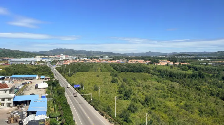
Photo adjustments
Full frame retained; proportionally resized and converted to WebP. No retouching or changes to the photographed subject. Card displays may crop the view.
- Administrative area
- County-level city · 县级市
- Part of
- Chengde
- Chinese name
- 平泉市
- Local areas
- County-level city guide
Area & population
- Area in the source
- 3,295.50 km²
- Population · 2020
- 399,378
- Administrative seat
- Pingquan (平泉镇)
Source: cited geographic source, as of the dates shown.
History
The name means "level spring". In 1677 the Kangxi Emperor, hunting here, saw water welling up from flat ground and praised the spot. After the Qing court built its summer retreat at Chengde, it improved the road from there to Shengjing (盛京); the gullies along the way were numbered one to eight, and the county seat stood at the eighth, Bagou (八沟). A Bagou sub-prefecture was set up in 1729, renamed Pingquan Zhou (平泉州) in 1778, and became Pingquan County after 1912. The county became a county-level city in 2017.
Under the Liao dynasty the area was Shenshan County (神山县). The Hebei Department of Culture and Tourism lists Liao remains here, among them the tomb of a grand princess, the Liao tomb group with stone sheep and tigers (石羊石虎辽古墓群) and the tomb of the Liao official Dou Jingyong (窦景庸).
Setting and landscape
Mount Mayu (马盂山), also called Guangtou Shan (光头山, "bald-head mountain"), is Pingquan's highest peak at 1,738 metres; its summit carries grass and wild flowers but almost no trees. It stands at the head of the Liao River, and the Liaoheyuan National Forest Park (辽河源国家森林公园) around it covers more than ten thousand hectares of mountain, forest, grassland and springs.
The Khitan ancestor legend (契丹始祖传说), on the third national intangible-heritage list, places the Khitans' origin on Mount Mayu: a divine man rode a white horse from the mountain and met a heavenly maiden driving an ox cart, and they had eight sons, whose descendants grew into the eight Khitan tribes. Local funerals still include a paper white horse for a man.
What to see
Zezhou Garden (泽州园) has a statue of the Liao founder Yelü Abaoji (耶律阿保机) and the dark-grey Jiuri Hall (就日馆). With the Zhanyun Jiuri archway (瞻云就日牌楼), over a century old, and the spring, the hall forms the town's central axis. Bagou Street (八沟大街) was a merchants' street in the Qing.
Food and local products
The city government calls Pingquan China's largest base for over-summer shiitake (越夏香菇), with firm flesh, thick caps and short, stout stems. Xinhua suggests a mushroom banquet, Bagou mutton soup (八沟羊汤), palace-style Yushan cakes (宫廷御膳饼) and Shanzhuang Laojiu (山庄老酒), a liquor on the national intangible-heritage list. Pingquan is also known for mountain apricots and activated carbon.
Highlights
- Mount Mayu 马盂山: Highest peak at 1,738 m, at the head of the Liao River and the setting of the Khitan ancestor legend.
- Liaoheyuan National Forest Park 辽河源国家森林公园: Over ten thousand hectares of mountain forest, grassland and springs at the Liao River source.
- Over-summer shiitake 越夏香菇: Pingquan is described by its government as the country's largest production base.
- Bagou mutton soup 八沟羊汤: Local soup named after Pingquan's Qing-era name, recommended by Xinhua.
Sources for this guide
塞外古邑新平泉-新华网 · Xinhua
契丹始祖传说 _ 河北省文化和旅游厅 · Hebei Provincial Department of Culture and Tourism
我为家乡代言 平泉香菇 源来更好 · Pingquan Municipal People's Government
河北平泉撤县设市 是京津挡风沙、保水源的“后花园” · China Economic Net (reprinting Hebei News Network)
平泉市 - 维基百科,自由的百科全书 · Wikipedia · CC BY-SA 4.0
Original English written from the listed sources and checked sentence by sentence against quoted extracts by a separate reviewer. Updated 2026-09-24.
Explore Pingquan
Core places to explore, with English and Chinese names.
Plan your visit
Getting there
Pingquan is about 60 km in a straight line from central Chengde. Search for 平泉市 in a map app to find stations and your accommodation.
Where to stay →More in Chengde
Sources & geographic information
Administrative names and parent areas: Official geographic directory · Reference date 2026-09-06.
Some facts checked against 平泉市 — Wikipedia contributors, CC BY-SA 4.0.
Map data © OpenStreetMap contributors. Pins mark approximate centres, not entrances or boundaries.