


Get to know Jinning Township
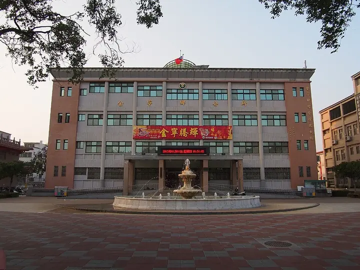
Photo adjustments
Full frame retained; proportionally resized and converted to WebP. No retouching or changes to the photographed subject. Card displays may crop the view.
- Administrative area
- Rural township · 鄉
- Part of
- Kinmen County
- Chinese name
- 金寧鄉
- Local areas
- Rural township guide
Area & population
- Area in the source
- 29.85 km²
Source: cited geographic source, as of the dates shown.
What to see
Beishan’s broadcasting wall (北山播音牆), old Western-style house (北山古洋樓) and the Guningtou Battle Museum (古寧頭戰史館) connect different aspects of the battlefield’s history. Traditional sites include the Gulongtou Zhenwei Residence (古龍頭振威第), Shuiwei Tower (水尾塔) and Three-Eye Well (三眼井). Shuangli Lake (雙鯉湖) provides a place to observe birds and waterside plants.
Food and local products
Guning’s coast produces small stone oysters (石蚵). Local preparations include oyster omelettes, fried oysters, oyster fritters, soup and thin-noodle dishes. Handmade noodles dry in the wind and sun, while twisted fried dough comes in flavors such as garlic, sesame and spring onion.
Getting oriented
The main-island end of Kinmen Bridge (金門大橋) lies on Jinning’s Cihu Road (慈湖路), connecting the township across the sea with Lieyu (烈嶼). National Quemoy University (國立金門大學) is also located here.
Sources for this guide
Jinning, Kinmen - Wikipedia · Wikipedia contributors · CC BY-SA 4.0
金門日報全球資訊網 -【漫遊金門】領略魅力浯島──金寧鄉 · Kinmen Daily News, reporter Lin Ling, April 2023
Original English written from the listed sources and checked sentence by sentence against quoted extracts by a separate reviewer. Updated 2026-09-30.
Explore Jinning Township
Core places to explore, with English and Chinese names.
Jinning Township 金寧鄉
Plan your visit
Getting there
Jinning Township covers the centre of Kinmen County. Search for 金寧鄉 in a map app to find stations and your accommodation.
Where to stay →More in Kinmen County
Sources & geographic information
Administrative names and parent areas: Official geographic directory · Reference date 2026-09-06.
Some facts checked against Jinning, Kinmen — Wikipedia contributors, CC BY-SA 4.0.
Map data © OpenStreetMap contributors. Pins mark approximate centres, not entrances or boundaries.