


Get to know Jincheng Township
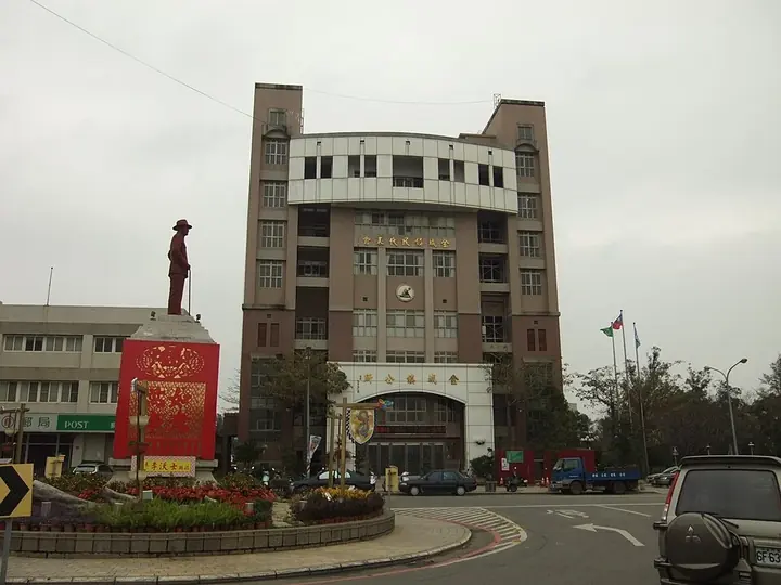
Photo adjustments
Full frame retained; proportionally resized and converted to WebP. No retouching or changes to the photographed subject. Card displays may crop the view.
- Administrative area
- Township · 鎮
- Part of
- Kinmen County
- Chinese name
- 金城鎮
- Local areas
- Township guide
Area & population
- Area in the source
- 21.72 km²
Source: cited geographic source, as of the dates shown.
History
A military commander moved his headquarters to Houpu in 1680. The commander’s office and Wujiang Academy (浯江書院) helped establish the settlement as an administrative center. Later, Western-style buildings built with remittances from overseas Chinese in Southeast Asia added another architectural layer.
What to see
Model Street (模範街), Juguang Tower (莒光樓) and the Shuitou settlement (水頭聚落) are among Jincheng’s named historical sites. At the southwestern harbor, Shuitou (水頭港) links the township with sea transport. Zhaishan Tunnel (翟山坑道) introduces a military engineering site beyond the urban streets.
Local traditions
The City God procession commemorates the deity’s move to Houpu. Its traditional date is the twelfth day of the fourth lunar month, when groups carry sacred images and banners through the town.
Sources for this guide
Jincheng, Kinmen - Wikipedia · Wikipedia contributors · CC BY-SA 4.0
金門日報全球資訊網 -縣府規劃觀光行動計畫案遊出金城好風光 · Kinmen Daily News, reporter Yang Shuiyong, January 2016
Original English written from the listed sources and checked sentence by sentence against quoted extracts by a separate reviewer. Updated 2026-09-30.
Explore Jincheng Township
Core places to explore, with English and Chinese names.
Jincheng Township 金城鎮
Plan your visit
Getting there
Jincheng Township covers the centre of Kinmen County. Search for 金城鎮 in a map app to find stations and your accommodation.
Where to stay →More in Kinmen County
Sources & geographic information
Administrative names and parent areas: Official geographic directory · Reference date 2026-09-06.
Some facts checked against Jincheng, Kinmen — Wikipedia contributors, CC BY-SA 4.0.
Map data © OpenStreetMap contributors. Pins mark approximate centres, not entrances or boundaries.