


Get to know Quangang District
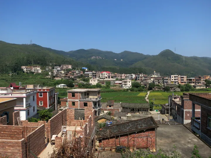
Photo adjustments
Full frame retained; proportionally resized and converted to WebP. No retouching or changes to the photographed subject. Card displays may crop the view.
- Administrative area
- District · 市辖区
- Part of
- Quanzhou
- Chinese name
- 泉港区
- Local areas
- District guide
Area & population
- Area in the source
- 299.40 km²
- Population · 2020 census
- 354,296
Source: cited geographic source, as of the dates shown.
Setting and landscape
Hui'an County lies to the south and Luojiang District (洛江区) to the south-west, while the bay forms the south-eastern edge. The district covers 341 square kilometres of land and 99 square kilometres of sea. Its climate is a subtropical maritime monsoon type: north-east winds prevail, summer brings southerlies, and average yearly rainfall is 1,240.9 mm.
Xiaocuo began as a fishing village under Nanpu (南埔镇), known for the harbour at its mouth. The district government describes the harbour as free of silting and ice all year, with 5.5 km of deep-water frontage able to take wharves of 10,000 to 300,000 tonnes.
History
Stone adzes and arrowheads turned up at Tuling (涂岭镇) and Lupu (芦朴村) in 1981, and in 1987 a Neolithic site of roughly Shang–Zhou date was found on Yishan (蚁山) at Lupu. Longtouling (龙头岭) in Tuling holds the tomb of Lin Lu (林禄), Prince of Jin'an Commandery, buried in 356 and honoured as the founding ancestor of Fujian's Lin clan.
The area belonged to Jinjiang County, created in 718, which opened an office at Guxian village (古县村) in today's Qianhuang (前黄镇) to govern it; after Hui'an County was created in 981, Quangang stayed under it for 1,015 years. A salt-police uprising at Shanyao (山腰) on 18 August 1949 marked the area's liberation. Fujian set up the Xiaocuo Economic Development Zone in 1996, the State Council approved the new district on 12 April 2000, and it was formally established on 28 December 2000. "Xiaocuo" was dropped because in dialect it sounds like "burning house" (烧厝), and "Meigang" as too easily confused with Meizhou Bay, so the name became Quangang, "Quanzhou's harbour".
Language and music
The Quanzhou form of Southern Min (闽南语) is spoken in Shanyao, most of Qianhuang, western Fengwei (峰尾镇) and eastern Tuling; the Toubei dialect (头北话) in Nanpu, Houlong (后龙镇) and most of Fengwei; and Puxian (莆仙语) in Jieshan (界山镇) and northern Tuling.
Quanzhou Beiguan (泉州北管), called Hui'an Beiguan locally, survives in Quangang and Hui'an as instrumental music for festival processions, led by the diaoguizi fiddle (吊规子), a jinghu type. It entered China's first national intangible cultural heritage list on 20 May 2006.
Getting oriented
The G15 Shenyang–Haikou Expressway on its Fuzhou–Xiamen stretch and National Road 324 cross the district, and the Fuzhou–Xiamen, Yingtan–Xiamen and Zhangzhou–Quanzhou–Xiaocuo railways serve it. Quanzhou Jinjiang Airport (泉州晋江机场) is about 68 km to the south.
Highlights
- Xiaocuo Harbour 肖厝港: Deep-water harbour on Meizhou Bay, described by the district as free of silting and ice, that gave the district its name.
- Tomb of Lin Lu 闽林始祖陵: Burial of Lin Lu (356) at Longtouling in Tuling, honoured as founder of Fujian's Lin clan.
- Quanzhou Beiguan 泉州北管: Processional instrumental music of Quangang and Hui'an, on the first national intangible heritage list (2006).
Sources for this guide
泉港概况-概况-走进泉港-泉州市泉港区人民政府 · Quangang District People's Government, Quanzhou
自然地理-概况-走进泉港-泉州市泉港区人民政府 · Quangang District People's Government, Quanzhou
历史沿革-概况-走进泉港-泉州市泉港区人民政府 · Quangang District People's Government, Quanzhou
泉港区 - 维基百科,自由的百科全书 · Wikipedia (Chinese) · CC BY-SA 4.0
北管 - 维基百科,自由的百科全书 · Wikipedia (Chinese) · CC BY-SA 4.0
Original English written from the listed sources and checked sentence by sentence against quoted extracts by a separate reviewer. Updated 2026-09-23.
Explore Quangang District
Core places to explore, with English and Chinese names.
Quangang District 泉港区
Plan your visit
Getting there
Quangang District is about 25 km in a straight line from central Quanzhou. Search for 泉港区 in a map app to find stations and your accommodation.
Where to stay →More in Quanzhou
Sources & geographic information
Administrative names and parent areas: Official geographic directory · Reference date 2026-09-06.
Some facts checked against 泉港区 — Wikipedia contributors, CC BY-SA 4.0.
Some facts checked against 北管 — Wikipedia contributors, CC BY-SA 4.0.
Map data © OpenStreetMap contributors. Pins mark approximate centres, not entrances or boundaries.