


Get to know Yongchun County

Photo adjustments
Full frame retained; proportionally resized and converted to WebP. No retouching or changes to the photographed subject. Card displays may crop the view.
- Administrative area
- County · 县
- Part of
- Quanzhou
- Chinese name
- 永春县
- Local areas
- County guide
Area & population
- Area in the source
- 1,469.00 km²
- Population · 2020 census
- 422,531
- Administrative seat
- Taocheng (桃城镇)
Source: cited geographic source, as of the dates shown.
Setting and landscape
Yongchun borders Xianyou (仙游县) to the east, Nan'an (南安市) and Anxi (安溪县) to the south, Zhangping (漳平市) to the west, and Dehua (德化县) and Datian (大田县) to the north. The main body of the Daiyun Mountains (戴云山脉) enters in the north-west, where Xueshan (雪山) in Chengxiang (呈祥乡) reaches 1,366 m, and a ridge on the northern border divides the Min and Jin river systems. Eastward the terrain steps down to about 200 m around a basin centred on the county town; the lowest point, 83 m, is at Dongguan (东关镇).
History
The Kuzhaikeng kiln site (苦寨坑窑址) in Jiefu (介福乡), dated from the middle Xia to the middle Shang, is described as the earliest site in China that fired proto-porcelain in dragon kilns. A settlement called Taolinchang (桃林场) was set up in 589, became Taoyuan County (桃源县) in 933 and was renamed Yongchun in 938. From 1734 it was Yongchun Prefecture (永春州), governing Dehua and Datian, until it reverted to a county in 1913. Yongchun merchants were already trading in Jiaozhi (交趾, today's Vietnam) under the Later Zhou, and the Yongchun association in Malacca was founded in 1800. The poet Yu Kwang-chung (余光中) came from here.
What to see
Four sites are national key protected cultural relics: the Kuzhaikeng kilns, the Kuixingyan cliff carvings (魁星岩摩崖石刻造像), the Yongchun Confucian Temple (永春文庙) and Fuxingtang (福兴堂). Niumulin (牛姆林) and Beixi Wenyuan (北溪文苑) are rated AAAA scenic areas.
Food and local products
White Crane boxing (永春白鹤拳), paper-weaving painting (纸织画) and Yongchun incense (永春香) are national intangible heritage items. The boxing style is credited to Fang Qiniang (方七娘), who taught in Yongchun with her husband Zeng Si (曾四) in the Kangxi reign (1662–1722). Incense-making arrived in the late Ming or early Qing with descendants of Quanzhou's Arab Pu family (蒲氏); Dapu (达埔镇) was named a "China incense capital" in 2014.
Yongchun aged vinegar (永春老醋) is brewed from glutinous rice, Fujian red yeast rice and sesame and aged for over three years; it is sharply sour, not astringent, and faintly sweet. Foshou oolong (永春佛手茶) came from Anxi; it was first planted in Yongchun at Shifeng village (狮峰村) in Dapu, where monks of Shifengyan (狮峰岩) grew it as a temple offering in 1704. Its aroma is likened to citron or pear. Ponkan mandarins (芦柑), brought from Zhangzhou (漳州) in the 1950s, won the county the title "home of Chinese ponkan" in 2001.
Highlights
- Kuzhaikeng kiln site 苦寨坑窑址: Xia–Shang kiln site in Jiefu, described as China's earliest use of dragon kilns for proto-porcelain; national protected site.
- Niumulin 牛姆林: One of Yongchun's two AAAA scenic areas.
- Beixi Wenyuan 北溪文苑: The county's other AAAA scenic area.
- Yongchun aged vinegar 永春老醋: Red-yeast vinegar from glutinous rice and sesame, aged over three years.
- Yongchun Foshou tea 永春佛手茶: Oolong from Anxi, first planted in Yongchun by monks at Shifengyan in Dapu in 1704.
- Yongchun White Crane boxing 永春白鹤拳: Martial art credited to Fang Qiniang, on the national intangible heritage list.
Sources for this guide
永春概况-走进永春-永春县人民政府 · Yongchun County People's Government
Original English written from the listed sources and checked sentence by sentence against quoted extracts by a separate reviewer. Updated 2026-09-23.
Explore Yongchun County
Core places to explore, with English and Chinese names.
Places to explore around Yongchun County
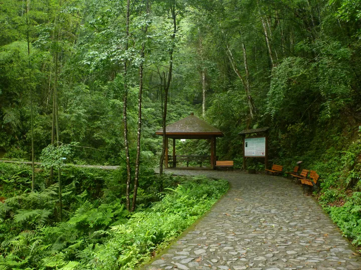 A cobbled stone path curving through dense green forest, with a wooden pavilion and benches beside it at the right, an information board on a timber post, and ferns, moss and broadleaf undergrowth filling the foreground and slopes.
Plan your visit
Getting there
Yongchun County is about 65 km in a straight line from central Quanzhou. Search for 永春县 in a map app to find stations and your accommodation.
Where to stay →Build your route
Start with Niumulin Nature Reserve. The linked place guides have entrance and visit details.
Continue with Quanzhou →More in Quanzhou
Sources & geographic information
Administrative names and parent areas: Official geographic directory (dmfw.mca.gov.cn) · Reference date 2026-09-06.
Photo: Niumulin Nature Reserve · rheins · CC BY 3.0. Full frame retained; proportionally resized and converted to WebP. No retouching or changes to the photographed subject. Card displays may crop the view.

Map data © OpenStreetMap contributors. Pins mark approximate centres, not entrances or boundaries.