


Get to know Baiyin District
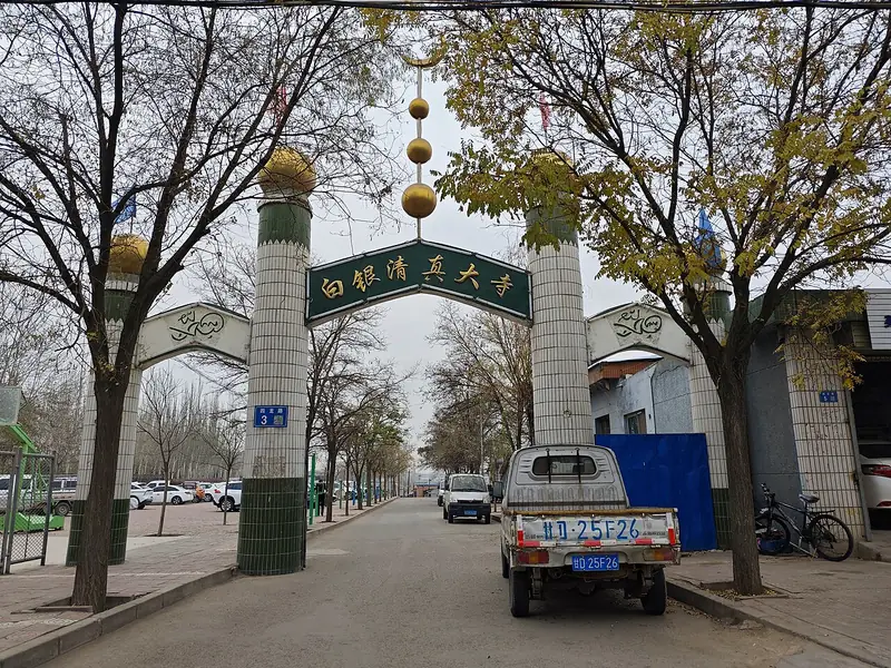
Photo adjustments
Full frame retained; EXIF orientation normalized, proportionally resized to at most 800 pixels and converted to WebP. No generated pixels or subject changes. Cards may crop the display.
- Administrative area
- District · 市辖区
- Part of
- Baiyin
- Chinese name
- 白银区
- Local areas
- District guide
Area & population
- Area in the source
- 1,372.00 km²
- Population · 2020 census
- 337,645
- Administrative seat
- Renminlu Subdistrict
Source: cited geographic source, as of the dates shown.
Setting and landscape
The district sits on the north-western edge of the Loess Plateau. Overall it is a structural basin ringed by hills, with the Yellow River valley to the south. The ground falls from north-west to south-east, from Biaogan Mountain (标杆山) in Wuchuan township (武川乡) at 2,273 metres to the Yellow River bank in Silong town (四龙镇) at 1,420 metres. Among the loess ridges, wind-eroded mushroom-shaped rocks give a Danxia-landform scenery.
The Yellow River runs for 38 km along the southern edge, from Xixiakou village (西峡口村) in Shuichuan town (水川镇) to Yongxing village in Silong. The climate is mid-temperate and continental, arid and semi-desert, with a long-term mean temperature of 8.5°C and 204.3 mm of rain a year.
History
A Qijia culture site (齐家文化遗址) on the southern slopes of Lianhua Mountain (莲花山) in Qiangwan township (强湾乡) shows settlement about 5,000 years ago. In 409 the Western Qin ruler Qifu Qiangui (乞伏乾归) moved his capital to Dujian City (度坚城), on the site of today's open-pit mine.
The name dates from the Hongwu reign of the Ming, when silver mining flourished and an official smelting works called Baiyin Chang (白银厂, "silver works") was set up here. A huge mine blast in 1956 opened the modern development of the area. A suburban district of Baiyin city was set up in November 1961; after the city was abolished it became Baiyin District under Lanzhou in July 1963, and returned to the restored Baiyin city in August 1985.
What to see
The Yellow River leaves the Daxia gorge (大峡) to cross the Shuichuan basin, then enters Wujin Gorge (乌金峡); the Daxia hydropower station was completed at Xixiakou in 1996. Wujin Gorge winds in an S-shape for 8.9 km between Wuliu village in Shuichuan and Silong village; it takes its name from the granite peaks on its banks, whose black surfaces resemble "wujin" (乌金, black gold). Jianjin Mountain (剪金山) in Silong, 1,742 metres high, is a Daoist site.
Getting oriented
The district borders Gaolan County (皋兰县) of Lanzhou to the west. Across the Yellow River to the south lie Qingcheng (青城镇) in Yuzhong County (榆中县) and Pingbao in Jingyuan County (靖远县); Jingyuan's Liuchuan lies to the east and Jingtai County (景泰县) to the north. The provincial capital Lanzhou (兰州) is 69 km away by the Lanzhou–Baiyin Expressway (兰白高速公路).
Highlights
- Wujin Gorge 乌金峡: S-shaped 8.9 km Yellow River gorge named for its black granite peaks.
- Jianjin Mountain 剪金山: Daoist site in Silong town, 1,742 metres high.
- Dujian City 度坚城: Capital of the Western Qin from 409, on the site of today's open-pit mine.
Sources for this guide
白银区区情简介 · Baiyin District People's Government
历史沿革 · Baiyin District People's Government
自然地理 · Baiyin District People's Government
Original English written from the listed sources and checked sentence by sentence against quoted extracts by a separate reviewer. Updated 2026-09-23.
Explore Baiyin District
Core places to explore, with English and Chinese names.
Baiyin District 白银区
Plan your visit
Getting there
Baiyin District covers the centre of Baiyin. Search for 白银区 in a map app to find stations and your accommodation.
Where to stay →More in Baiyin
Sources & geographic information
Administrative names and parent areas: Official geographic directory · Reference date 2026-09-06.
Map data © OpenStreetMap contributors. Pins mark approximate centres, not entrances or boundaries.