


Get to know Huining County
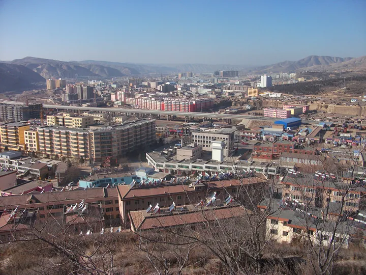
Photo adjustments
Full frame retained; proportionally resized and converted to WebP. No retouching or changes to the photographed subject. Card displays may crop the view.
- Administrative area
- County · 县
- Part of
- Baiyin
- Chinese name
- 会宁县
- Local areas
- County guide
Area & population
- Area in the source
- 6,439.00 km²
- Population · 2018
- 543,900
- Administrative seat
- Huishi
Source: cited geographic source, as of the dates shown.
History
The name goes back to the Tang, when Liangchuan County (凉川县) in the region was renamed Huining. A Huining County was set up again in the early Ming, and in the early Qing it belonged to Gongchang prefecture (巩昌府). After 1949 it came under Dingxi (定西) prefecture, and it has been part of Baiyin since the city was restored in 1985. The middle route of the Silk Road, opened somewhat later than the northern route, ran from Xi'an through Pingliang (平凉), Longde (隆德) and Jingning (静宁) to Huining and on through Dingxi to Lanzhou (兰州); a line opened after the Northern Song over the Liupan Mountains (六盘山) roughly matches today's G312 national road. Huining has a long tradition of valuing study, and is called the "top-scholar county of the north-west" (西北状元县) and the "home of doctors" (博士之乡).
On 2 October 1936 a Red Army cavalry regiment took the county town, and on 10 October units of the First and Fourth Front Armies held a joint rally on the square before the Dacheng Hall (大成殿) of the town's Confucian temple. The Baiyin city government describes Huining as the only area where all three front armies came together during the Long March. On 22–23 October the deputy commander of the Fifth Army, Luo Nanhui (罗南辉), and more than 800 soldiers were killed in a blocking action against enemy forces around Huajialing (华家岭).
What to see
The Huining Red Army Meeting Site (会宁红军会师旧址) was listed in the fourth batch of national key cultural relics protection sites on 20 November 1996 and covers about 40,000 square metres. It includes the Meeting Tower (会师楼), the site of the joint rally, the memorial pagoda (会师纪念塔), a stele forest of generals' inscriptions (将帅碑林), a museum of revolutionary relics, the former Red Army headquarters and the former quarters of Zhu De (朱德), Zhang Guotao (张国焘) and Xu Xiangqian (徐向前). The county also has a Long March Victory Memorial Hall (红军长征胜利纪念馆).
Beyond the Red Army sites, layered terraced fields spread across the county's loess-plateau landscape, and the temples and grottoes of Taohua Mountain (桃花山) are counted among the Silk Road relics of the Baiyin area.
Food and local products
Huining is known as the "home of Chinese minor grains" (中国小杂粮之乡).
Getting oriented
The Qingdao–Lanzhou Expressway (青兰高速) and National Road G312 cross the county.
Highlights
- Huining Red Army Meeting Site 会宁红军会师旧址: National key protected site since 1996, about 40,000 square metres, with the Meeting Tower and memorial pagoda.
- Long March Victory Memorial Hall 红军长征胜利纪念馆: One of the county's Red Army landmarks.
- Taohua Mountain 桃花山: Temples and grottoes counted among the Silk Road relics of the Baiyin area.
Sources for this guide
白银历史沿革 · Baiyin Municipal People's Government
旅游日来会宁,唤醒你沉睡的旅行DNA! · Baiyin Municipal People's Government
会宁红军会师旧址 - 维基百科,自由的百科全书 · Wikipedia (Chinese) · CC BY-SA 4.0
会宁县 - 维基百科,自由的百科全书 · Wikipedia (Chinese) · CC BY-SA 4.0
Huining County - Wikipedia · Wikipedia (English) · CC BY-SA 4.0
Original English written from the listed sources and checked sentence by sentence against quoted extracts by a separate reviewer. Updated 2026-09-23.
Explore Huining County
Core places to explore, with English and Chinese names.
Places to explore around Huining County
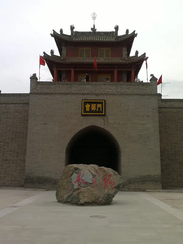 Huining Red Army Reunion Site (
Plan your visit
Getting there
Huining County is about 125 km in a straight line from central Baiyin. Search for 会宁县 in a map app to find stations and your accommodation.
Where to stay →Build your route
Start with Huining Red Army Reunion Site. The linked place guides have entrance and visit details.
Continue with Baiyin →More in Baiyin
Sources & geographic information
Administrative names and parent areas: Official geographic directory · Reference date 2026-09-06.
Some facts checked against 会宁红军会师旧址 — Wikipedia contributors, CC BY-SA 4.0.
Some facts checked against 会宁县 — Wikipedia contributors, CC BY-SA 4.0.
Some facts checked against Huining County — Wikipedia contributors, CC BY-SA 4.0.
Photo: Huining Red Army Reunion Site · DarthVachel · CC BY-SA 3.0. Full frame retained; EXIF orientation normalized, proportionally resized to at most 800 pixels and converted to WebP. No generated pixels or subject changes. Cards may crop the display.

Map data © OpenStreetMap contributors. Pins mark approximate centres, not entrances or boundaries.