


Get to know Pingchuan District
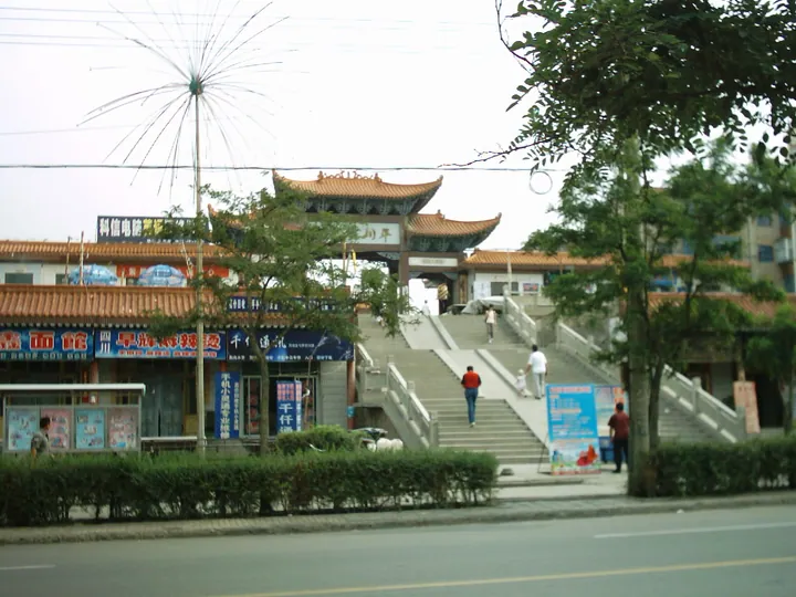
Photo adjustments
Full frame retained; proportionally resized and converted to WebP. No retouching or changes to the photographed subject. Card displays may crop the view.
- Administrative area
- District · 市辖区
- Part of
- Baiyin
- Chinese name
- 平川区
- Local areas
- District guide
Area & population
- Area in the source
- 2,106.00 km²
- Population · 2016
- 209,000
- Administrative seat
- Xingpinglu
Source: cited geographic source, as of the dates shown.
Setting and landscape
The land rises from north-west to south-east. The highest point is the Nangou Dading summit of Mount Quwu (屈吴山) at 2,858 metres, while the lowest ground, at 1,347 metres, lies at Hongmawan in Shuiquan (水泉). The Yellow River runs for 35 km through the district. Rainfall averages less than 200 mm a year, against about 1,700 mm of evaporation.
Coal and pottery clay are the main minerals, and the clay includes large reserves of purple clay (紫砂土).
History
The Baiyin city history traces pottery-making in what is now Pingchuan back more than 3,000 years BC, and cites Western Han drain pipes and a pottery stove from a Han tomb at Laozhuang (老庄) as signs that hand-made pottery had reached a high standard. A kiln site at Hongtuwa (红土洼) below Beizhang Mountain (北掌山) dates from the Song dynasty at the latest. From the Ming period many more kilns were built 3 km to the west, near the coal of Baojishan (宝积山), at a place called Ciyao (磁窑, "porcelain kilns"). After the Qing, Ciyao became a market town trading pottery, coal and lime, drew people from 18 provinces and was nicknamed a "dry dock" (旱码头).
In the early Qing a Dalachi sub-county (打拉池分县) of Haicheng County was set up here, and it was abolished in the Republican period. On 14 May 1985 the State Council restored Baiyin as a city and created Pingchuan from Baoji town (宝积镇) and five townships of Jingyuan County.
What to see
Dalachi (打拉池) is where the First and Fourth Front Armies of the Red Army met in 1936. Hongshan Ancient Temple (红山古寺) in Gonghe (共和镇) served as their command post after that meeting. The Zhanyin crossing (鹯阴口) is listed as an important Silk Road ferry crossing, and the Baiyin city history counts sites on Mount Quwu and the Beiwudang temple (北武当庙) among the temples and caves it lists as Silk Road relics. Mount Beiwudang (北武当山) stands in Zhongwan village in Shuiquan.
Getting oriented
The G6 Beijing–Lhasa Expressway, National Highway 109 and the Honghui railway serve the district, and the Pingchuan railway station and Changzheng station lie here. Pingchuan West (平川西站) is one of four Baiyin stations on the Yinchuan–Lanzhou high-speed railway, which opened fully in 2022.
Highlights
- Dalachi 打拉池: Where the Red Army's First and Fourth Front Armies met in 1936.
- Hongshan Ancient Temple 红山古寺: Temple in Gonghe used as the Red Army command post after the 1936 meeting.
- Zhanyin crossing 鹯阴口: Listed as an important Silk Road ferry crossing.
- Mount Quwu 屈吴山: Highest point of the district at 2,858 metres; the Baiyin city history lists sites here among its Silk Road temple relics.
- Ciyao 磁窑: Kiln town near Baojishan that grew after the Qing into a pottery, coal and lime market.
Sources for this guide
平川区 - 维基百科,自由的百科全书 · Chinese Wikipedia · CC BY-SA 4.0
白银历史沿革 · Baiyin Municipal People's Government
白银市情简介 · Baiyin Municipal People's Government
Pingchuan, Baiyin - Wikipedia · English Wikipedia · CC BY-SA 4.0
Original English written from the listed sources and checked sentence by sentence against quoted extracts by a separate reviewer. Updated 2026-09-23.
Explore Pingchuan District
Core places to explore, with English and Chinese names.
Pingchuan District 平川区
Plan your visit
Getting there
Pingchuan District is about 65 km in a straight line from central Baiyin. Search for 平川区 in a map app to find stations and your accommodation.
Where to stay →More in Baiyin
Sources & geographic information
Administrative names and parent areas: Official geographic directory · Reference date 2026-09-06.
Some facts checked against 平川区 — Wikipedia contributors, CC BY-SA 4.0.
Some facts checked against Pingchuan, Baiyin — Wikipedia contributors, CC BY-SA 4.0.
Map data © OpenStreetMap contributors. Pins mark approximate centres, not entrances or boundaries.