


Get to know Linxia County
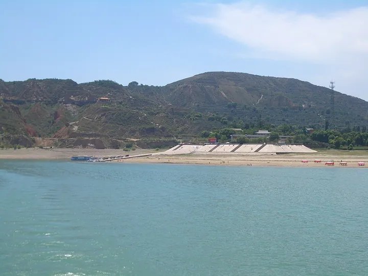
Photo adjustments
Full frame retained; proportionally resized and converted to WebP. No retouching or changes to the photographed subject. Card displays may crop the view.
- Administrative area
- County · 县
- Part of
- Linxia Hui Autonomous Prefecture
- Chinese name
- 临夏县
- Local areas
- County guide
Area & population
- Area in the source
- 1,212.40 km²
- Population · 2020
- 322,628
- Administrative seat
- Hanji [zh]
Source: cited geographic source, as of the dates shown.
Setting and landscape
The county climbs from 1,735 metres at the reservoir to 4,613 metres on Dalijia Mountain (达里加山) in the west, its highest point. Small rivers run north and north-east from the mountains on the south-western border towards the Yellow River. The largest, the Daxia River (大夏河), enters from Gannan Tibetan Autonomous Prefecture (甘南藏族自治州); its lower course marks the border with Dongxiang Autonomous County (东乡族自治县), and it opens into a wide bay where it meets the reservoir.
In the south-west, the Guantangou valley (关滩沟) in Manisigou township (麻尼寺沟乡) covers 225 square kilometres of well-watered pasture between mountain ridges. The valley is a forest-regrowth area of the Taizi Mountain natural forest protection bureau (太子山天然林保护局), and a deer farm there keeps sika deer.
History
Under the Qin, Fuhan County (枹罕县) was set up with its seat at today's Shuangcheng (双城), and in the early Western Han Shuangcheng was the seat of Baishi County (白石县). In 1913 the old Hezhou (河州) became Daohe County (导河县), which took the name Linxia County in 1928. When Linxia City was separated from it on 23 June 1950, the county seat moved to Hanji. The two were merged from 1958 to 1961 and again from 1973 to 1983.
Ma Fuxiang (马福祥, 1876-1932), who fought in Beijing in 1900 and became a leading warlord and politician of the Republic, came from near Hanji. The brothers Ma Bufang (马步芳) and Ma Buqing (马步青), who controlled the region until August 1949, came from Monigou township (漠泥沟乡).
What to see
Longshou ("dragon head") Mountain (龙首山), 4 kilometres south-east of the county town, is named for its eastern end, which looks like a dragon's head; it is also called Qinglong Mountain (青龙山). Known as "Big Temple Mountain" (大庙山), it is one of Hezhou's Buddhist and Taoist sites, facing Yandong Mountain (烟洞山) to the north and Gucheng Mountain (古城山) to the south.
Lianhua Tai (莲花台) on the Liujiaxia Reservoir has a wharf that also serves Linxia City, with vehicle ferries across to Liujiaxia town in Yongjing County (永靖县) and boats to Bingling Temple (炳灵寺). Nuo masked dance and drama (傩舞傩戏), which the prefecture lists as national intangible heritage, is performed in Xianfeng township (先锋乡) as well as in Yongjing County.
Highlights
- Longshou Mountain 龙首山: Buddhist and Taoist temple hill 4 km south-east of the county town, named for its dragon-head eastern end.
- Guantangou 关滩沟: 225-square-kilometre pasture valley in Manisigou township, with a sika deer farm.
- Lianhua Tai wharf 莲花台: Wharf on the Liujiaxia Reservoir with ferries to Liujiaxia and boats to Bingling Temple.
- Dalijia Mountain 达里加山: Highest point of the county at 4,613 metres, on the western edge.
Sources for this guide
临夏县 - 维基百科,自由的百科全书 · Wikipedia (Chinese) · CC BY-SA 4.0
Linxia County - Wikipedia · Wikipedia (English) · CC BY-SA 4.0
临夏县龙首山景区(AAA) · Linxia Hui Autonomous Prefecture People's Government
临夏县关滩沟景区(AAA) · Linxia Hui Autonomous Prefecture People's Government
【国家级非物质文化遗产】傩舞傩戏 · Linxia Hui Autonomous Prefecture People's Government
临夏州州情概况 · Linxia Hui Autonomous Prefecture People's Government
Original English written from the listed sources and checked sentence by sentence against quoted extracts by a separate reviewer. Updated 2026-09-23.
Explore Linxia County
Core places to explore, with English and Chinese names.
Linxia County 临夏县
Plan your visit
Getting there
Linxia County is about 20 km in a straight line from central Linxia Hui Autonomous Prefecture. Search for 临夏县 in a map app to find stations and your accommodation.
Where to stay →More in Linxia Hui Autonomous Prefecture
Sources & geographic information
Administrative names and parent areas: Official geographic directory · Reference date 2026-09-06.
Some facts checked against 临夏县 — Wikipedia contributors, CC BY-SA 4.0.
Some facts checked against Linxia County — Wikipedia contributors, CC BY-SA 4.0.
Map data © OpenStreetMap contributors. Pins mark approximate centres, not entrances or boundaries.